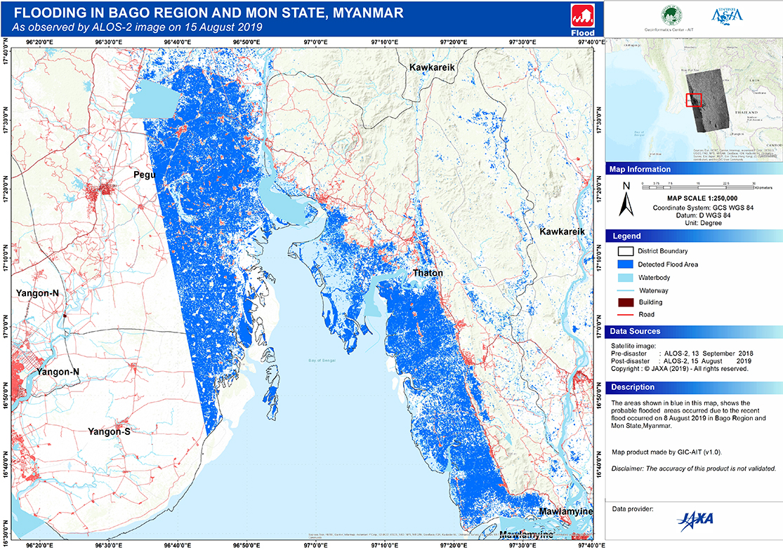
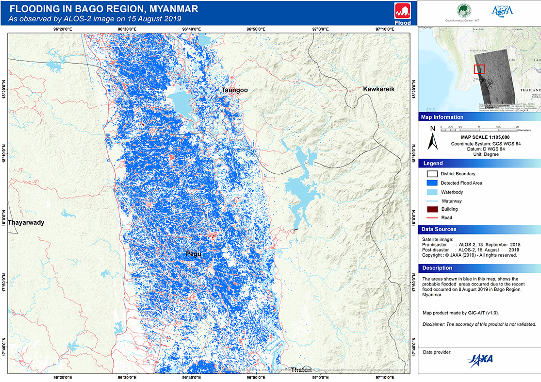
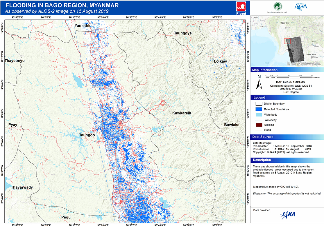
2019-08-08 Flood in Myanmar, August 8-11, 2019

Emergency Obs. Request Information

  • Disaster Type: Flood
  • Country: Myanmar
  • Occurrence Date (UTC): 08 August, 2019
  • SA activation Date(UTC): 13 August, 2019
  • Requester: ASEAN Coordinating Centre for Humanitarian Assistance on Disaster Management (AHA Centre)
  • Escalation to the International Charter: No
  • GLIDE Number:

Disaster Situation

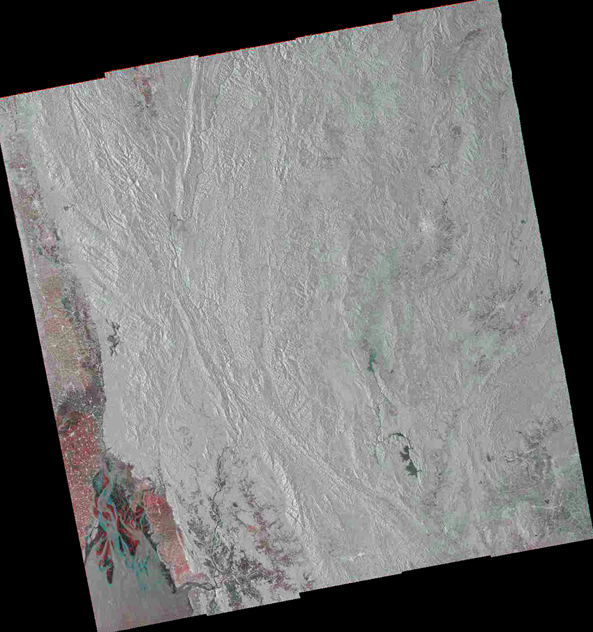
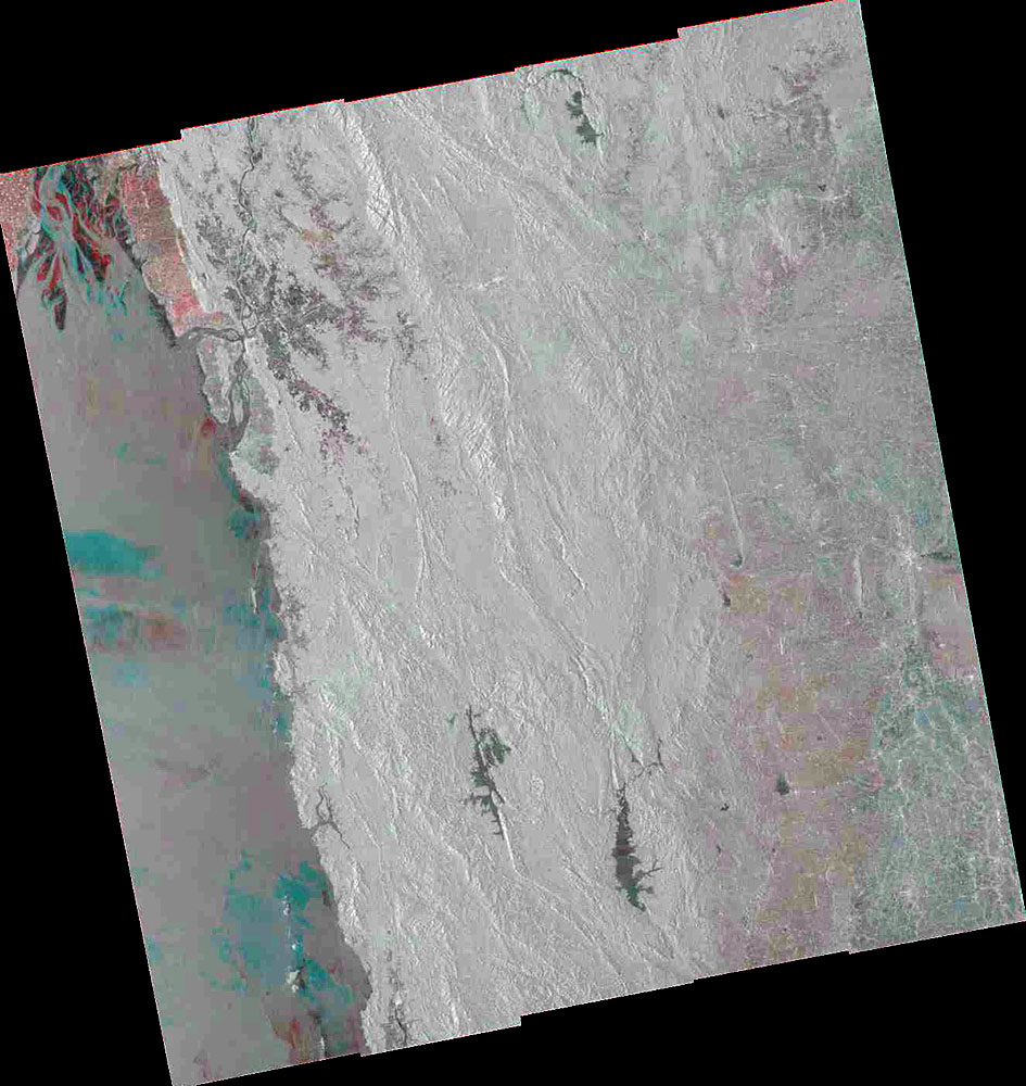
The flood has been on and off in Myanmar area sin June 2019 due to the Southwest Monsoon. However, for this satellite imagery we would like to focus on the recent Flood which starts Since August 8 th 2019 in three states, Bago, Kayin, and Mon.

Product

 JAXA 

2019-08-15

ALOS-2 PALSAR-2, HH, P151F350
RGB color composite image, R:G:B = 15/Aug/2019 : 14/Sept/2018 : 14/Sept/2018

2019-08-15

ALOS-2 PALSAR-2, HH, P151F300
RGB color composite image, R:G:B = 15/Aug/2019 : 14/Sept/2018 : 14/Sept/2018

 AIT 

2019-08-15

ALOS-2/PALSAR-2 13/Sep/2018, 15/Aug/2019 Map Scale 1:70,000

2019-08-15

ALOS-2/PALSAR-2 13/Sep/2018, 15/Aug/2019 Map Scale 1:250,000

2019-08-15

ALOS-2/PALSAR-2 13/Sep/2018, 15/Aug/2019 Map Scale 1:250,000

2019-08-15

ALOS-2/PALSAR-2 13/Sep/2018, 15/Aug/2019 Map Scale 1:185,000

2019-08-15

ALOS-2/PALSAR-2 13/Sep/2018, 15/Aug/2019 Map Scale 1:250,000

2019-08-16

Product-AIT(RAR)
Shape Files of the Detected Flood Area

 EOS 

2019-08-18

ARIA-SG Flood Proxy Map: Myanmar, 2019 Floods v2.0 (Main)

2019-08-18

ARIA-SG Flood Proxy Map: Myanmar, 2019 Floods v2.0 (Shapefile)

2019-08-18

ARIA-SG Flood Proxy Map: Myanmar, 2019 Floods v1.0 (Shapefile)

 RIKEN 

2019-08-18

Preliminary flood mapping after the Southwest Monsoon in Myanmar

2019-08-18

Preliminary flood mapping after the Southwest Monsoon in Myanmar (Shapefile)

Satellite Image

 ISRO 

2019-08-17

Resoucesat-2A AWiFS data as observed on Aug 17, 2019

2019-08-15

Resourcesat-2 AWiFS data as observed on Aug 15, 2019