2020-07-13
Emergency Obs. Request Information
- Disaster Type: Flood
- Country/Region: India
- Occurrence Date (UTC): 13 July, 2020
- SA activation Date(UTC): 13 July, 2020
- Requester: National Remote Sensing Center (NRSC), ISRO, India
- Escalation to the International Charter: No
- GLIDE Number:
Disaster Situation
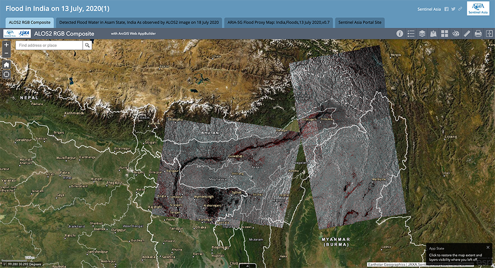
According to the Assam State Disaster Management Authority, over six lakh people are affected in 1,109 villages and localities across 20 of the state’s 33 districts. The standing crop affected was in areas of over 46,000 hectares. The floodwater breached river embankments and damaged bridges and roads in some districts. Almost all major rivers such as Brahmaputra, Burhi Dehing, Disang, Dhansiri, Jia Bharali, Puthimari, Beki and Gaurang were flowing above the danger level at several places. The authorities set up 92 relief camps in nine districts where 8,474 people were taking refuge. Personnel of the National Disaster Response Force and State Disaster Response Force were engaged in rescuing the marooned. (Source: https://www.newindianexpress.com/nation/2020/jul/11/assam-flood-situation-worsens-death-toll-rises-to-42-2168438.)
Product
AIT
Detected Flood Water in Asam State, India
As observed by ALOS2 image on 18 July 2020
Detected Flood Water in Asam State, India
As observed by ALOS2 image on 18 July 2020
ICIMOD
EOS
ARIA-SG Flood Proxy Map:
India,Floods,13 July 2020,v0.7
Earth Observatory of Singapore (EOS)/NASA-JPL/Caltech/ARIA-SG team
ISRO
Web GIS
Flood in India on 13 July, 2020(1) see detail
-

Sentinel Asia member only.
The account will be sent to the EOR requester after Web GIS page is prepared.
If you are interested in to be a member of Sentinel Asia, please contact: z-sentinel.asia ml.jaxa.jp