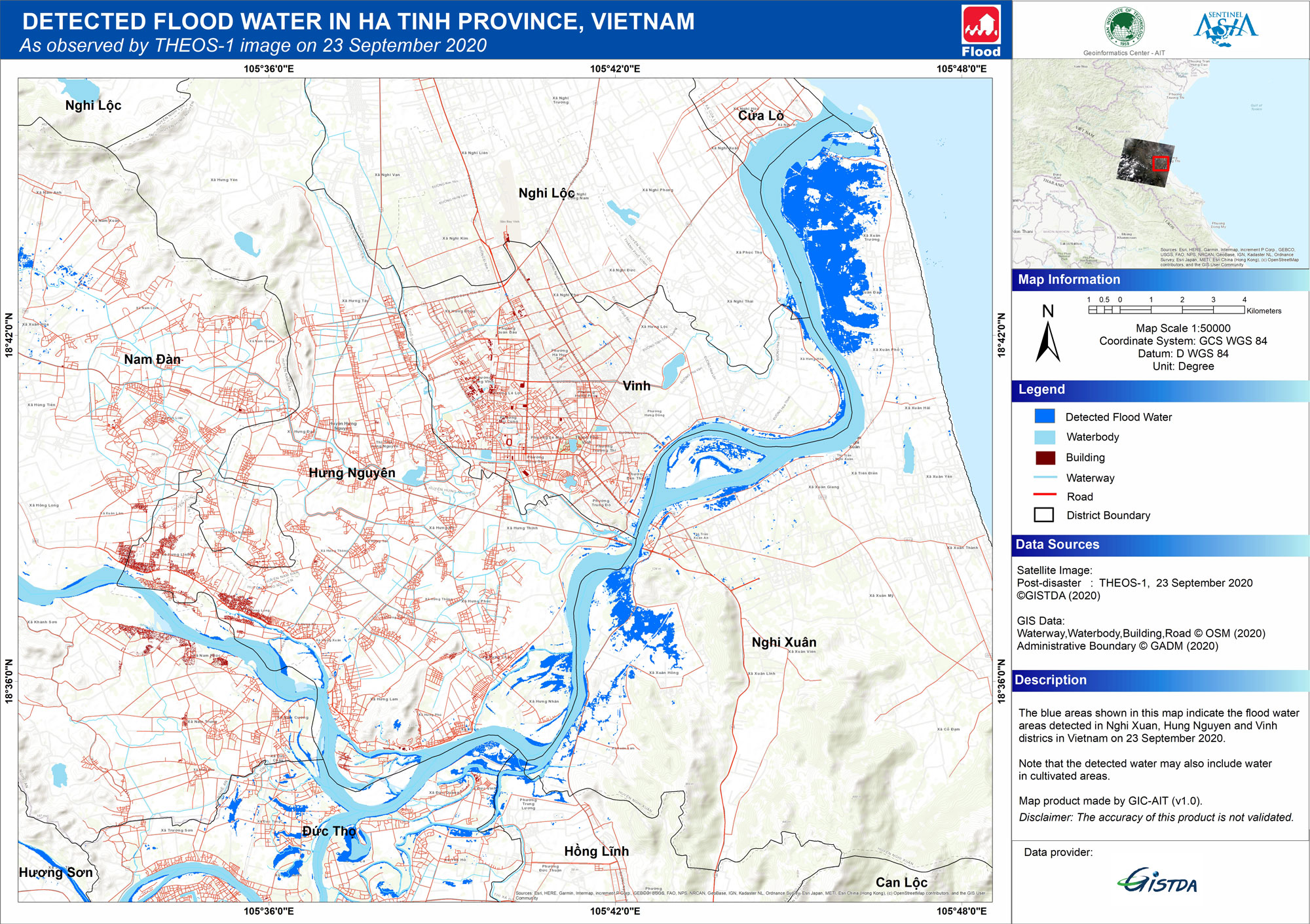
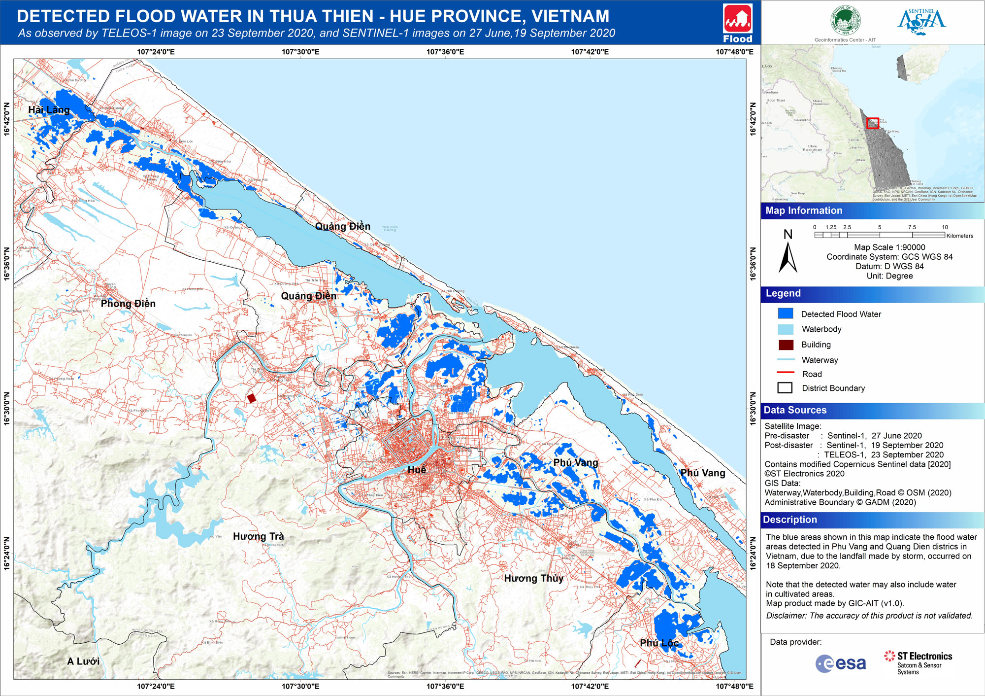
2020-09-17
Emergency Obs. Request Information
- Disaster Type: Flood, Landslide, Storm
- Country/Region: Vietnam
- Occurrence Date (UTC): 18 September, 2020
- SA activation Date(UTC): 17 September, 2020
- Requester: Department of National Remote Sensing -Vietnam Ministry of Natural Resources and Environment (MONRE)
- Escalation to the International Charter: No
- GLIDE Number:
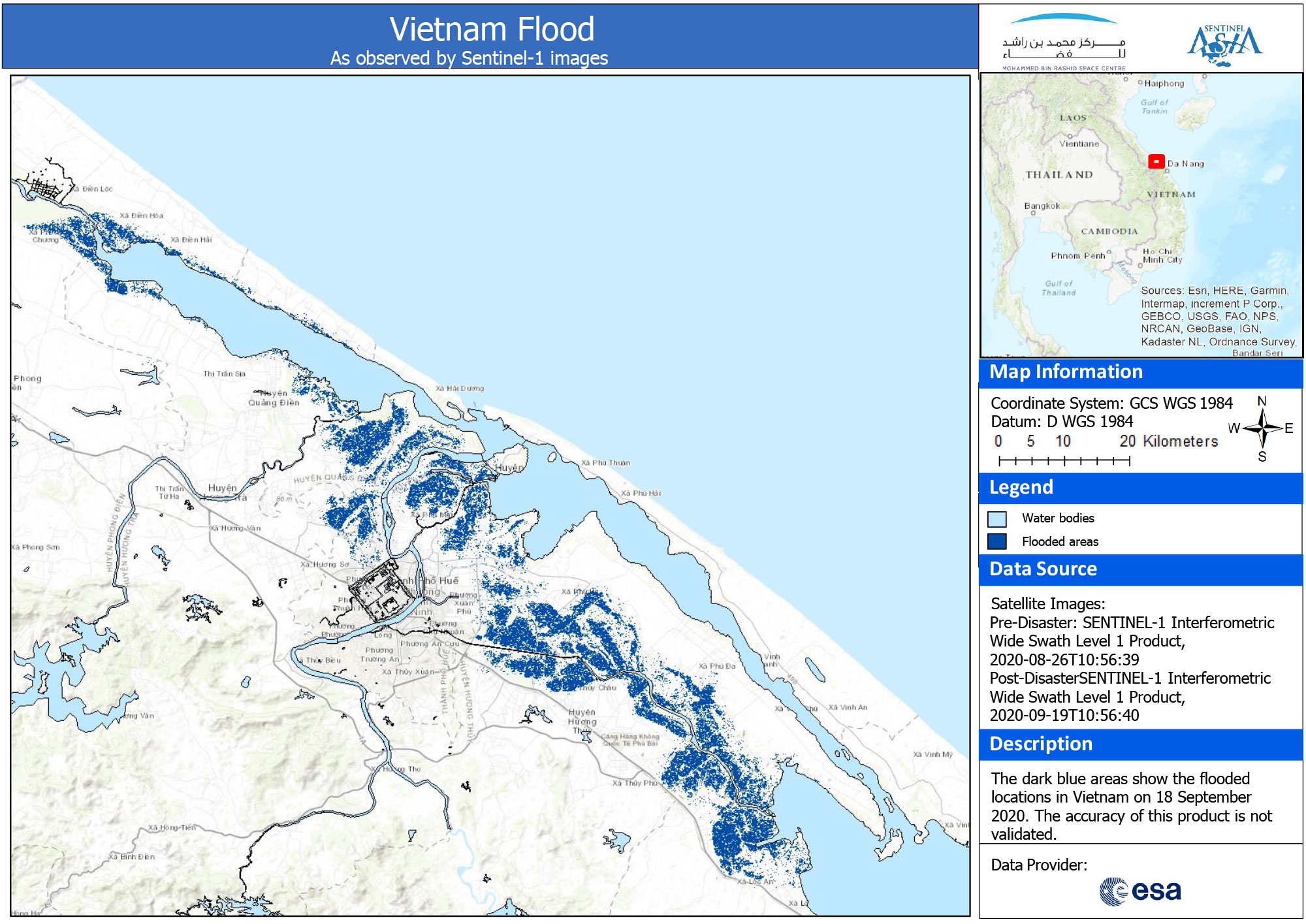
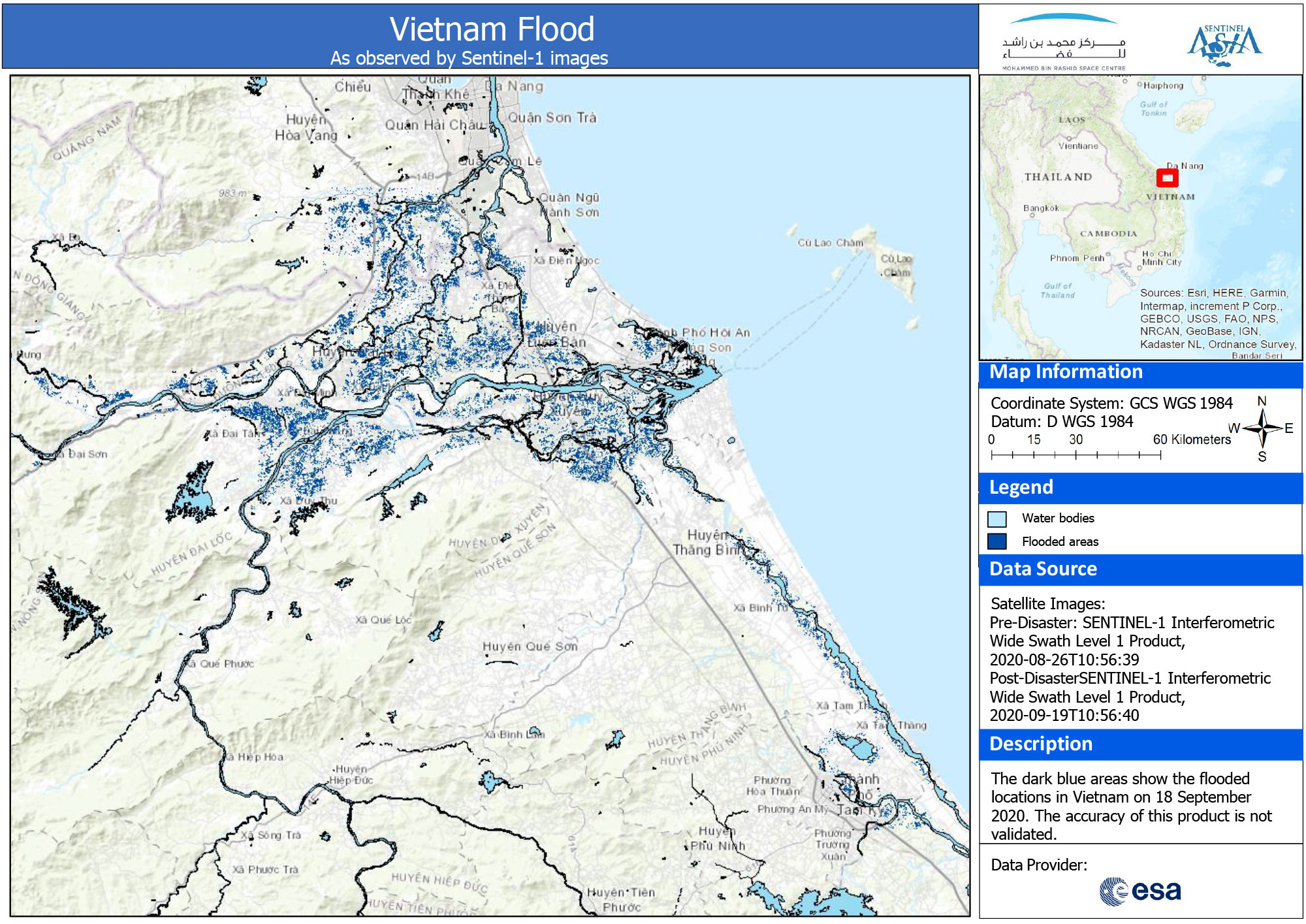
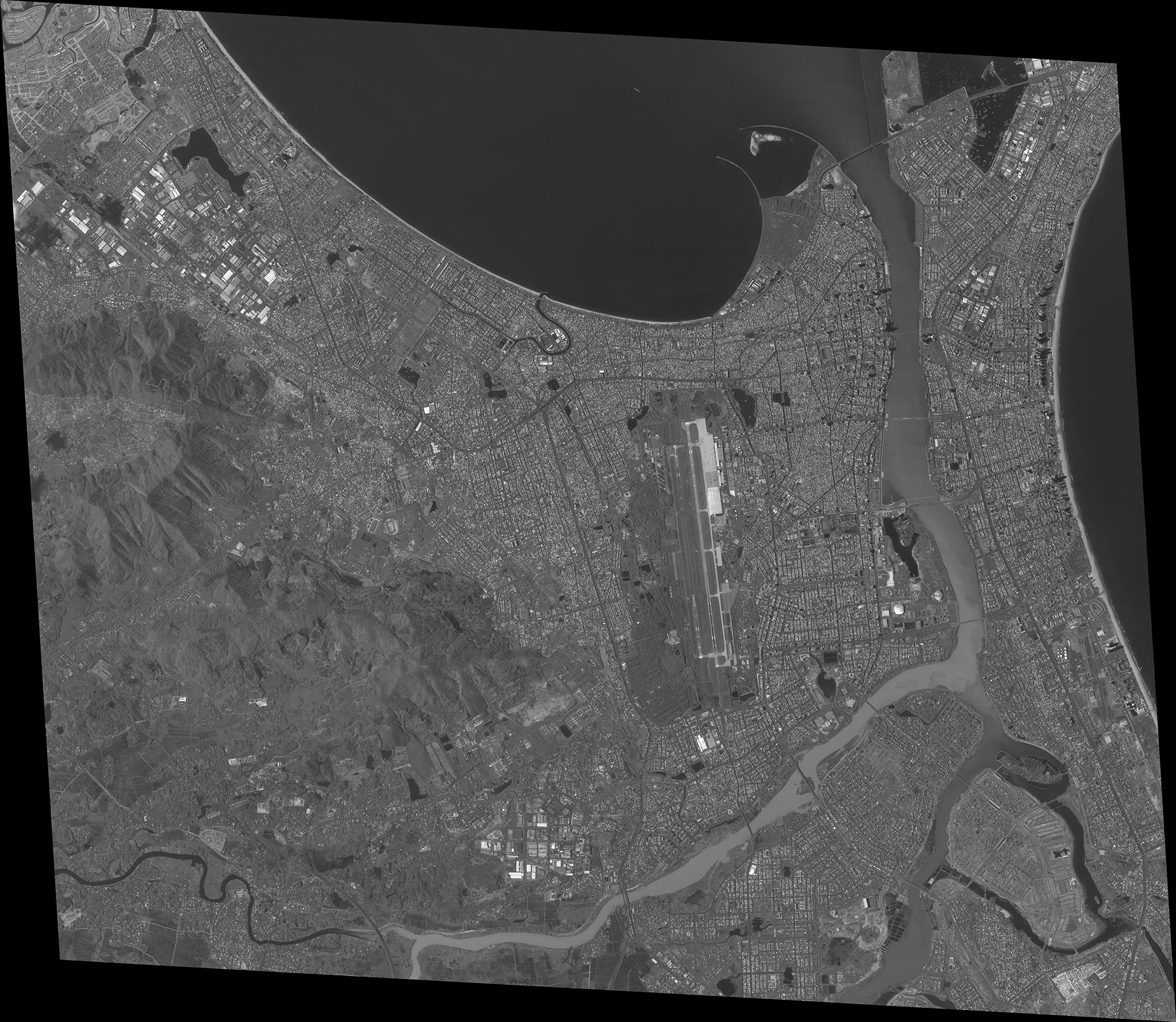
Disaster Situation
Vietnam Meteorological Agency said that from afternoon on September 17 to the night of September 18, provinces from Ha Tinh to Quang Ngai rained 200-300 mm, some places over 400 mm. According to the disaster response scenario, for typhoon level 10 and level 13, more than 107,000 households with more than 548,000 people in the central danger zone may be evacuated. This is usually done 12 hours before a storm hits.