2023-03-06
Emergency Obs. Request Information
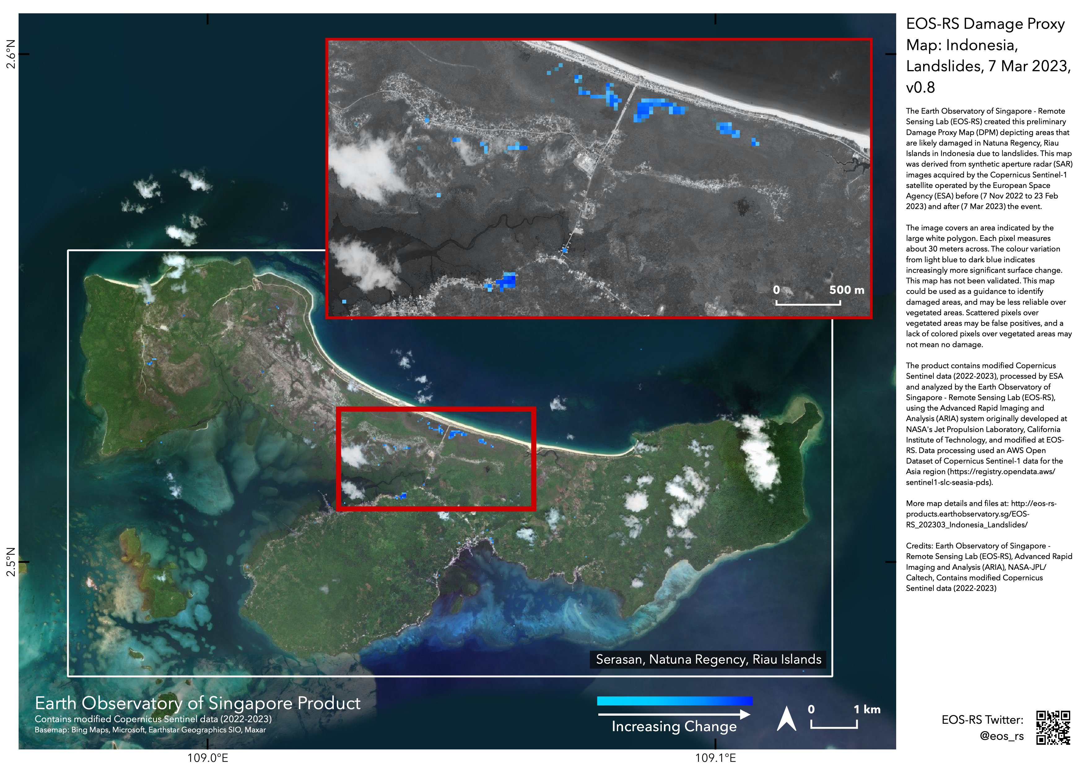
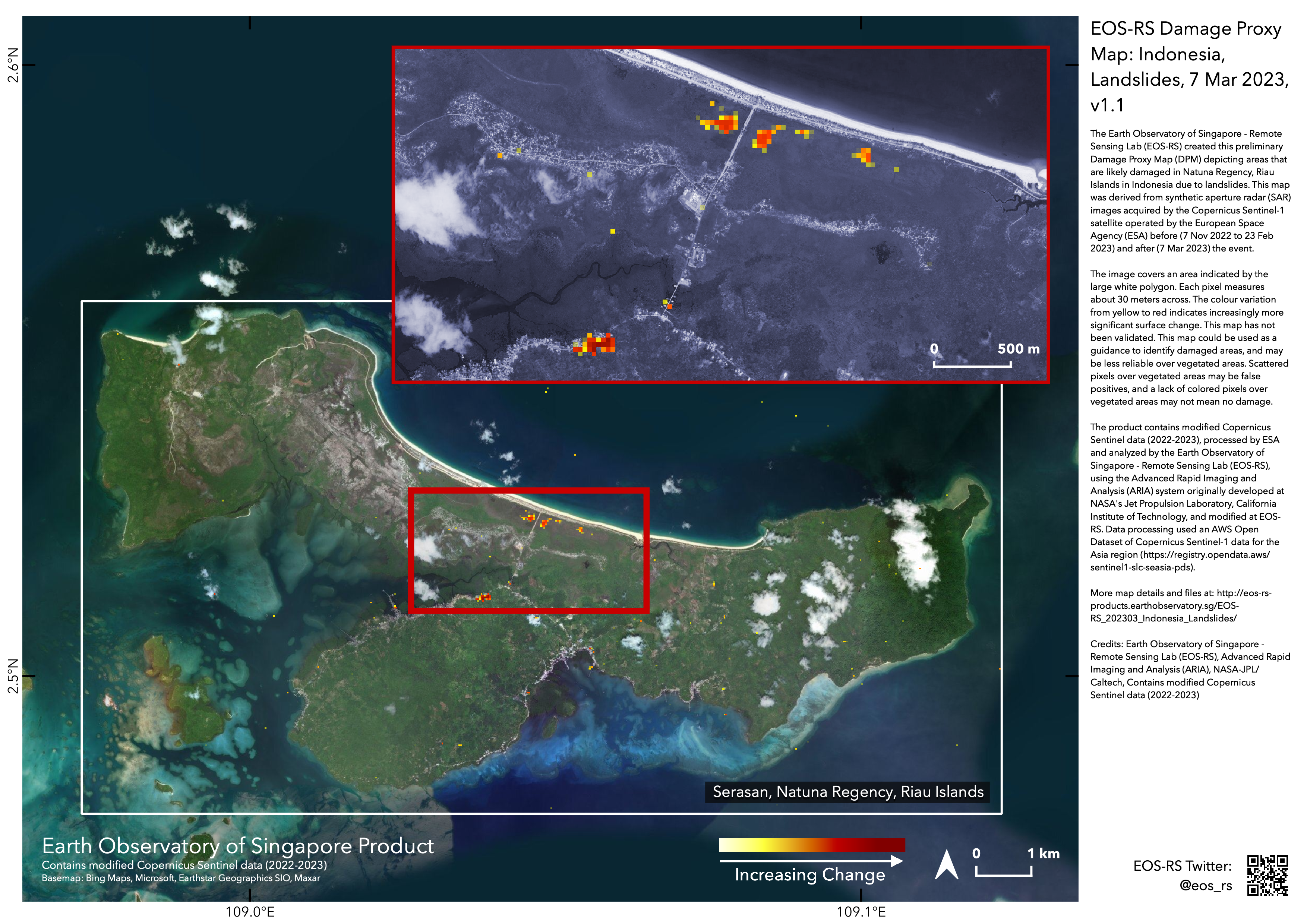
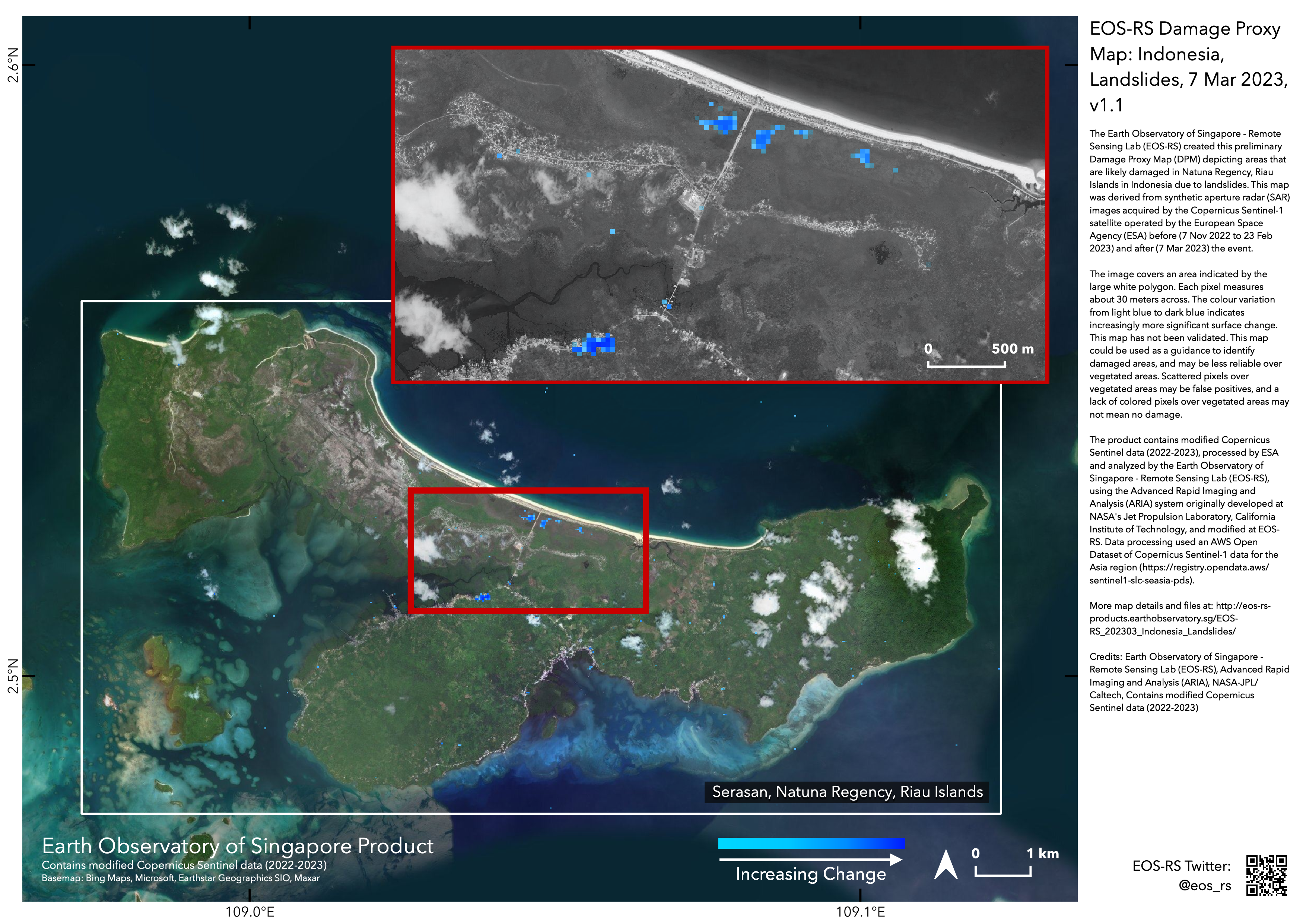
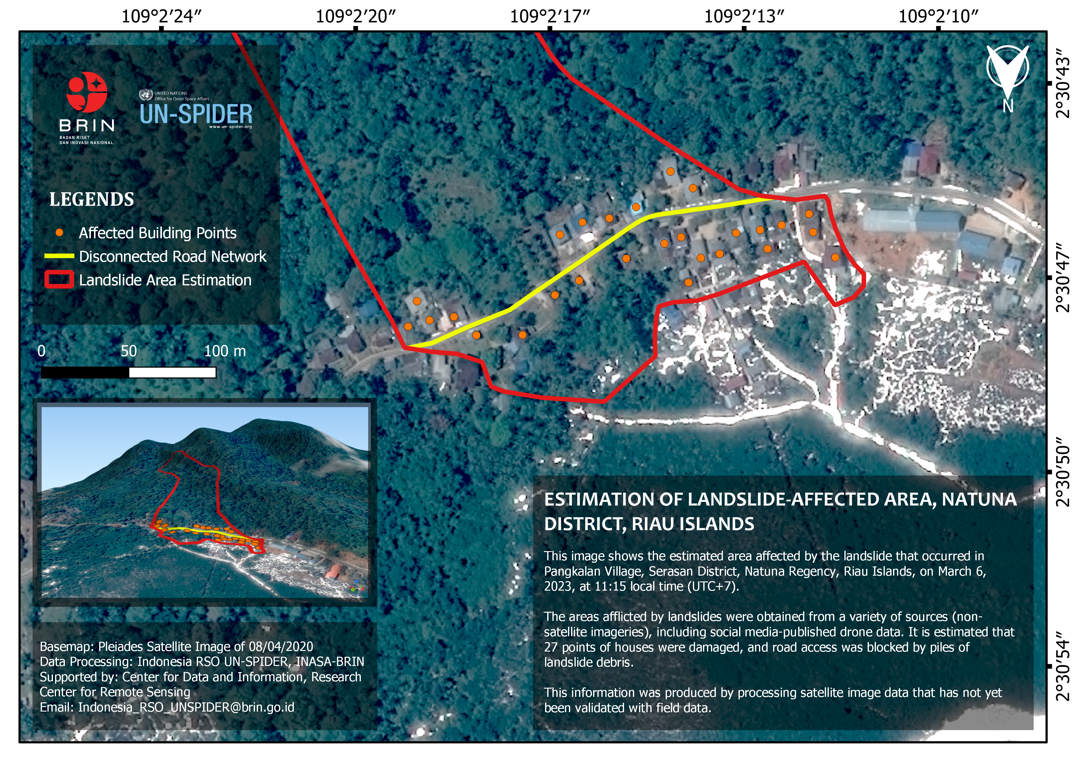
- Disaster Type: Landslide
- Country/Region: Indonesia
- Occurrence Date (UTC): 06 March, 2023
- SA activation Date(UTC): 07 March, 2023
- Requester: Indonesian National Institute of Aeronautics and Space (LAPAN)
- Escalation to the International Charter: Yes
- GLIDE Number: LS-2023-000032-IDN
Disaster Situation
Landslides disaster buried a village (kampung) in Natuna Regency, Riau Islands. At least 10 people have already declared dead. The incident happened in Pangkalan Village at 01.00 PM on Monday. The Regional Disaster Management Agency (BPBD) reported that the landslides happened because of high rain intensity and the flimsy terrain. The agency also said the blocked roads and the problems with telecommunication in the area became hindrance for the rescue teams. BPBD is assisted by the National Search And Rescue Agency (Basarnas), military, polce, and also volunteers. According to the press release in Monday's evening, About 50 people were reported missing, meanwhile 10 people died. "Possible that the data can change. The last information is that 10 body bags were already filled," said the emergency and logistics official at BPBD Riau, Junainah. Furthermore, Junaiah explained how the changing weather made the evacuation difficult. The village's location is also on a different island from Natuna's government office.
News link :
https://www.liputan6.com/global/read/5225640/landslides-buried-a-village-in-natuna-50-people-missing
https://www.thejakartapost.com/indonesia/2023/03/07/natuna-landslide-kills-15-dozens-feared-missing.html
https://www.channelnewsasia.com/asia/indonesia-natuna-landslide-heavy-rain-people-dead-3328476