2023-07-18 Flood, Landslide and Storm in Vietnam on 18 July, 2023

Emergency Obs. Request Information

  • Disaster Type: Flood, Landslide and Storm
  • Country: Vietnam
  • Occurrence Date (UTC): 18 July, 2023
  • SA activation Date(UTC): 17 July, 2023
  • Requester: Ministry of Natural Resources and Environment (MONRE)
  • Escalation to the International Charter: No
  • GLIDE Number: FL-2023-000125-VNM
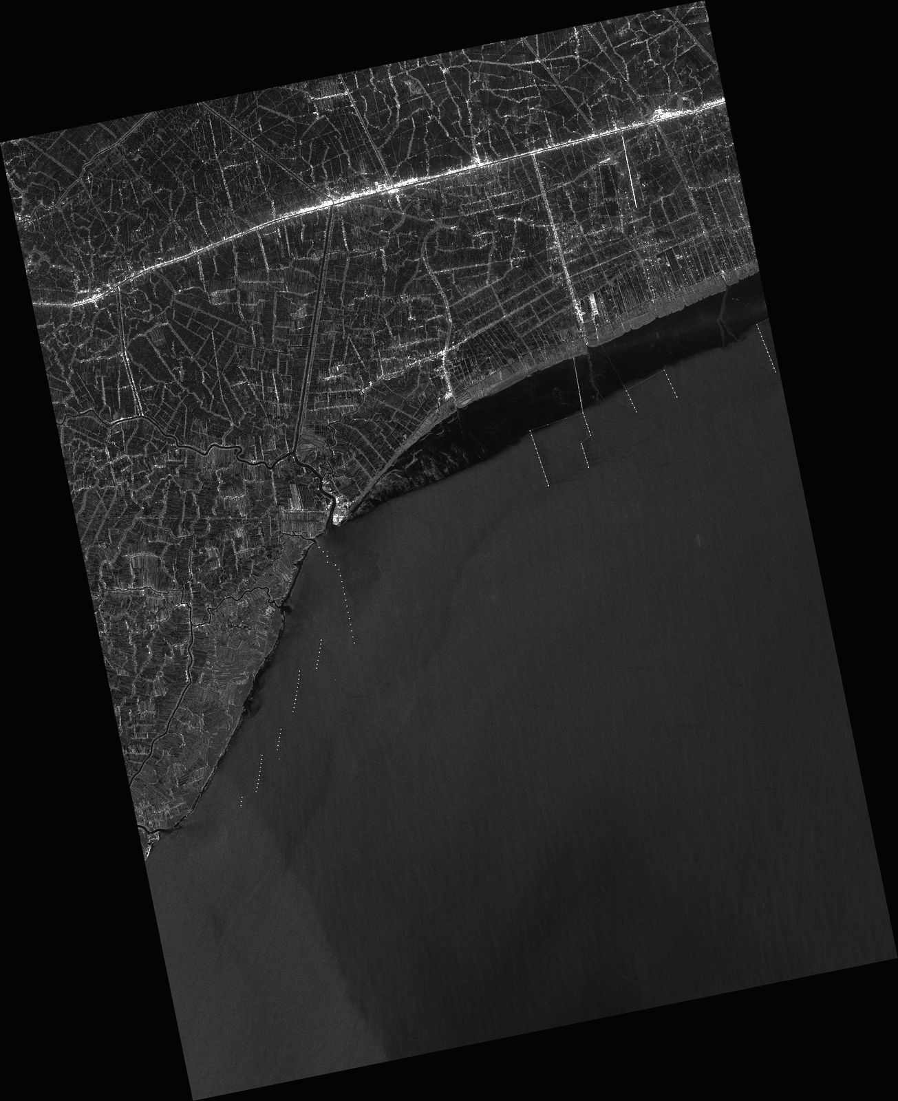
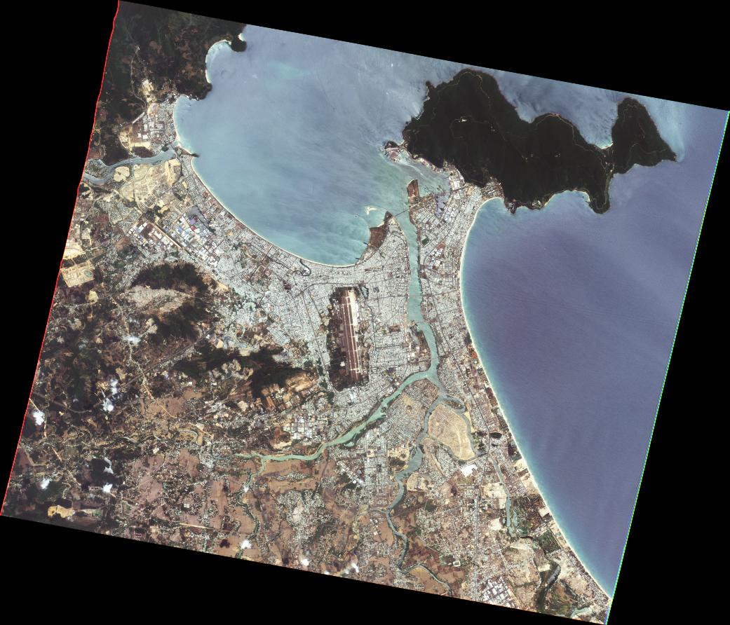
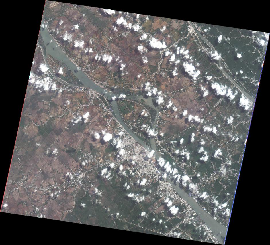
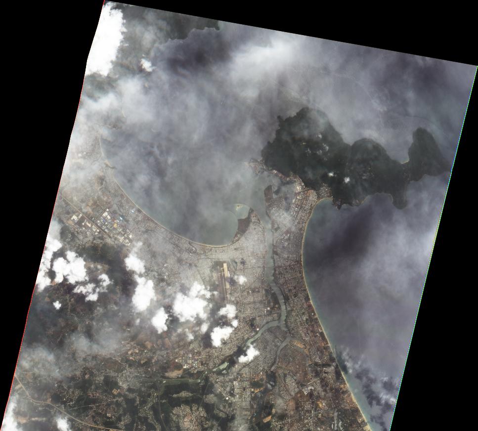
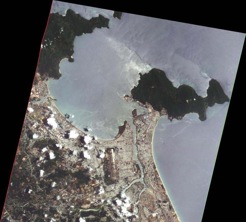
Disaster Situation

https://nchmf.gov.vn/Kttv/vi-VN/1/tin-bao-khan-cap-con-bao-so-04-post29340.html
News about typhoon Talim, the Japanese radio forecast that the storm will maintain winds of 126 km/h when approaching the shore.
The North Sea of the East Sea has 6-8 m high waves. From tomorrow morning, the northern Gulf of Tonkin will have increasing waves, 3-5 m high. Coastal provinces of Quang Ninh - Nam Dinh, sea waves are 2-4 m high. Along the coasts of Quang Ninh - Thai Binh provinces, the storm surge is 0.5-0.8 m, and the total water level is 2.3-2.9 m high. From tonight to July 20, the North will have heavy rain of 200-350 mm, in some places over 500 mm. Located at the edge of the storm's center, Thanh Hoa and Nghe An rain commonly 70-150 mm, in some places over 250 mm.
The Vietnam Meteorological Agency has especially warned that heavy rain may cause urban flooding; risk of flash floods and landslides from July 18 in the North, especially in the provinces of Quang Ninh, Lang Son, Cao Bang, Ha Giang, Lao Cai, and Yen Bai.

Web GIS

Product

   AIT   

2023-07-22

DETECTED FLOOD WATER IN SOUTHERN REGION, VIETNAM
As observed by ALOS-2 image on 21 July 2023


2023-07-22

DETECTED FLOOD WATER IN SOUTHERN REGION, VIETNAM
As observed by ALOS-2 image on 21 July 2023


2023-07-24

DETECTED FLOOD WATER IN CENTRAL COAST REGION, VIETNAM
As observed by ALOS-2 image on 21 July 2023


2023-07-24

DETECTED FLOOD WATER IN CENTRAL COAST REGION, VIETNAM
As observed by ALOS-2 image on 21 July 2023


   MBRSC   

2023-08-07

DETECTED FLOOD WATER NORTH COASTAL CENTRAL REGION, VIETNAM
As Observed by Sentinel-1 image on 23 July 2023


2023-08-07

DETECTED FLOOD WATER NORTH COASTAL CENTRAL REGION, VIETNAM
As Observed by Sentinel-1 image on 23 July 2023


2023-08-07

DETECTED FLOOD WATER SOUTHERN REGION,
VIETNAM
As Observed by Sentinel-1 image on 28 July 2023


2023-08-07

DETECTED FLOOD WATER SOUTHERN REGION,
VIETNAM
As Observed by Sentinel-1 image on 28 July 2023


Satellite Image

   Before Disaster   

   JAXA   

2023-05-12

ALOS-2 Level2.1
IMG HH ALOS2 48424/3300 2023/05/12 WBD R 2.1 GUD

2023-05-12

ALOS-2 Level2.1
IMG HH ALOS2 48424/3350 2023/05/12 WBD R 2.1 GUD

2023-06-23

ALOS-2 Level2.1
IMG HH ALOS2 49053/0170 2023/06/23 HBQ R 2.1 GUA

2023-06-23

ALOS-2 Level2.1
IMG HH ALOS2 49053/0180 2023/06/23 HBQ R 2.1 GUA

2023-06-23

ALOS-2 Level2.1
IMG HH ALOS2 49053/0190 2023/06/23 HBQ R 2.1 GUA

2023-06-23

ALOS-2 Level2.1
IMG HH ALOS2 49053/0200 2023/06/23 HBQ R 2.1 GUA

2023-06-23

ALOS-2 Level2.1
IMG HH ALOS2 49053/0210 2023/06/23 HBQ R 2.1 GUA

2023-07-07

ALOS-2 Level2.1
IMG HH ALOS2 49252/3400 2023/07/07 WBD R 2.1 GUD

2023-07-07

ALOS-2 Level2.1
IMG HH ALOS2 49260/0170 2023/07/07 HBQ R 2.1 GUA

2023-07-07

ALOS-2 Level2.1
IMG HH ALOS2 49260/0180 2023/07/07 HBQ R 2.1 GUA

2023-07-07

ALOS-2 Level2.1
IMG HH ALOS2 49260/0190 2023/07/07 HBQ R 2.1 GUA

2023-07-07

ALOS-2 Level2.1
IMG HH ALOS2 49260/0200 2023/07/07 HBQ R 2.1 GUA

2023-07-07

ALOS-2 Level2.1
IMG HH ALOS2 49260/0210 2023/07/07 HBQ R 2.1 GUA

   TASA   

2021-05-18

FORMOSAT-5 Level4
FS5 G000 PMS L4UTM 2021/05/18 03:54:49

2022-04-17

FORMOSAT-5 Level4
FS5 G000 PMS L4UTM 2022/04/17 03:48:34

   After Disaster   

   JAXA   

2023-07-21

ALOS-2 Level2.1
IMG HH ALOS2 49459/3300 2023/07/21 WBD R 2.1 GUD

2023-07-21

ALOS-2 Level2.1
IMG HH ALOS2 49459/3350 2023/07/21 WBD R 2.1 GUD

2023-07-21

ALOS-2 Level2.1
IMG HH ALOS2 49459/3400 2023/07/21 WBD R 2.1 GUD

2023-07-21

ALOS-2 Level2.1
IMG HH ALOS2 49467/0170 2023/07/21 HBQ R 2.1 GUA

2023-07-21

ALOS-2 Level2.1
IMG HH ALOS2 49467/0180 2023/07/21 HBQ R 2.1 GUA

2023-07-21

ALOS-2 Level2.1
IMG HH ALOS2 49467/0190 2023/07/21 HBQ R 2.1 GUA

2023-07-21

ALOS-2 Level2.1
IMG HH ALOS2 49467/0200 2023/07/21 HBQ R 2.1 GUA

2023-07-21

ALOS-2 Level2.1
IMG HH ALOS2 49467/0210 2023/07/21 HBQ R 2.1 GUA

   TASA   

2023-07-19

FORMOSAT-5 Level4
FS5 G000 PMS L4UTM 2023/07/19 03:42:50

2023-07-19

FORMOSAT-5 Level4
FS5 G001 PMS L4UTM 2023/07/19 03:42:53

2023-07-21

FORMOSAT-5 Level4
FS5 G000 PMS L4UTM 2023/07/21 03:42:50

2023-07-21

FORMOSAT-5 Level4
FS5 G001 PMS L4UTM 2023/07/21 03:42:53

2023-07-23

FORMOSAT-5 Level4
FS5 G000 PMS L4UTM 2023/07/23 03:44:28

2023-07-25

FORMOSAT-5 Level4
FS5 G000 PMS L4UTM 2023/07/25 03:44:28

2023-07-25

FORMOSAT-5 Level4
FS5 G001 PMS L4UTM 2023/07/25 03:44:31

   ISRO   

2023-07-22

Resourcesat-2 AW
Path=128 Row=061
22-JUL-2023 03:08:40

   GISTDA   

2023-07-20

THEOS1 level 2A
T1 M 2023/07/20 03:09:23.8 0274-0315
1504

2023-07-20

THEOS1 level 2A
T1 M 2023/07/20 03:09:32.5 0274-0317
0

2023-07-20

THEOS1 level 2A
T1 P 2023/07/20 03:09:21.8 0274-0315
0

2023-07-20

THEOS1 level 2A
T1 P 2023/07/20 03:09:25.2 0274-0316
0

2023-07-20

THEOS1 level 2A
T1 P 2023/07/20 03:09:28.6 0274-0316
0

2023-07-20

THEOS1 level 2A
T1 P 2023/07/20 03:09:32.0 0274-0317
0

2023-07-20

THEOS1 level 2A
T1 P 2023/07/20 03:09:35.4 0274-0317
0