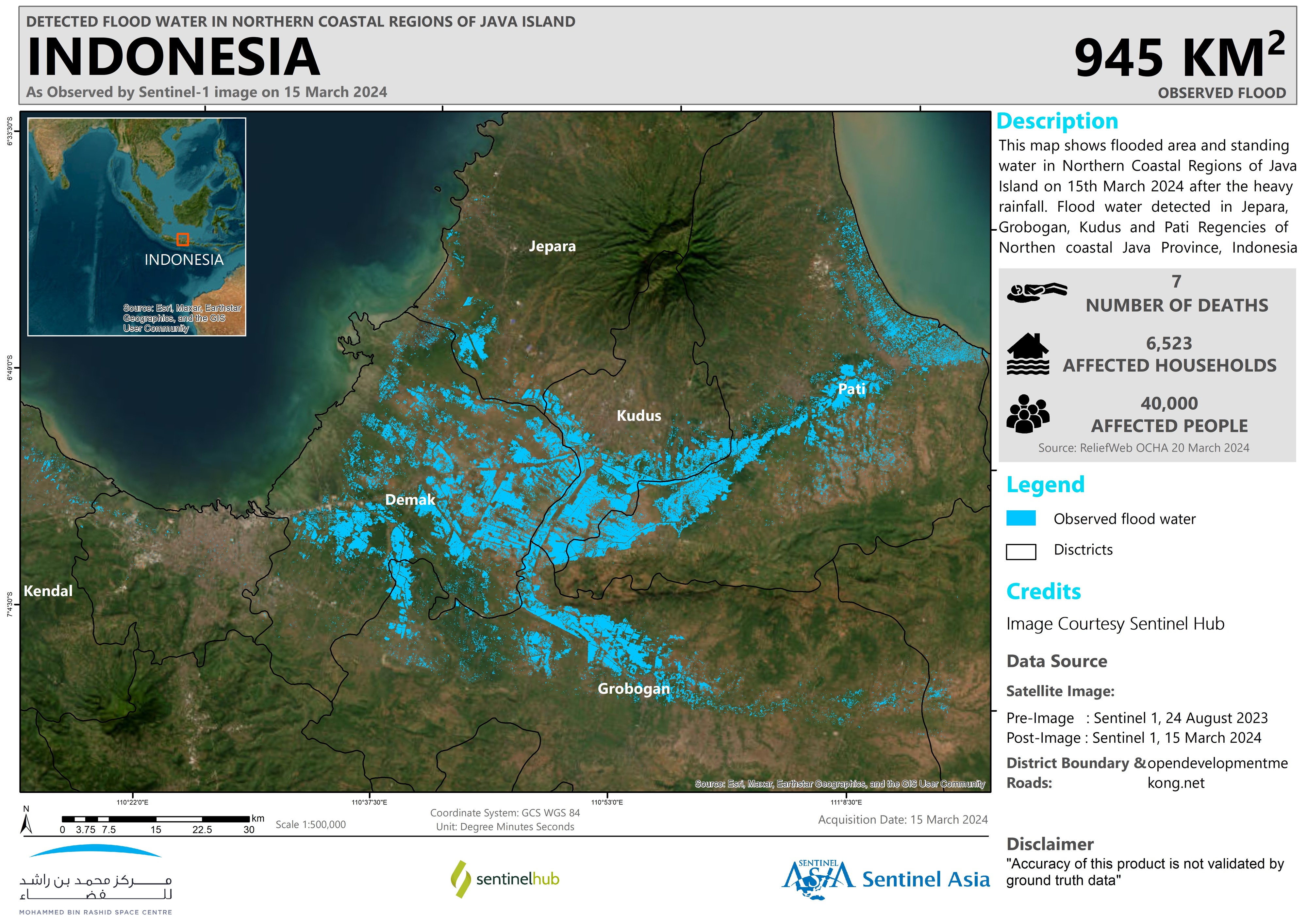
2024-03-15
Emergency Obs. Request Information
- Disaster Type: Flood
- Country/Region: Indonesia
- Occurrence Date (UTC): 15 March, 2024
- SA activation Date(UTC): 20 March, 2024
- Requester: National Research and Innovation Agency (BRIN)
- Escalation to the International Charter: No
- GLIDE Number: FL-2024-000026-IDN
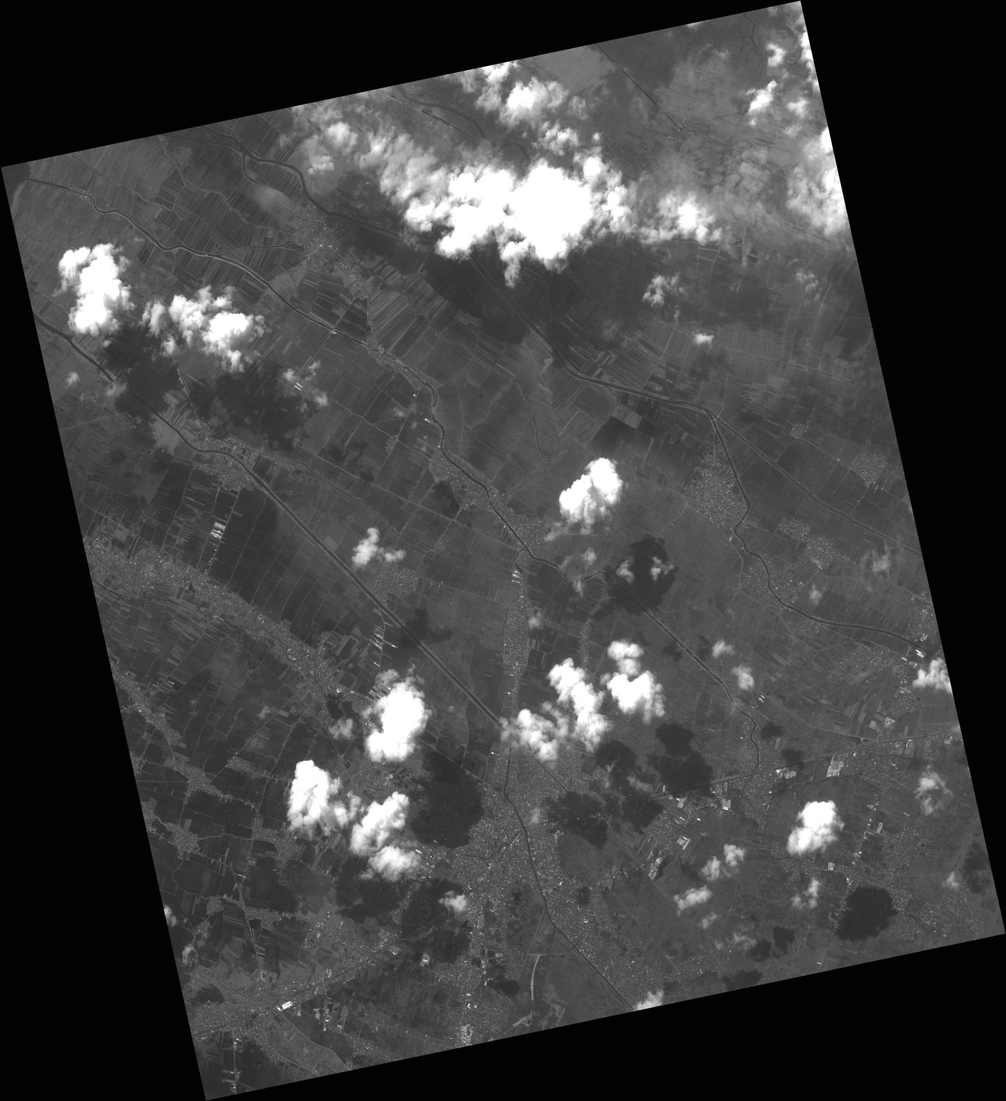
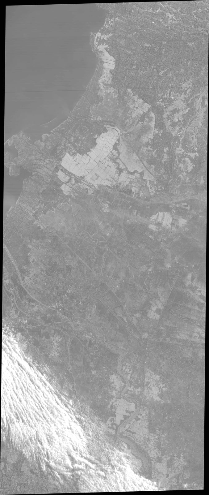
Disaster Situation
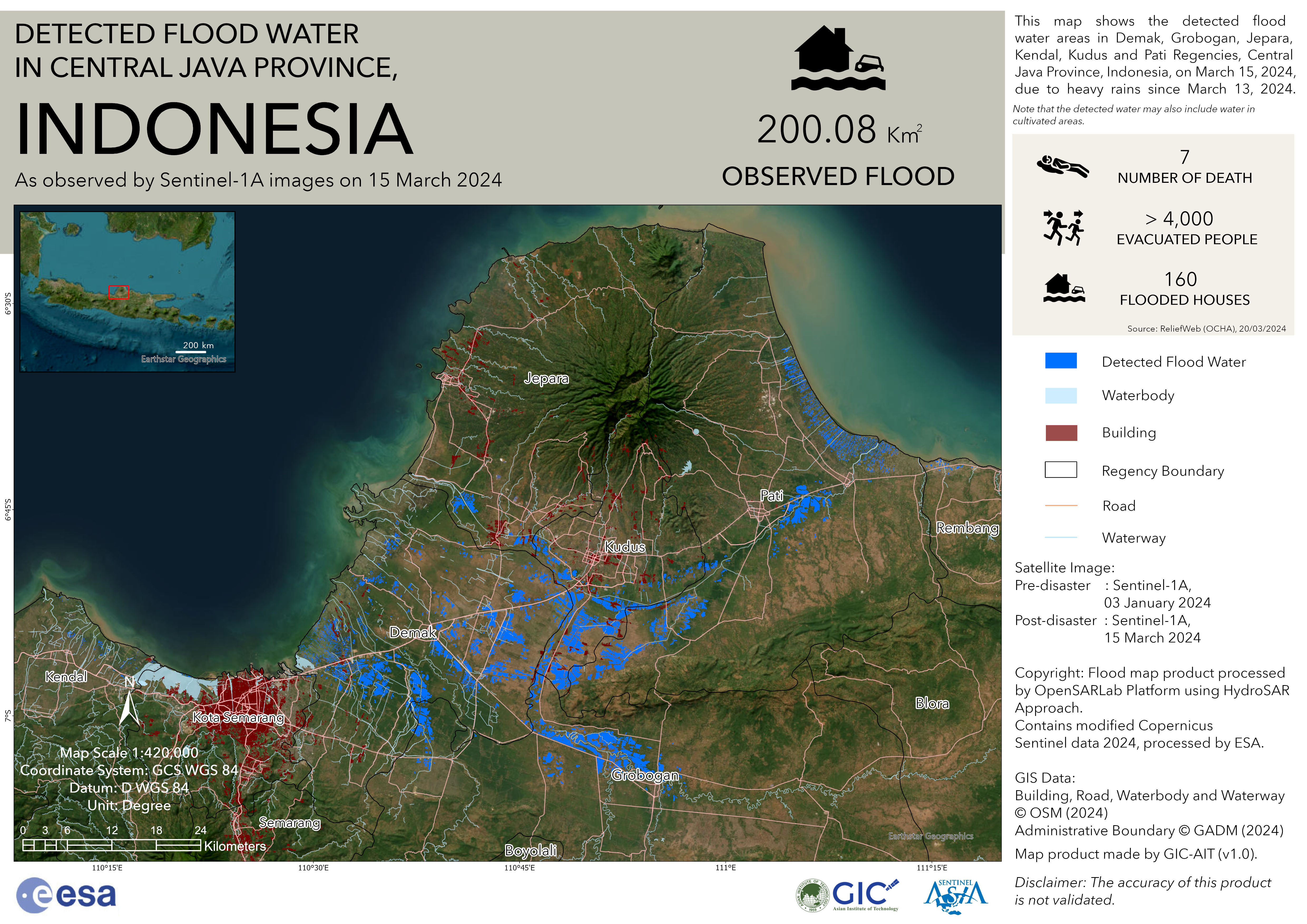
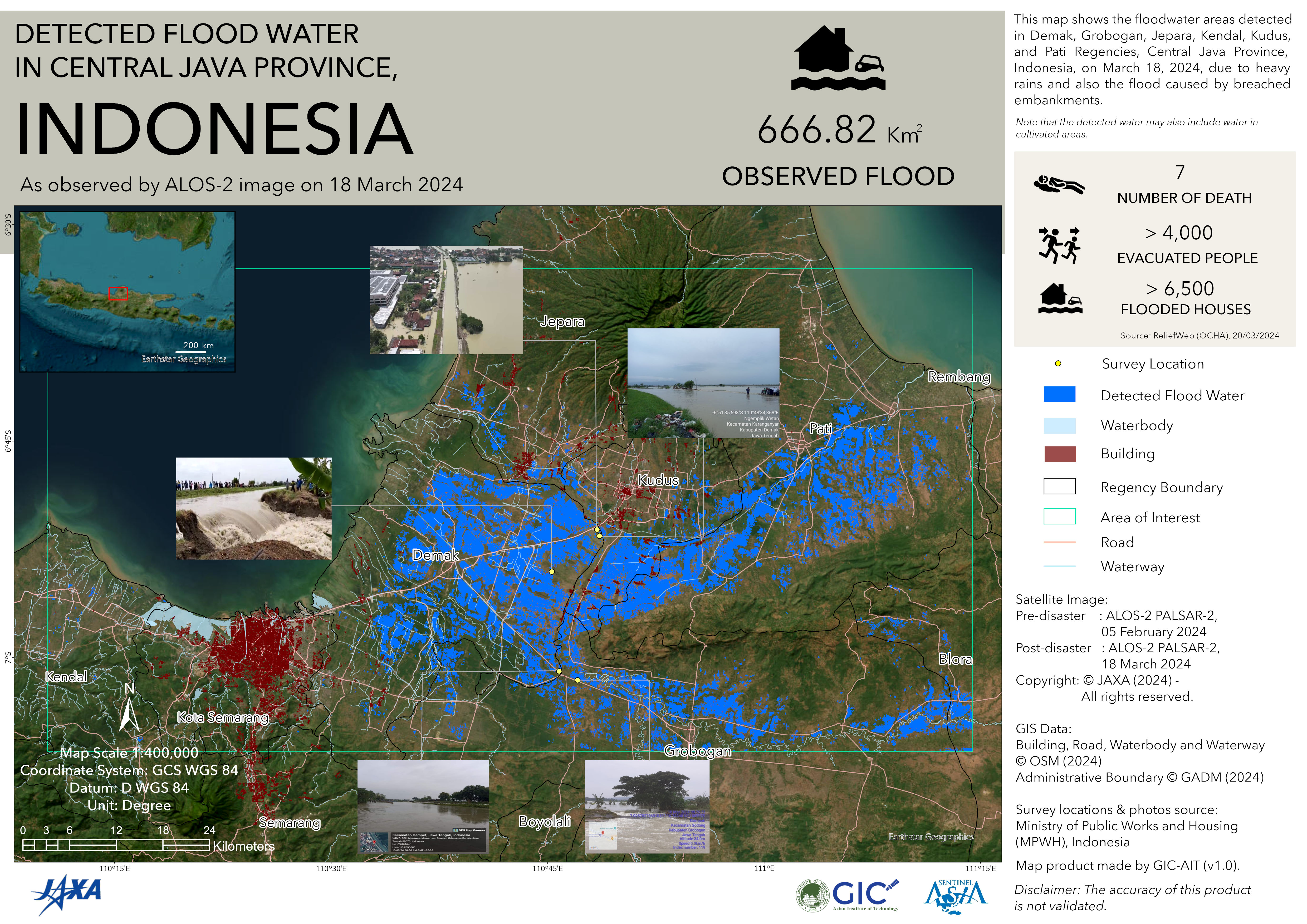
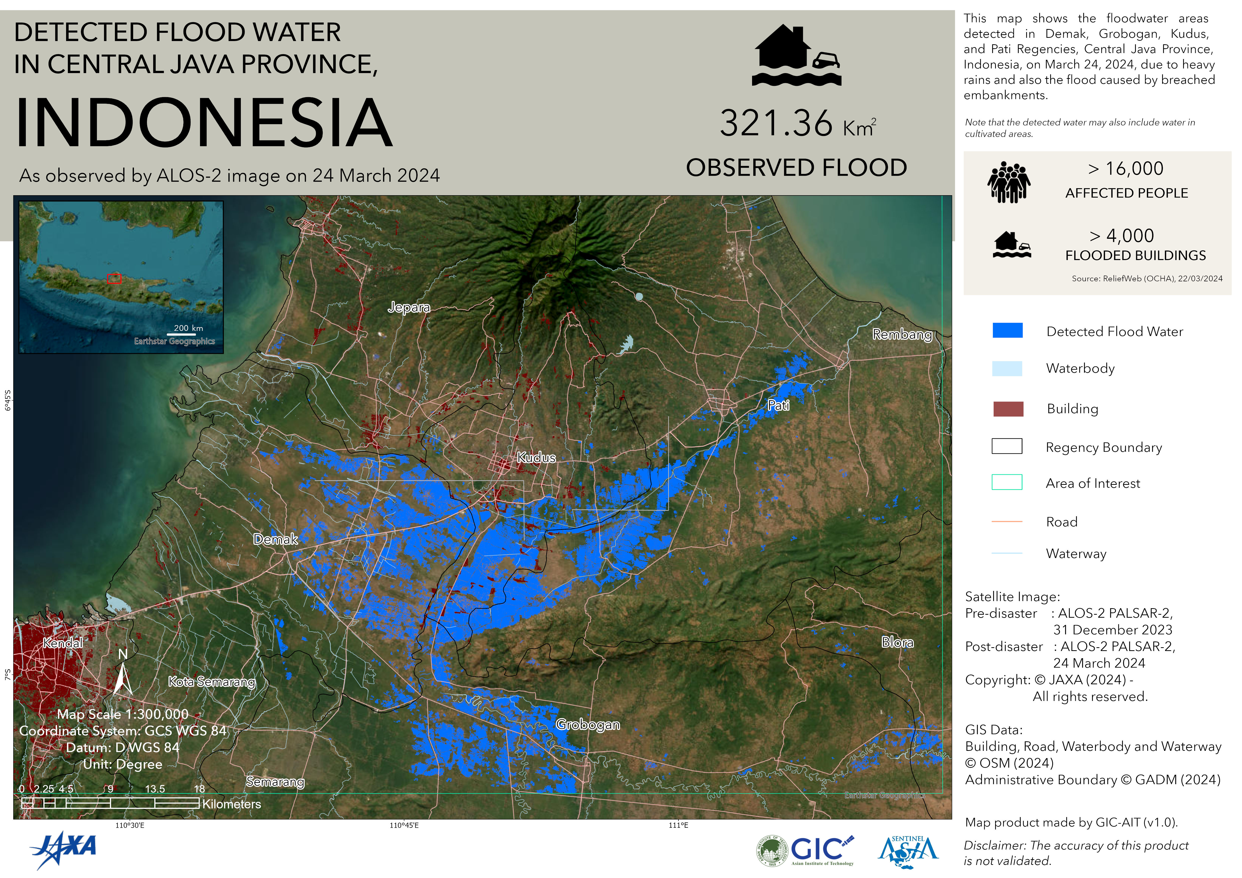
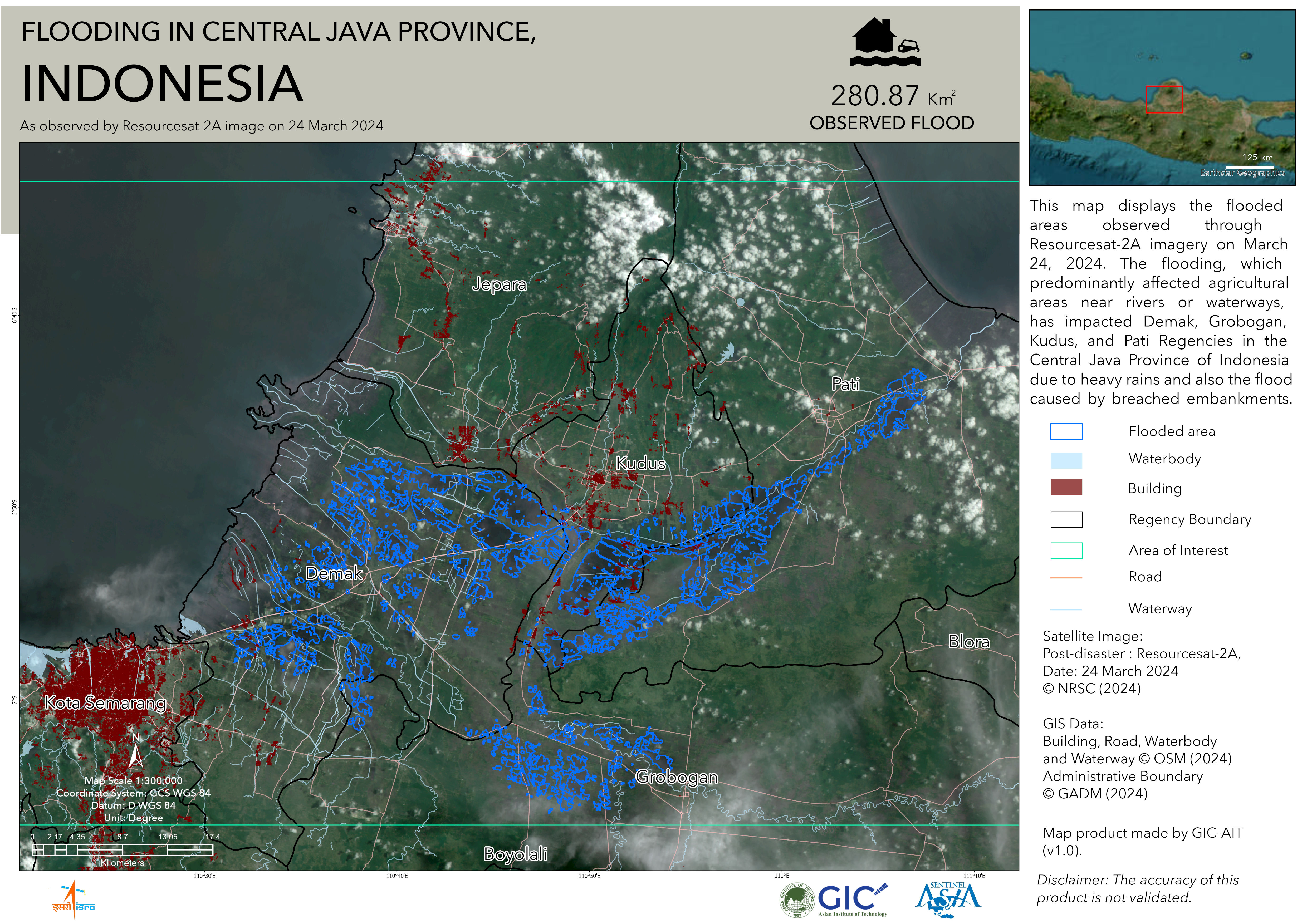
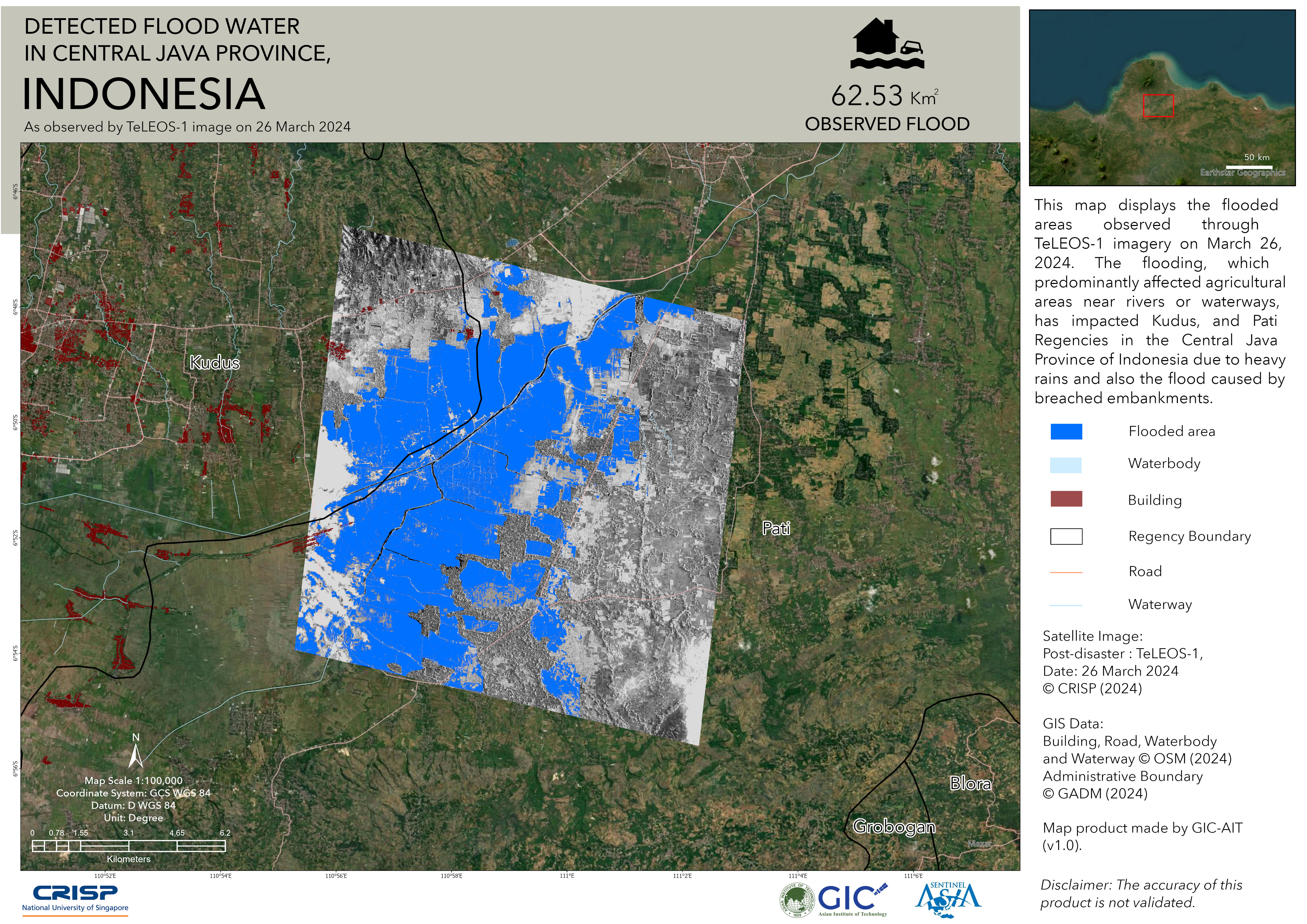
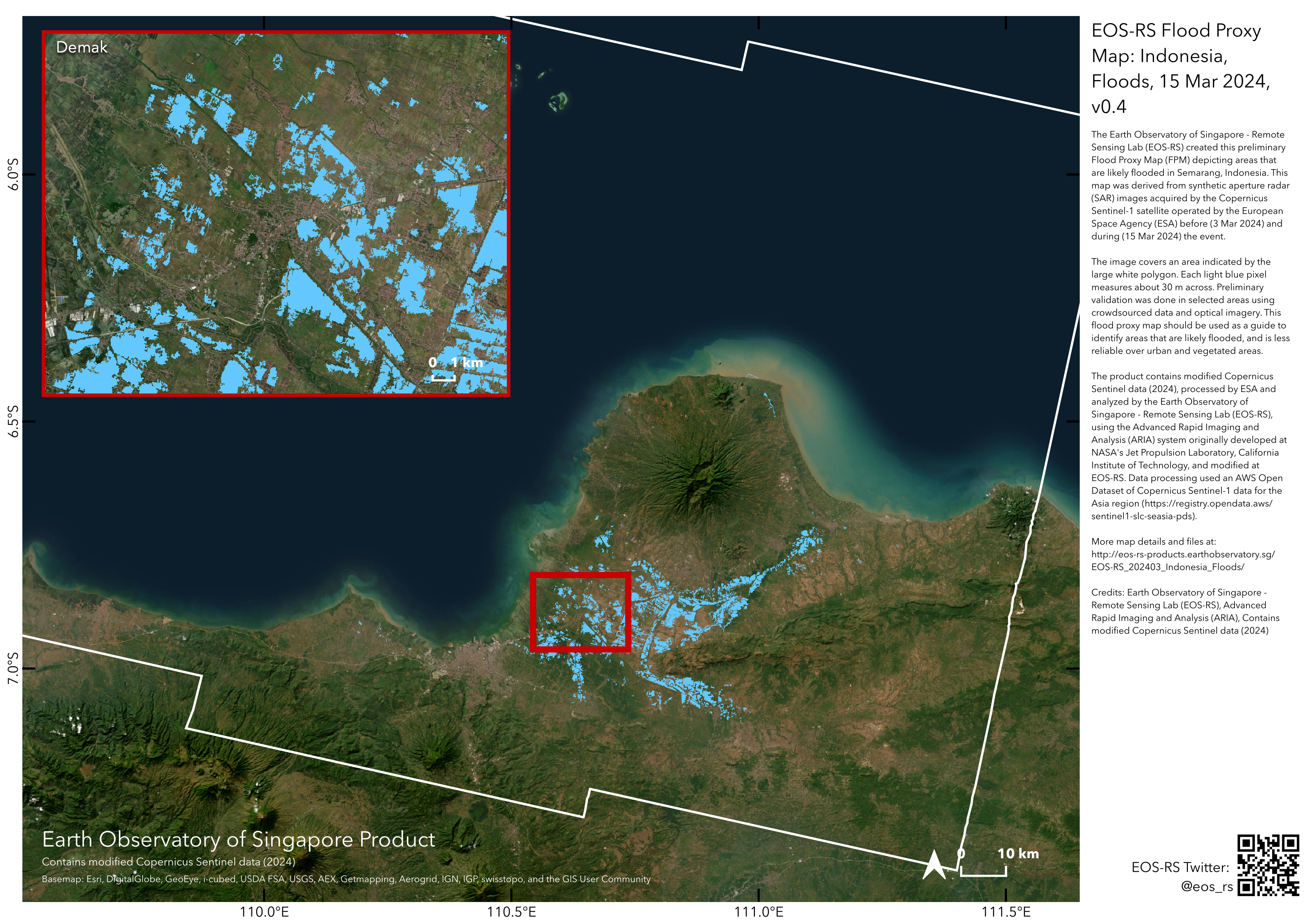
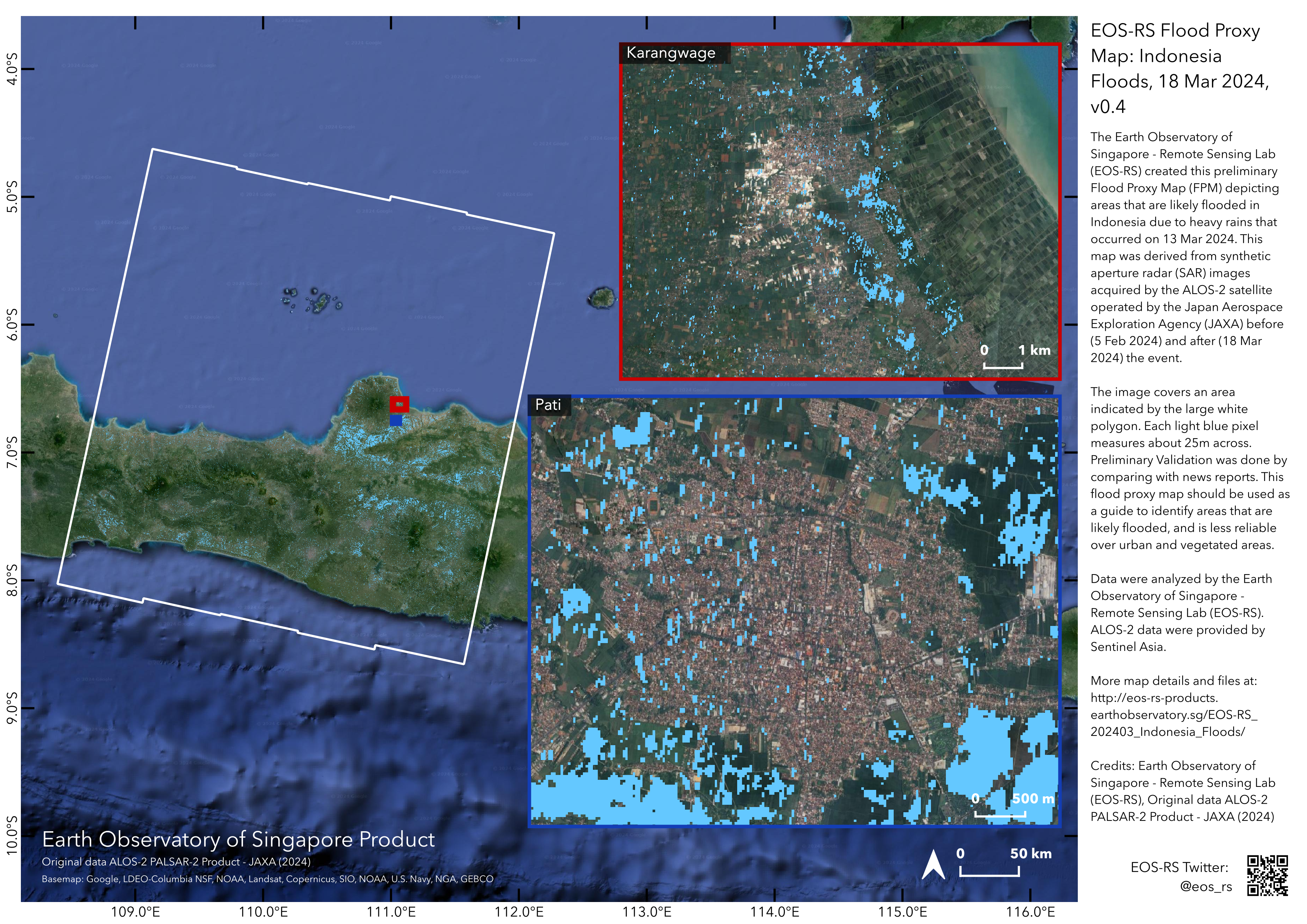
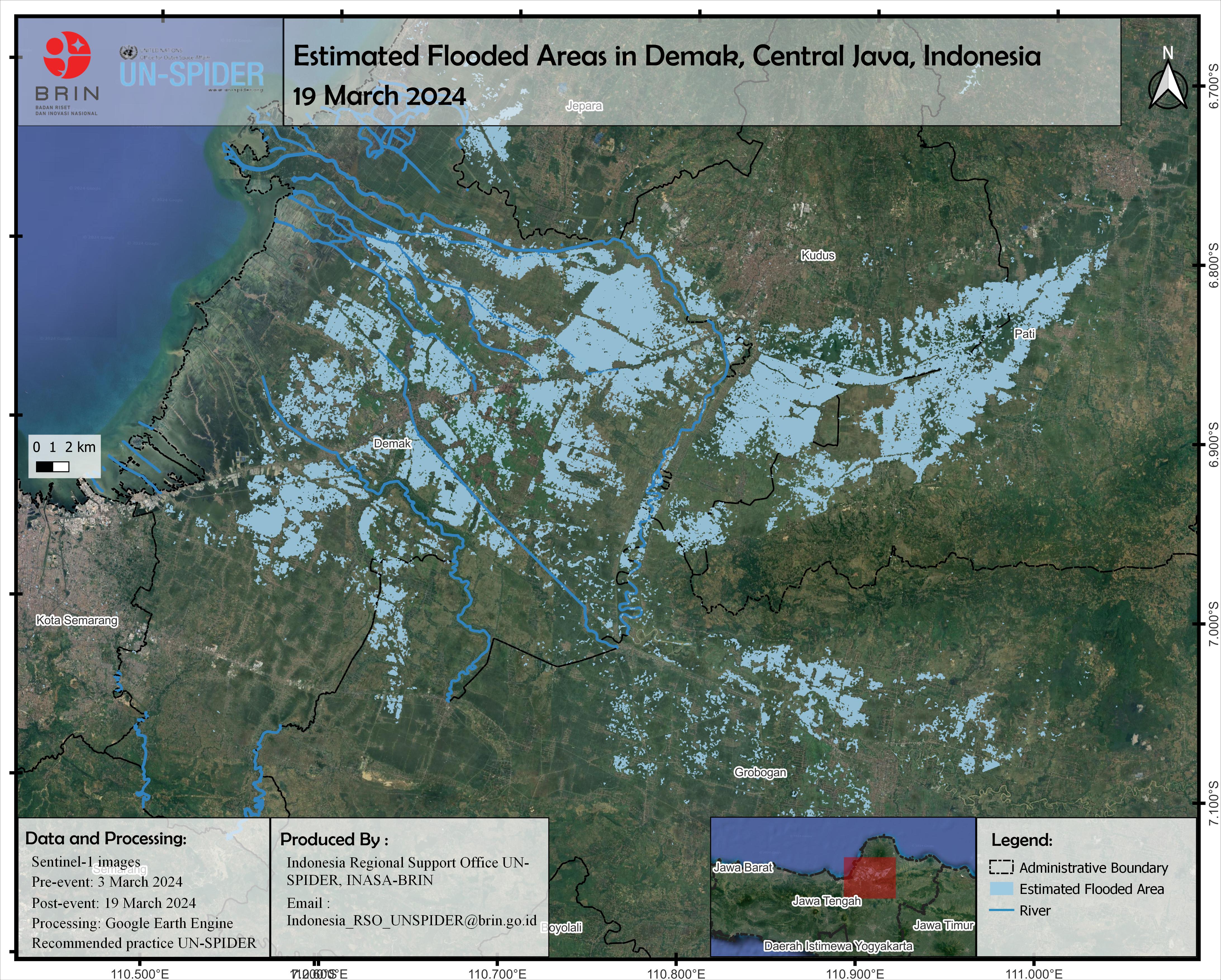
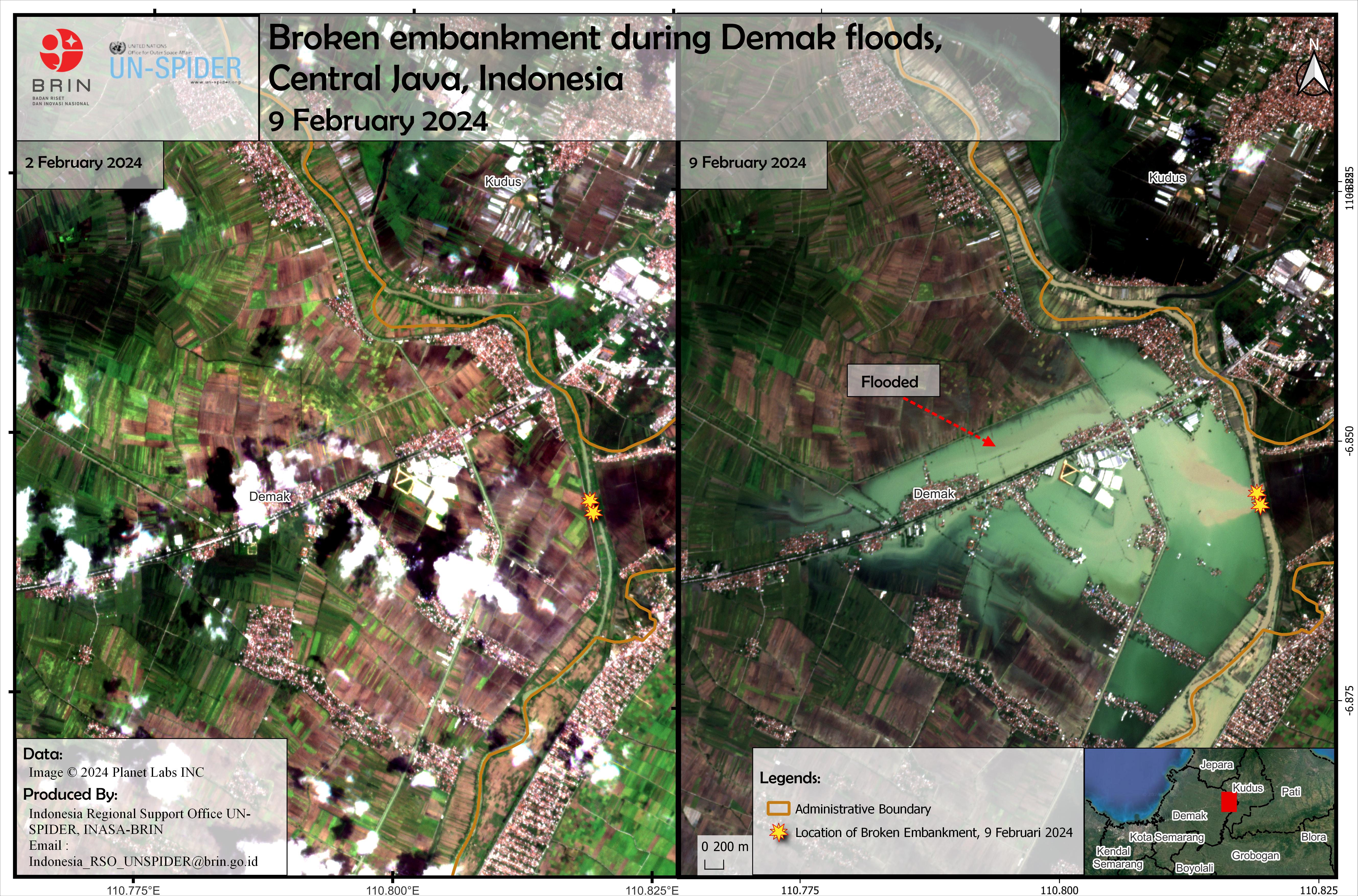
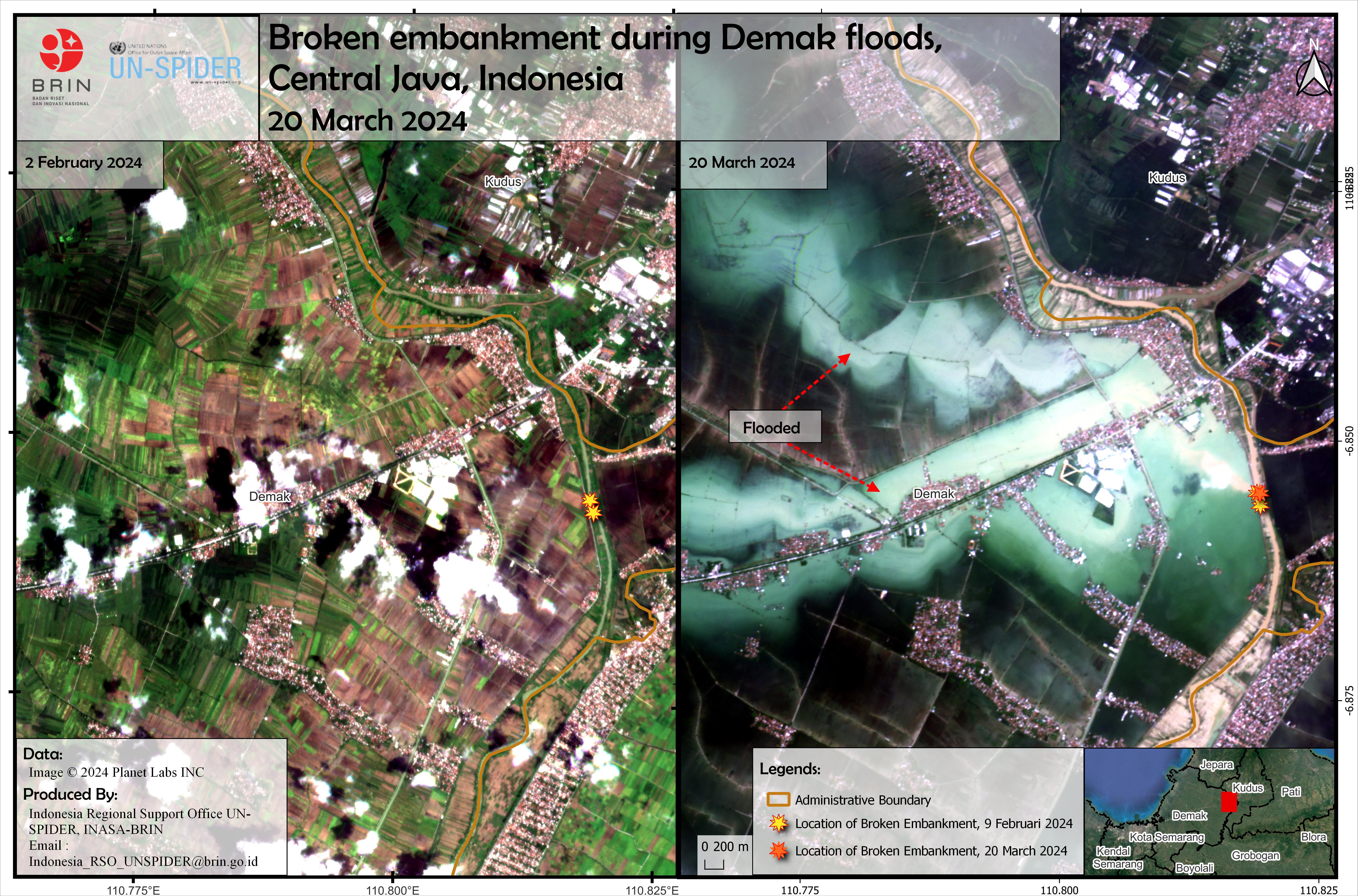
The northern coastal regions of Java Island have experienced an escalation in the extent of persistent flooding that has lasted for over a week. Considerable human and material loss of life and property is a risk in this densely populated agricultural region. Additionally, this catastrophe occurs during a sacred month in Indonesia, which is extremely distressing. We intend to monitor it. Floods that have been ongoing for more than a week have gotten more prevalent in Java Island's northern coastal districts. According to reports/news, the event began in several districts between March 13 and 15. Flooding has not subsided as of today due to heavy rainfall.
https://bnpb.go.id/berita/enam-tanggul-jebol-11-kecamatan-di-kabupaten-demak-terendam-banjir
https://bnpb.go.id/berita/kepala-bnpb-tinjau-lokasi-terdampak-banjir-di-kendal
https://en.antaranews.com/news/308901/flash-floods-in-central-javas-kudus-affected-39272-residents-bpbd?utm_source=antaranews&utm_medium=desktop&utm_campaign=top_news
Web GIS
-
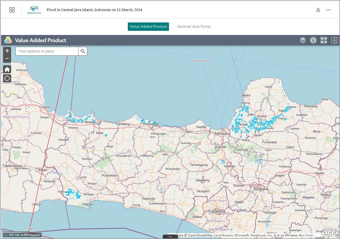
Flood in Central Java Island, Indonesia on 15 March, 2024 see detail
-
EOR requesters-only Web-GIS site (with satellite imagery)
see detail
The account will be sent to the EOR requester after Web GIS page is prepared.
If you are interested in to be a member of Sentinel Asia, please contact: z-sentinel.asia@ml.jaxa.jp