2024-09-19
Emergency Obs. Request Information
- Disaster Type: Flood, Landslide and Storm
- Country/Region: Vietnam
- Occurrence Date (UTC): 19 September, 2024
- SA activation Date(UTC): 19 September, 2024
- Requester: Ministry of Natural Resources and Environment (MONRE)
- Escalation to the International Charter: No
- GLIDE Number: TC-2024-000172-VNM
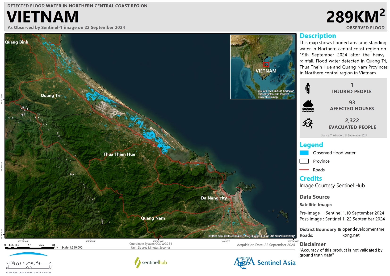
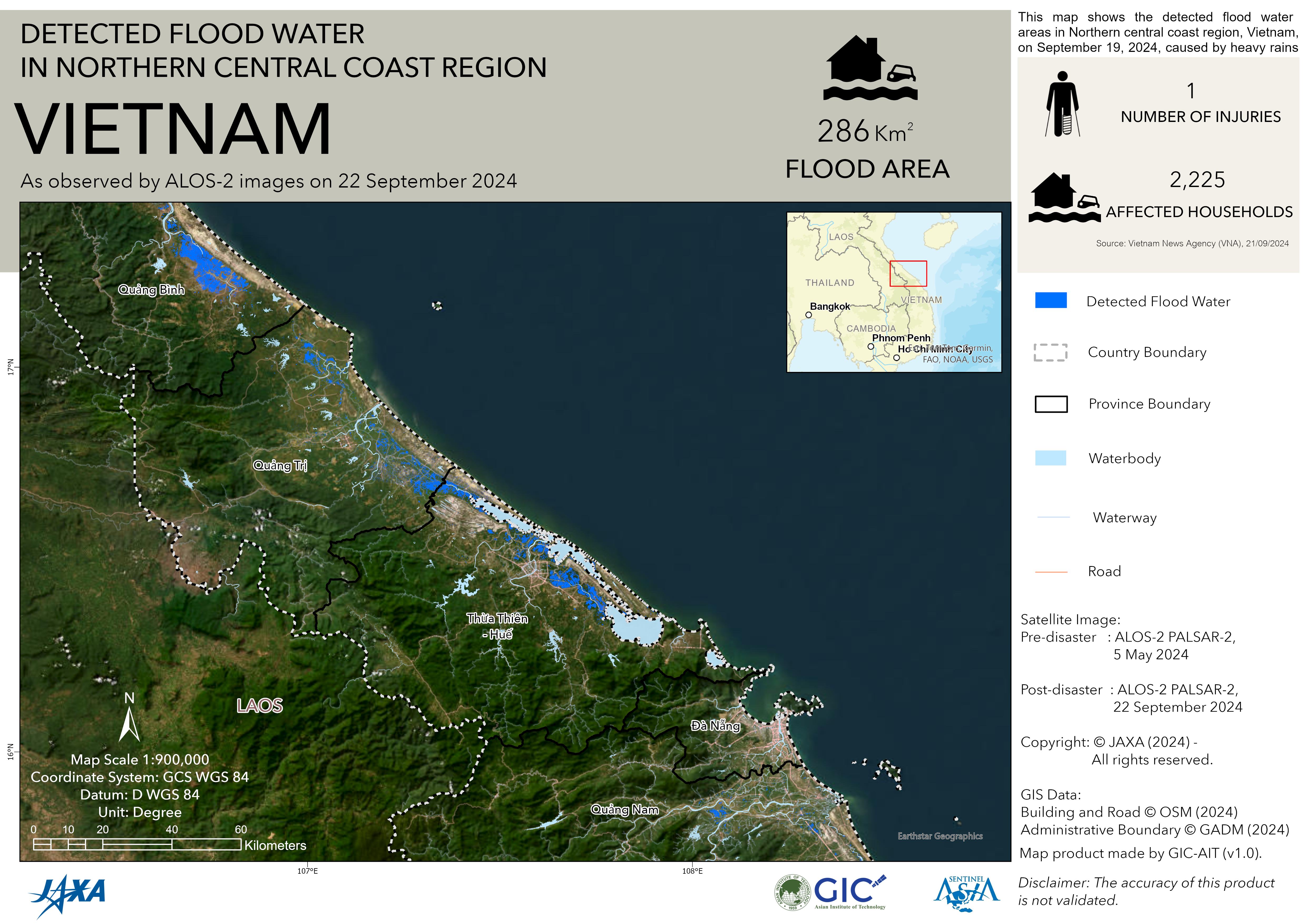
Disaster Situation
At 10:00 on September 19, the center of storm No. 4 (international name Soulik) was located at about 17.2 degrees North latitude; 107.6 degrees East longitude, over the sea of Quang Binh - Thua Thien Hue provinces. The strongest wind near the center of the storm is level 8-9 (62-88km/h), gusting to level 10-11 (89-117km/h); moving in the West-Southwest direction at a speed of about 25km/h…
https://nchmf.gov.vn/Kttv/vi-VN/1/tin-bao-khan-cap-con-bao-so-4-post398.html
https://e.vnexpress.net/news/news/environment/tropical-storm-to-hit-central-vietnam-thursday-afternoon-4794044.html
https://en.vietnamplus.vn/pm-urges-immediate-actions-as-tropical-depression-threatens-central-vietnam-post296836.vnp
Web GIS
-
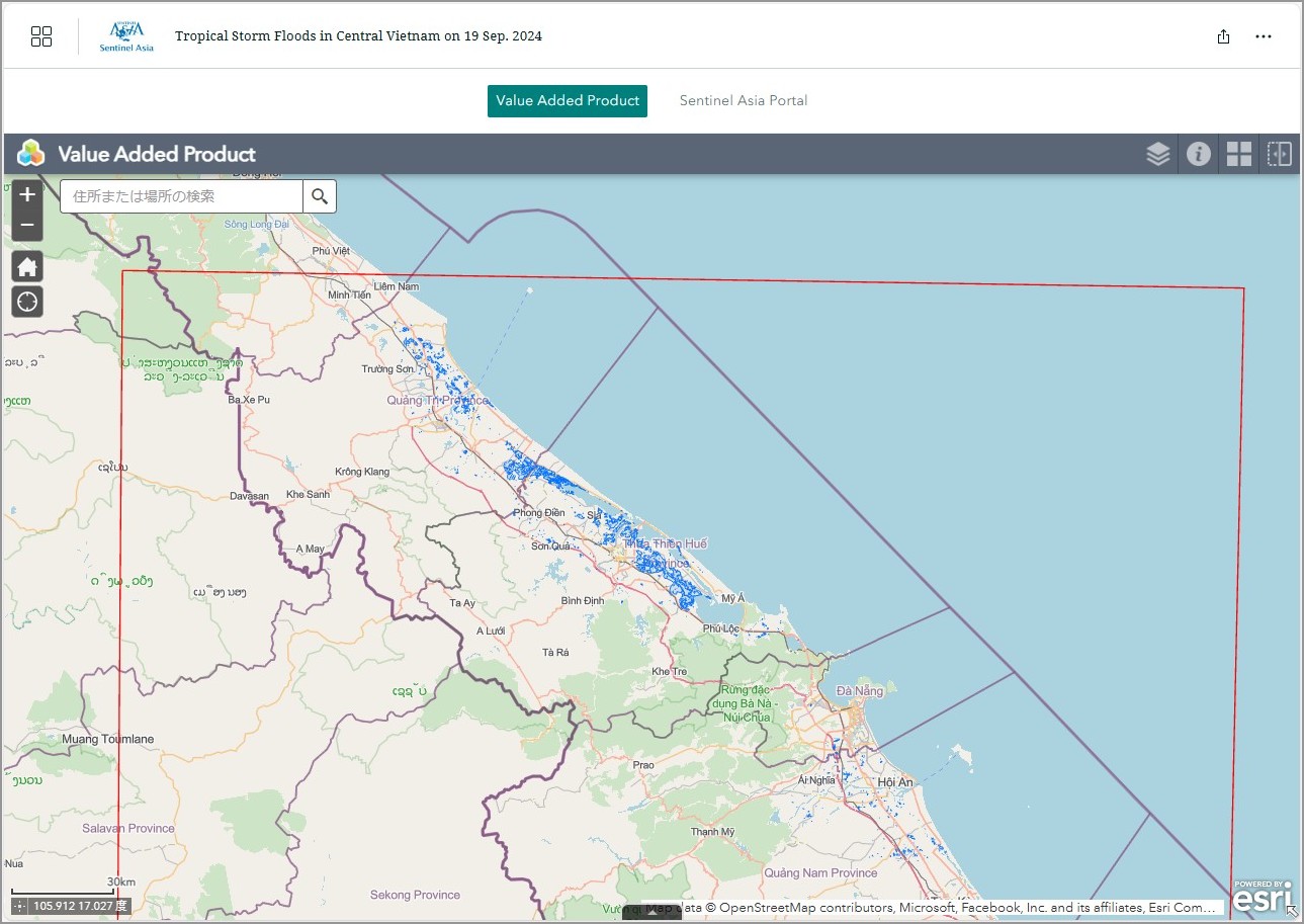
Tropical Storm Floods in Central Vietnam on 19 September, 2024 see detail
-
EOR requesters-only Web-GIS site (with satellite imagery)
see detail
The account will be sent to the EOR requester after Web GIS page is prepared.
If you are interested in to be a member of Sentinel Asia, please contact: z-sentinel.asia@ml.jaxa.jp