2024-11-03
Emergency Obs. Request Information
- Disaster Type: Volcano eruption
- Country/Region: Indonesia
- Occurrence Date (UTC): 03 November, 2024
- SA activation Date(UTC): 05 November, 2024
- Requester: ASEAN Coordinating Centre for Humanitarian Assistance on disaster management (AHA Centre)
- Escalation to the International Charter: Yes
- GLIDE Number: VO-2024-000202-IDN
Disaster Situation
According to the Pusat Vulkanologi dan Mitigasi Bencana Geologi (PVMBG), Mount Lewotobi Laki-laki erupted on Sunday, 3 November at 2257 HRS UTC+7. The height of the eruption column was not observed. The eruption was recorded on a seismograph with a maximum amplitude of 47.3 mm and a duration of 1,450 seconds. Based on both visual and instrumental observations, there has been a significant increase in volcanic activity. Consequently, PVMBG has elevated the alert status of Mount Lewotobi Laki-laki to Alert Level IV on 3 November at 2300 HRS UTC+7. Flores Timur Government has declared an Emergency Response Status starting from 3 November until 31 December 2024.
https://bnpb.go.id/berita/update-10-meninggal-dunia-akibat-erupsi-gunung-lewotobi-laki-laki
https://ahacentre.org/flash-update/flash-update-no-01-lewotobi-laki-laki-volcano-eruption-in-indonesia-4-november-2024/
Web GIS
-
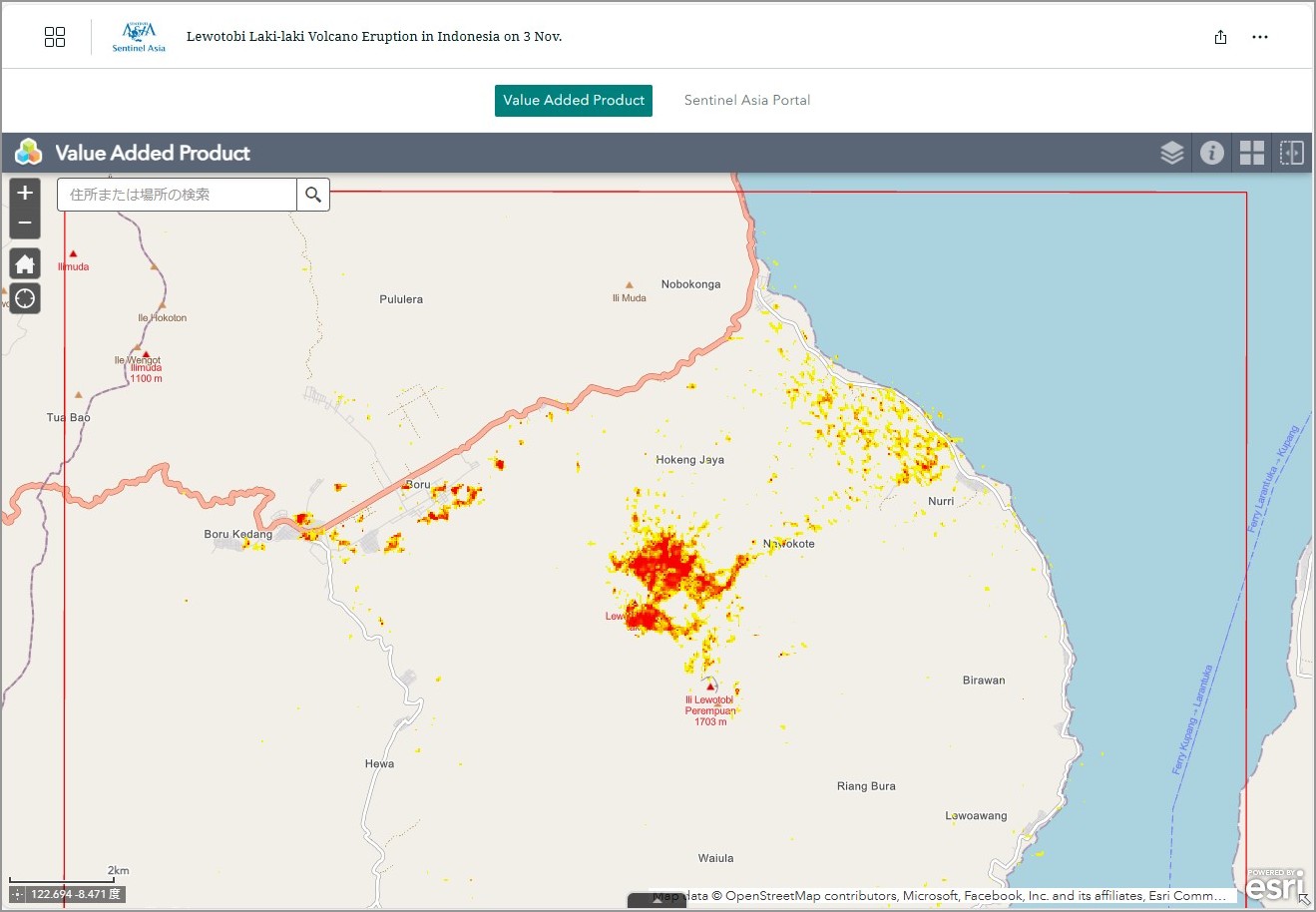
Lewotobi Laki-laki Volcano Eruption in Indonesia on 03 November, 2024 see detail
-

EOR requesters-only Web-GIS site (with satellite imagery)
see detail
The account will be sent to the EOR requester after Web GIS page is prepared.
If you are interested in to be a member of Sentinel Asia, please contact: z-sentinel.asia@ml.jaxa.jp
Product
EOS
EOS-RS Damage Proxy Map:
Flores Island, Indonesia,
Volcanic Eruption,
As Observed by Sentinel-1 image 04 November 2024, v0.9
EOS-RS Damage Proxy Map:
Flores Island, Indonesia,
Volcanic Eruption,
As Observed by Sentinel-1 image 04 November 2024, v0.9
MBRSC
VOLCANO ERUPTION IN SUNDA ISLANDS OF INDONESIA
As Observed by Sentinel-1 image on 04 November 2024
VOLCANO ERUPTION IN SUNDA ISLANDS OF INDONESIA
As Observed by Sentinel-1 image on 04 November 2024
BRIN
Estimated Ash Dispersion of Mt. Lewotobi Laki-laki Eruption INDONESIA
As Observed by Landsat-8 and Landsat-9 image on 04 November 2024
AIT
VOLCANO ERUPTION AT THE MOUNT LEWOTOBI LAKI-LAKI, INDONESIA
As observed by Sentinel-2 images on 13 November 2024
VOLCANO ERUPTION AT THE MOUNT LEWOTOBI LAKI-LAKI, INDONESIA
As observed by Sentinel-2 images on 13 November 2024

For more Value Added Products provided by International Disaster Charter, Please refer to the link below.
https://disasterscharter.org/web/guest/activations/-/article/volcano-in-indonesia-activation-927-