2025-05-25
Emergency Obs. Request Information
- Disaster Type: Storm, Flood and Landslide
- Country/Region: Vietnam
- Occurrence Date (UTC): 25 May, 2025
- SA activation Date(UTC): 26 May, 2025
- Requester: VietNam Ministry of Agriculture and Environment (MAE)
- Escalation to the International Charter: No
- GLIDE Number: FL-2025-000069-VNM
Disaster Situation
https://tienphong.vn/toan-canh-tran-lu-bat-thuong-o-ha-tinh-post1745324.tpo;
https://vnexpress.net/nhieu-xa-o-ha-tinh-ngap-sau-4890171.html
https://dantri.com.vn/xa-hoi/mua-lon-keo-dai-nguoi-ha-tinh-trang-dem-chay-lu-giua-mua-he-20250525070049797.htm
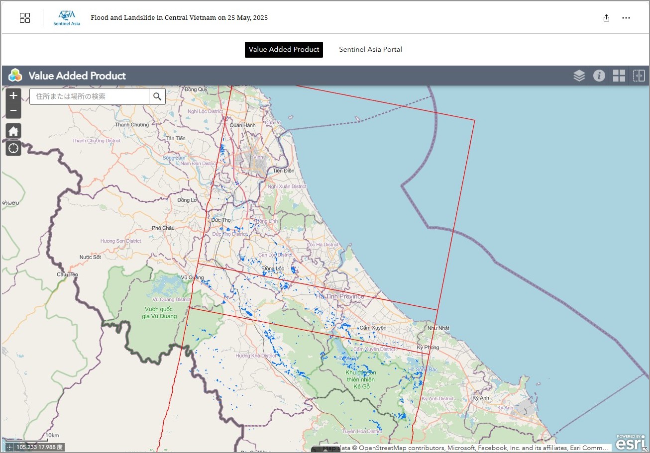
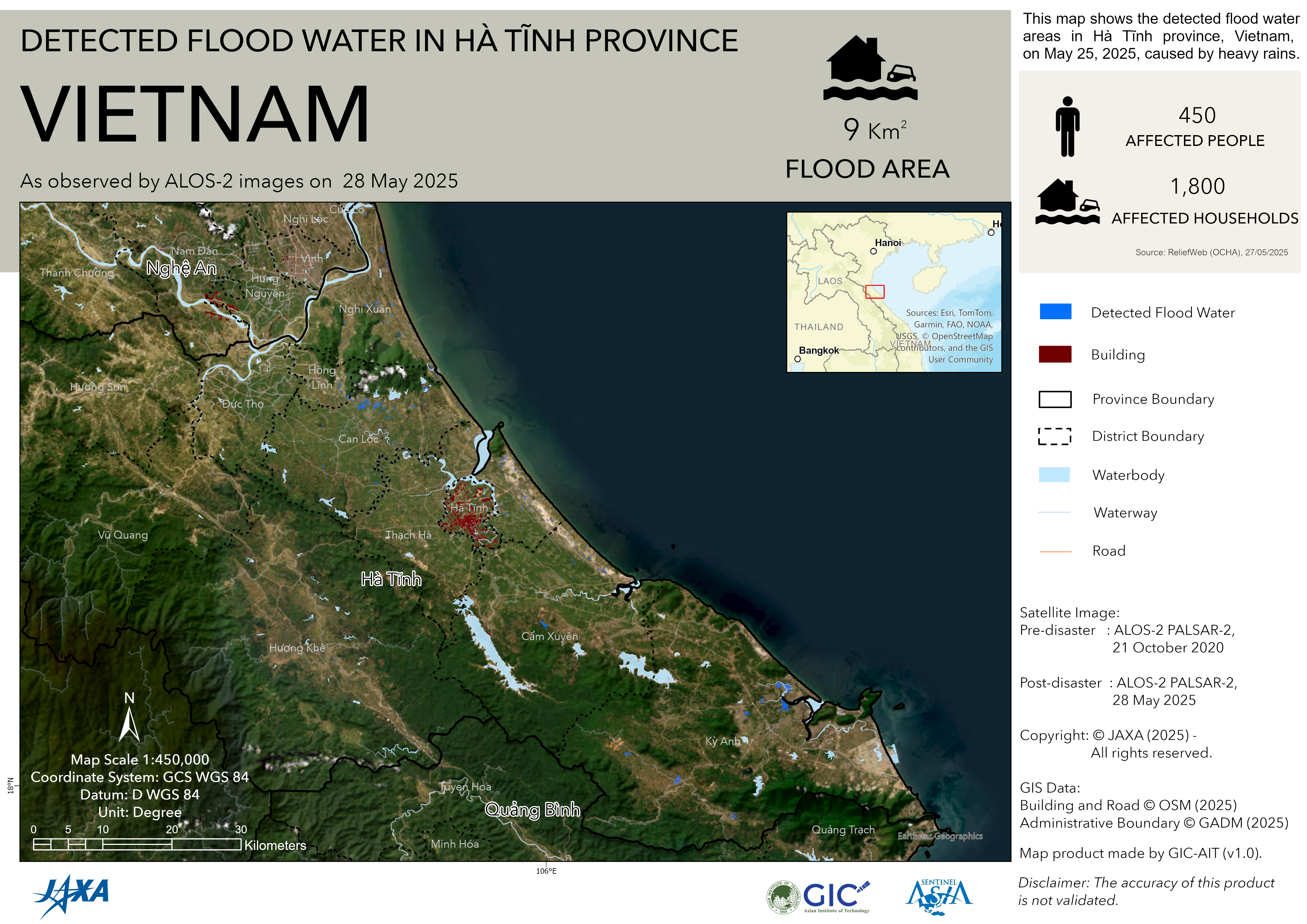
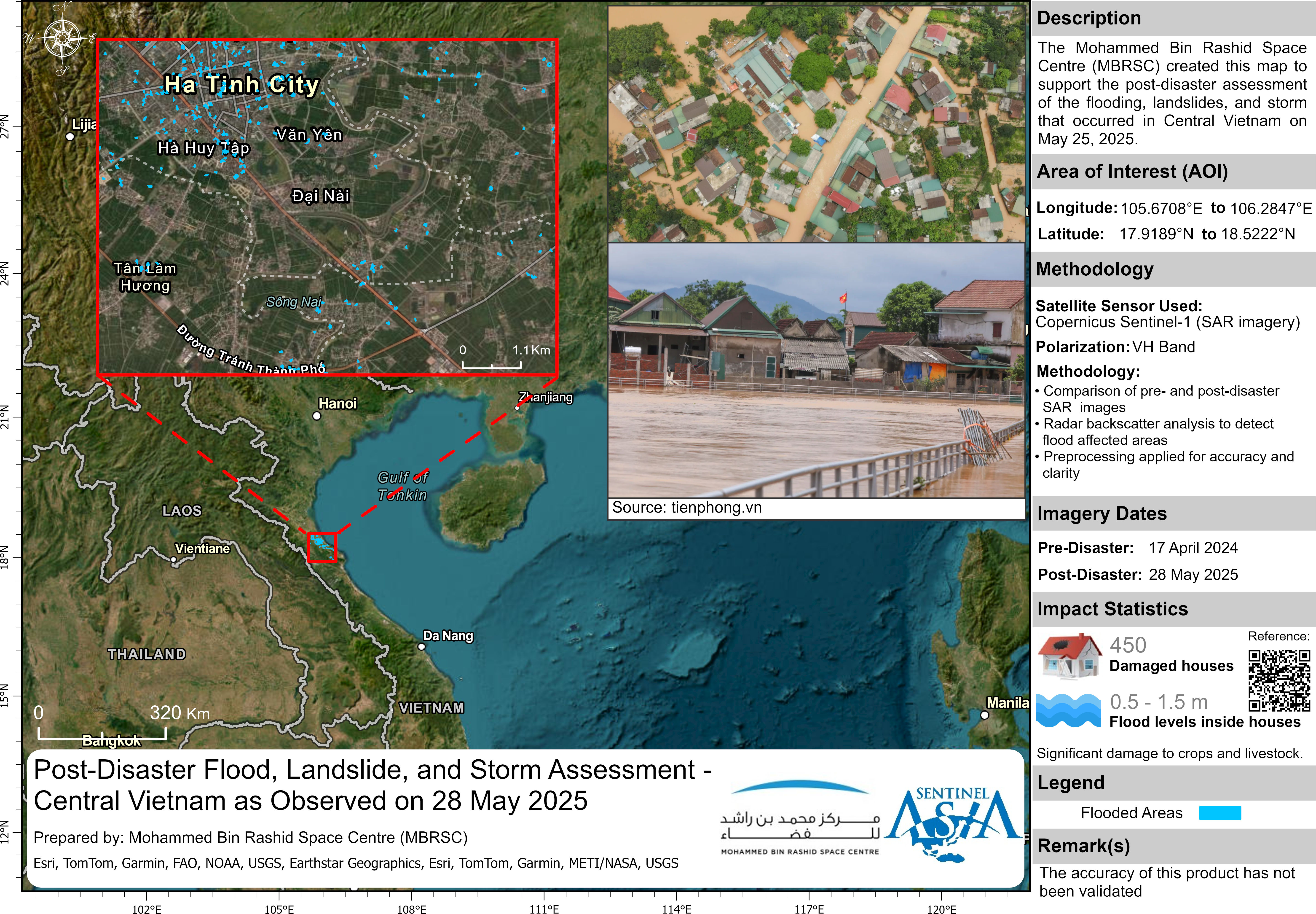
In recent days, Ha Tinh Province has experienced an unusual heavy rainfall event, causing severe flooding and significant property damage. The heavy rains have led to serious flooding in many localities. In Cam Xuyen District, over 500 households were inundated, and many inter-village and inter-commune roads were cut off due to rising floodwaters. Notably, in Cam My Commune, floodwaters rose rapidly, submerging nearly the entire area, with around 450 households experiencing flood levels of 0.5 to 1.5 meters inside their homes.
Web GIS
-
Flood and Landslide in Central Vietnam on 25 May, 2025 see detail
-
EOR requesters-only Web-GIS site (with satellite imagery)
see detail
The account will be sent to the EOR requester after Web GIS page is prepared.
If you are interested in to be a member of Sentinel Asia, please contact: z-sentinel.asia@ml.jaxa.jp