2025-06-08
Emergency Obs. Request Information
- Disaster Type: Storm, Flood and Landslide
- Country/Region: Vietnam
- Occurrence Date (UTC): 08 June, 2025
- SA activation Date(UTC): 09 June, 2025
- Requester: VietNam Ministry of Agriculture and Environment (MAE)
- Escalation to the International Charter: No
- GLIDE Number: FL-2025-000079-VNM
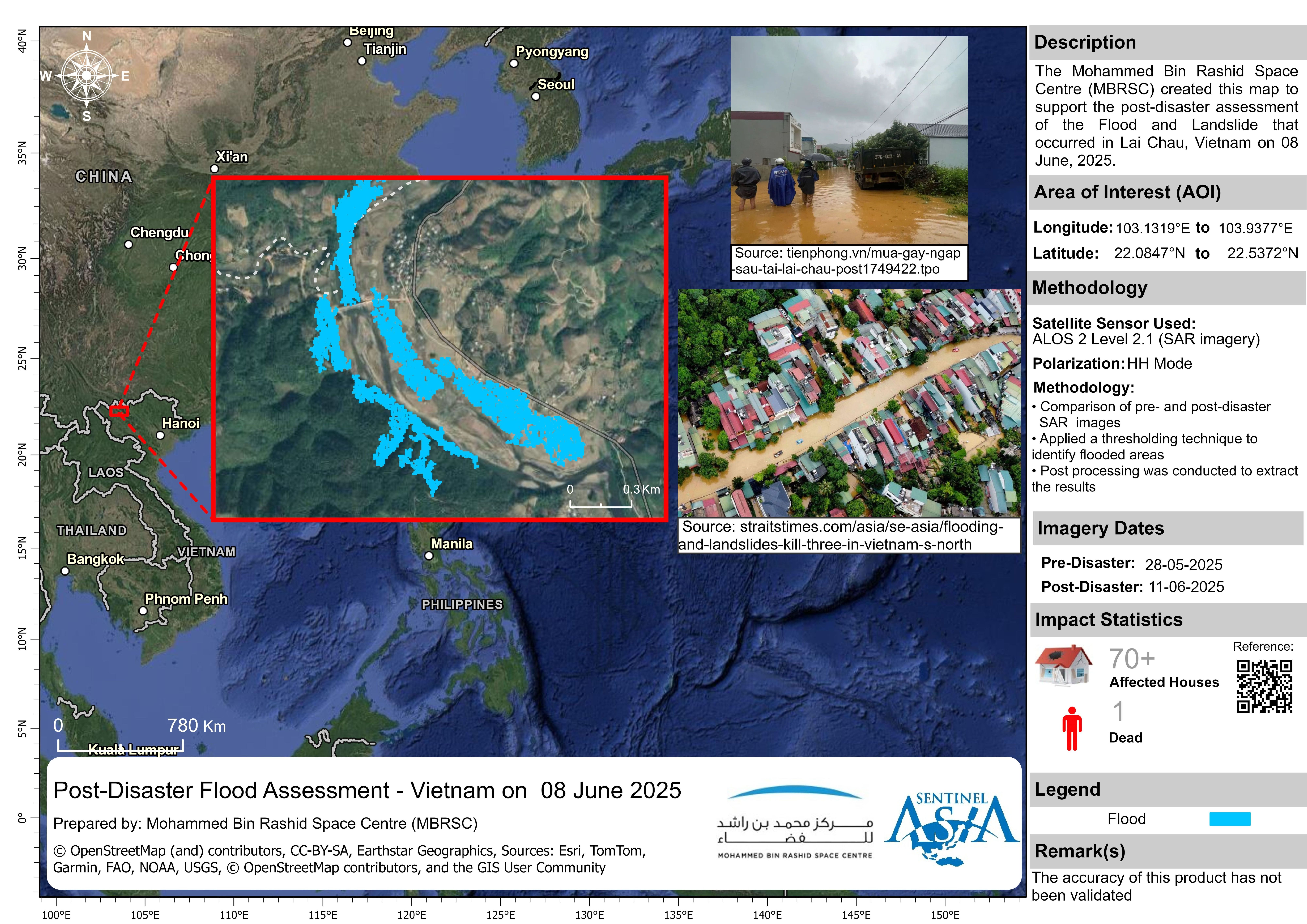
Disaster Situation
https://tienphong.vn/mua-gay-ngap-sau-tai-lai-chau-post1749422.tpo
Heavy rain lasting from the night of June 7 to midday June 8, 2025, caused widespread flooding and landslides in several districts such as Tam Đường, Tân Uyên, Phong Thổ, and Lai Châu City. Recorded rainfall ranged from approximately 67 to 256 mm over 24 hours — specifically, 256 mm in Mường Khoa and 150 mm in Bản Giang, among others.
Web GIS
-
Flood and Landslide in Lai Chau, Vietnam on 08 June, 2025 see detail
-
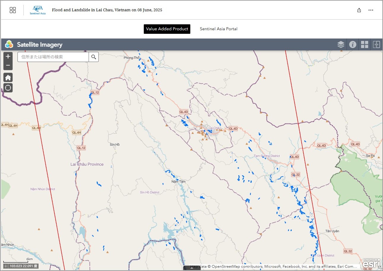
EOR requesters-only Web-GIS site (with satellite imagery)
see detail
The account will be sent to the EOR requester after Web GIS page is prepared.
If you are interested in to be a member of Sentinel Asia, please contact: z-sentinel.asia@ml.jaxa.jp
Product
JAXA
MBRSC
2025-06-19
Post-Disaster Flood Assessment - Vietnam
As Observed by ALOS-2 image on 11 June 2025
2025-06-19