2025-08-25
Emergency Obs. Request Information
- Disaster Type: Storm, Flood and Landslide
- Country/Region: Vietnam
- Occurrence Date (UTC): 25 August, 2025
- SA activation Date(UTC): 24 August, 2025
- Requester: VietNam Ministry of Agriculture and Environment (MAE)
- Escalation to the International Charter: No
- GLIDE Number: TC-2025-000144-VNM
Disaster Situation
https://vnexpress.net/bao-kajiki-manh-len-cap-12-huong-nghe-an-ha-tinh-4930807.html
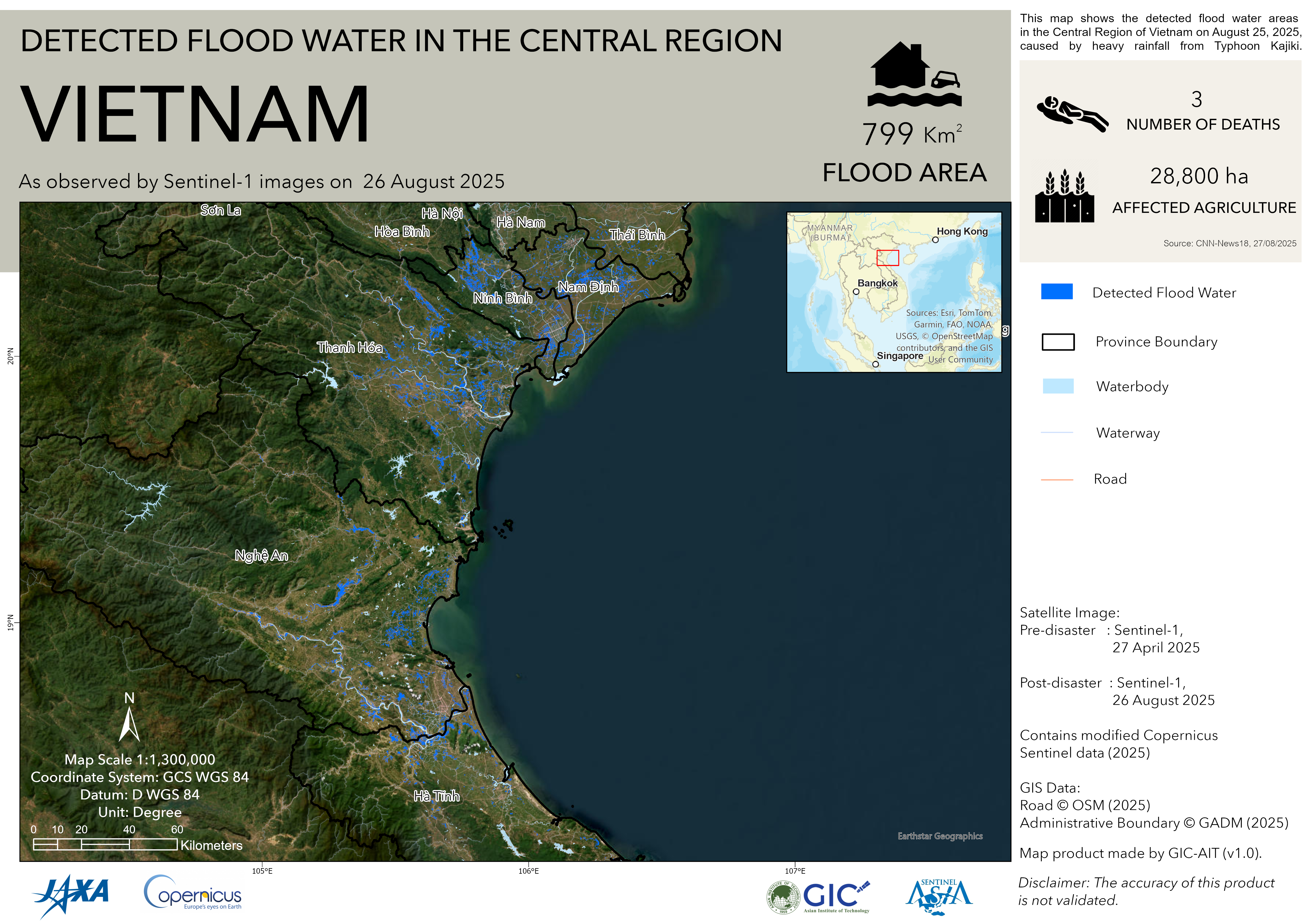
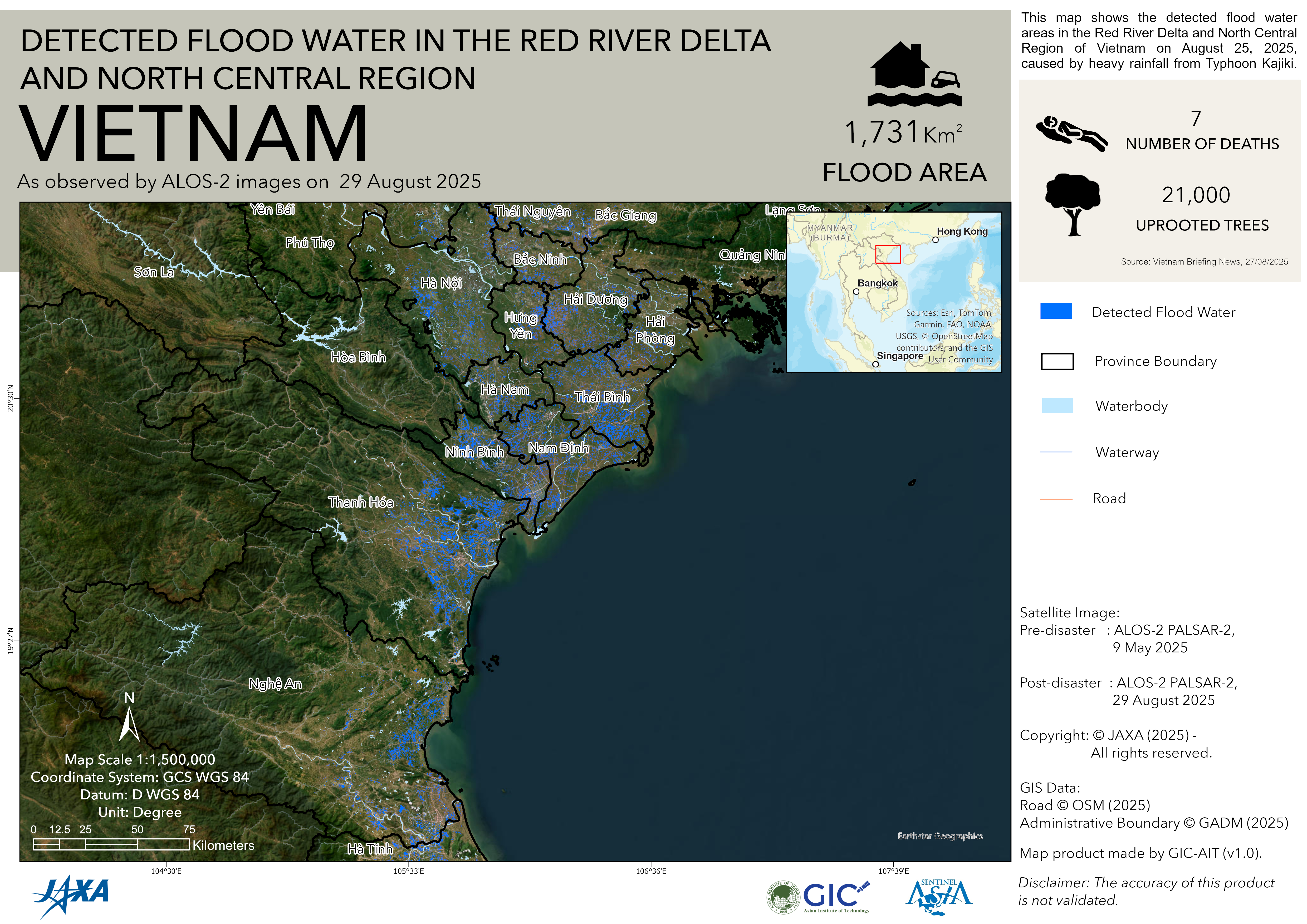
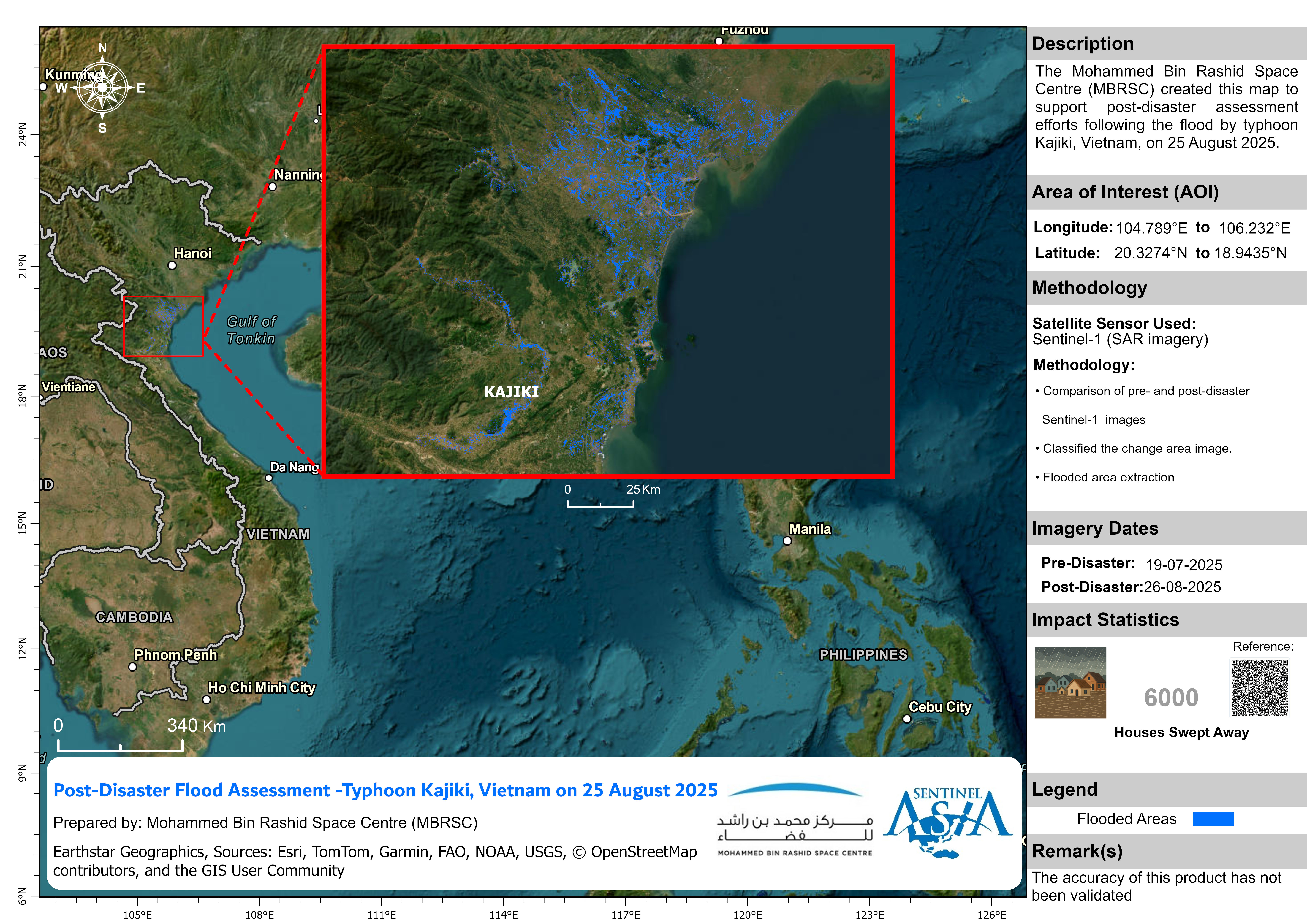
Typhoon KAJIKI, the fifth storm to hit Vietnam in 2025, is bringing heavy to extremely heavy rainfall to Thanh Hoa, Nghe An, and Ha Tinh provinces. The most affected areas are expected to be along the coast and in low-lying regions.
Consequently, central Vietnam is likely to experience widespread severe rainfall, with forecasts indicating very high precipitation in many locations. This poses a significant risk of flash floods,landslides, and flooding in low-lying areas.
Web GIS
-
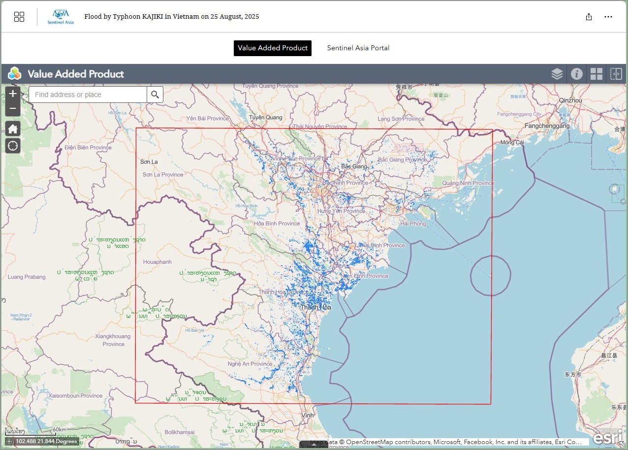
Flood by Typhoon KAJIKI in Vietnam on 25 August, 2025 see detail
-
EOR requesters-only Web-GIS site (with satellite imagery)
see detail
The account will be sent to the EOR requester after Web GIS page is prepared.
If you are interested in to be a member of Sentinel Asia, please contact: z-sentinel.asia@ml.jaxa.jp