2025-09-17
Emergency Obs. Request Information
- Disaster Type: Flood and Landslide
- Country/Region: Philippines
- Occurrence Date (UTC): 17 September, 2025
- SA activation Date(UTC): 17 September, 2025
- Requester: Philippine Space Agency (PhilSA)
- Escalation to the International Charter: No
- GLIDE Number: TC-2025-000167-PHL
Disaster Situation
Web GIS
-
Flood Due to Tropical Depression concerns in Philippines on 17 September, 2025 see detail
-
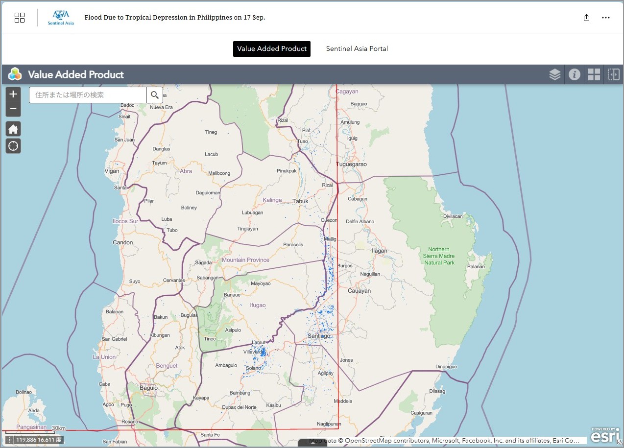
EOR requesters-only Web-GIS site (with satellite imagery)
see detail
The account will be sent to the EOR requester after Web GIS page is prepared.
If you are interested in to be a member of Sentinel Asia, please contact: z-sentinel.asia@ml.jaxa.jp
Product
EOS
2025-09-18
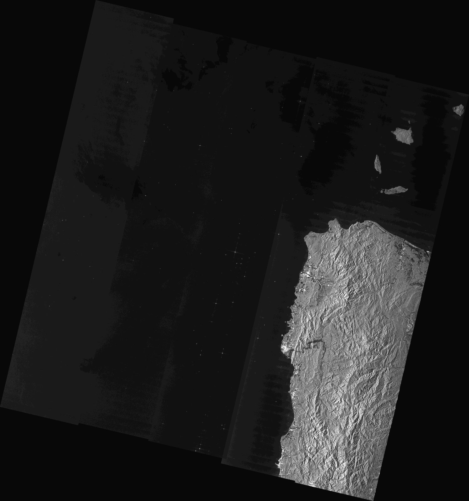
EOS-RS Flood Proxy Map:
Northern Luzon, Philippines, Floods,
As Observed by Sentinel-1 image 17 September 2025, v0.9
2025-09-18
EOS-RS Flood Proxy Map:
Northern Luzon, Philippines, Floods,
As Observed by Sentinel-1 image 17 September 2025, v0.9
2025-09-18
EOS-RS Flood Proxy Map:
Northern Luzon, Philippines, Floods,
As Observed by Sentinel-1 image 17 September 2025, v0.9
MBRSC
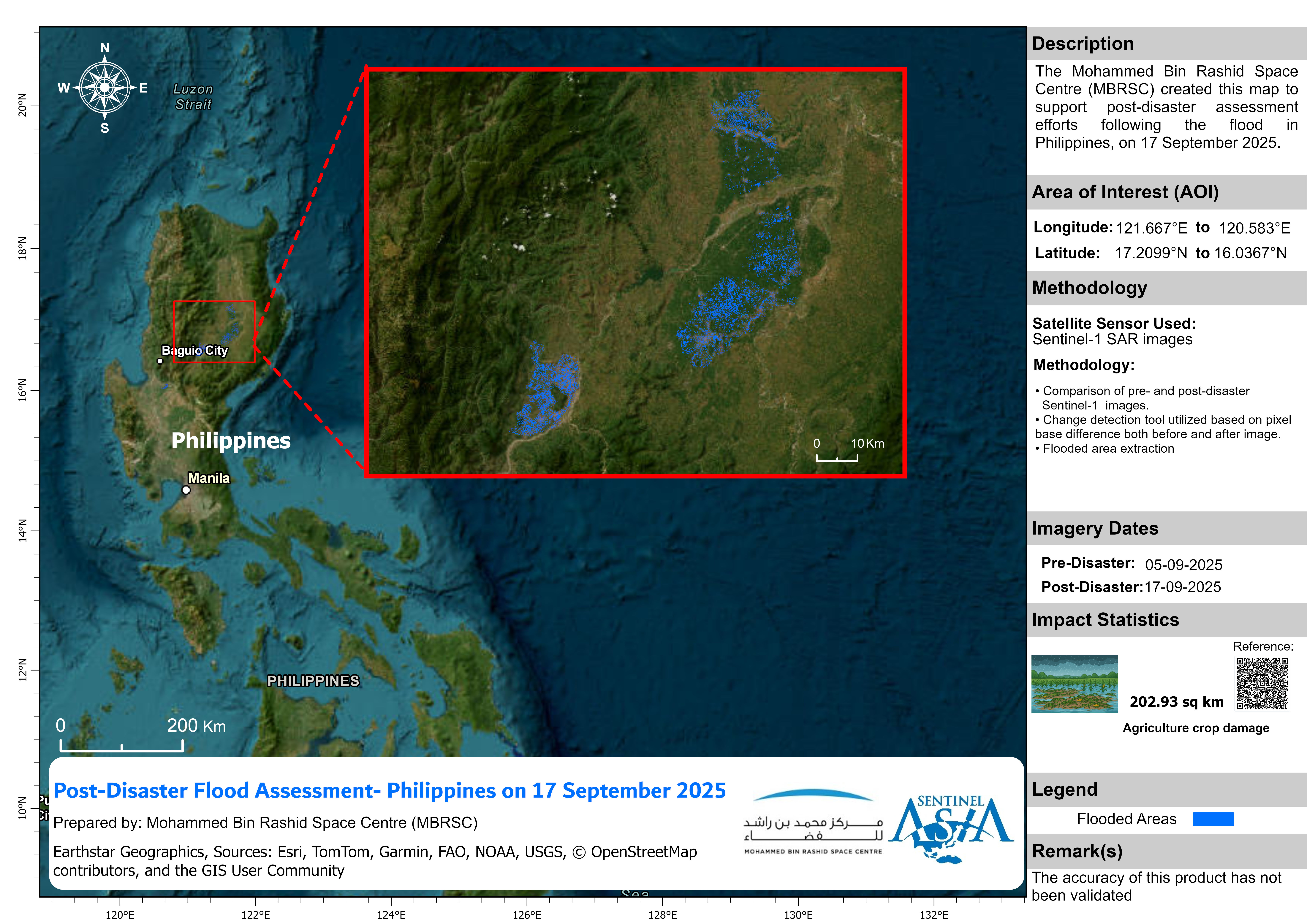
2025-09-23
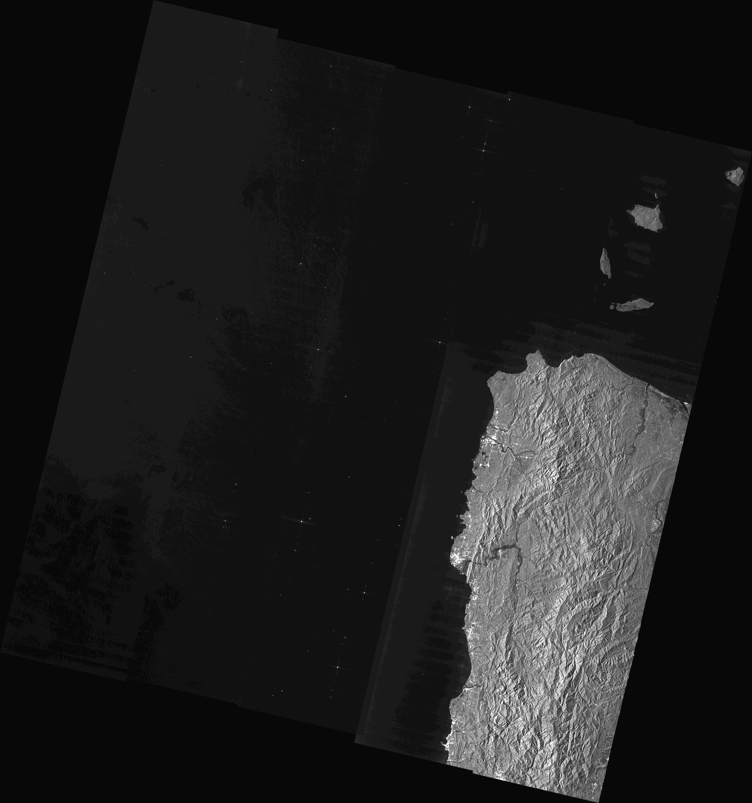
Post-Disaster Flood Assessment - Philippines
As Observed by Sentinel-1 image on 17 September 2025
2025-09-23
Post-Disaster Flood Assessment - Philippines
As Observed by Sentinel-1 image on 17 September 2025
AIT
2025-09-23
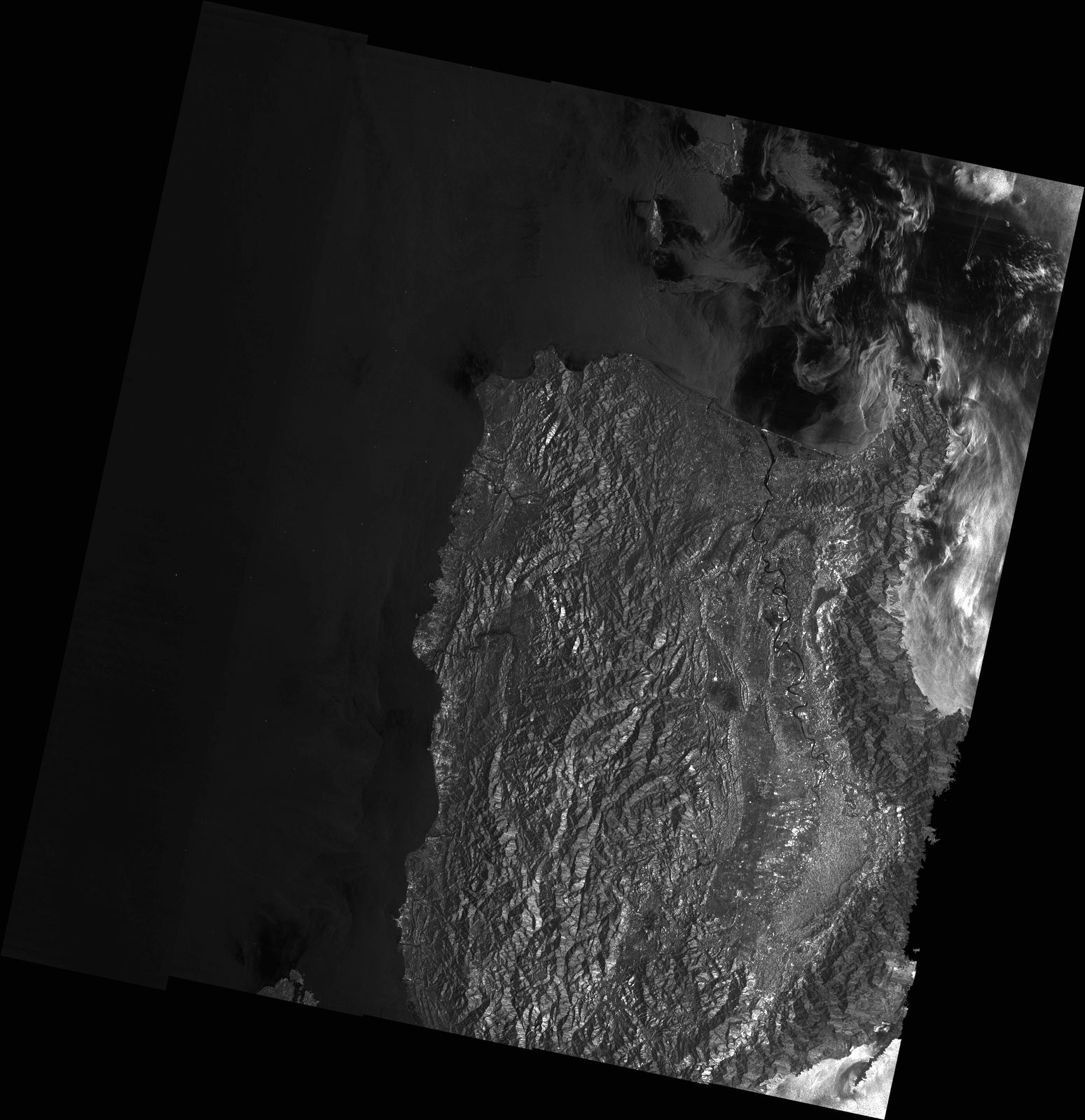
DETECTED FLOOD WATER IN APAYAO AND CAGAYAN PROVINCES, PHILIPPINES
As Observed by ALOS-2 images on 21 September 2025
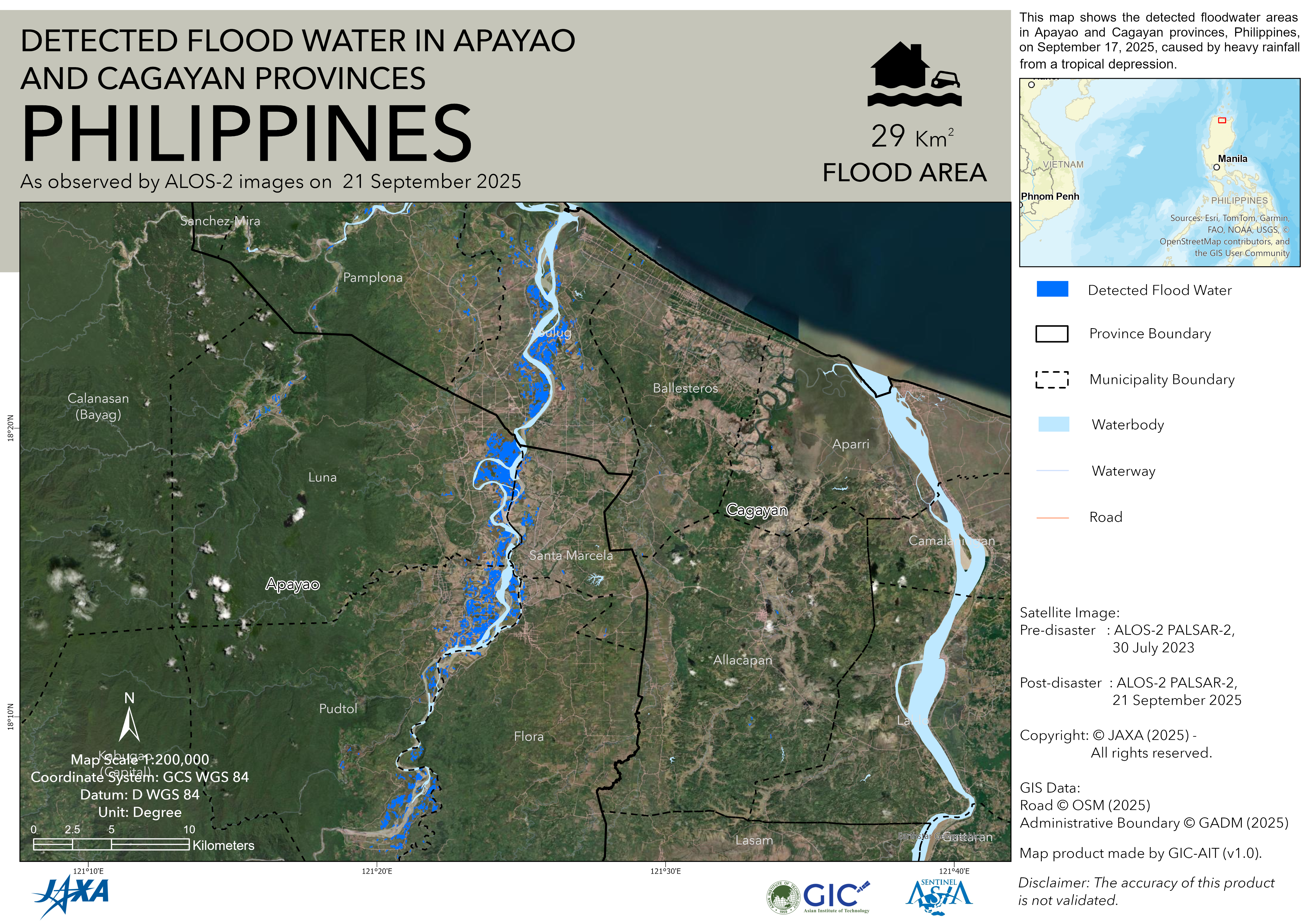
2025-09-23