Ms. G.A. Bissenalina and Mr. A.M. Tleubergenov, JSC "National Company Kazakhstan Gharysh Sapary" (JSC KGS), Kazakhstan
Joint Stock Company "National Company" "Kazakhstan Gharysh Sapary" (KGS) was established in 2005 and determined as National Operator of the Earth Remote Sensing Space System in Kazakhstan in 2014. At present, KGS is actively implementing systems of space and navigation monitoring, with satellite images of high and medium spatial resolution from Kazakhstan's KazEOSat-1,2 satellites being used everywhere. Starting from 2018, KGS has provided space monitoring service to solve a number of industry-specific tasks of the economy.
The main activities of KGS include participation in the development and implementation of current, long-term intersectoral programs in the field of space activities of the Republic of Kazakhstan, introduction of space technologies aimed at solving the socio-economic problems of Kazakhstan and carrying out experimental design work to create space systems and facilities.
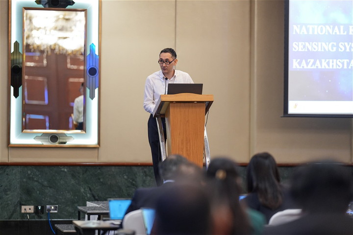
KGS joined Sentinel Asia in May 2025 as a Data Provider Node (DPN) and participated for the first time in the Joint Project Team Meating (JPTM), held in Dubai in February 2026 (JPTM2025). On this occasion, the Sentinel Asia Secretariat interviewed two KGS participants who attended JPTM2025, Ms. Gulnara A. Bissenalina and Mr. Altair M. Tleubergenov.
 |
 |
| KGS Engineer Ms. G.A. Bissenalina | KGS Engineer Mr. A.M. Tleubergenov |
Sentinel Asia Secretariat:
JSC National Company Kazakhstan Gharysh Sapary (KGS) joined Sentinel Asia in 2025 as a Data Provider Node (DPN). Can you introduce your organization to our readers, including your activities relating to disaster management?
KGS:
Joint-Stock Company «National Company «Kazakhstan Gharysh Sapary» (KGS) is the operator of the Earth remote sensing space system of the Republic of Kazakhstan. Today, the current constellation includes high-resolution satellite KazEOSat-1 and medium-resolution satellite KazEOSat-2, as well as the KazSTSAT technology satellite. KGS provides the collection, processing, and delivery of space-based data for various sectors of the economy and for government needs.
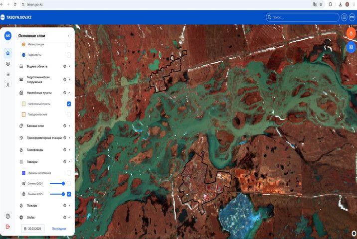
In terms of emergency management, KGS develops digital platforms that allow monitoring areas for potential disasters such as floods, fires, or other natural disasters. For example, the «Tasqyn» system uses satellite data to predict flood zones and visualize in real time, which supports operational decision-making by government agencies in Kazakhstan to minimize socio-economic risks.
Satellite data has become a tool for damage prevention, not just for fixing the consequences.
 |
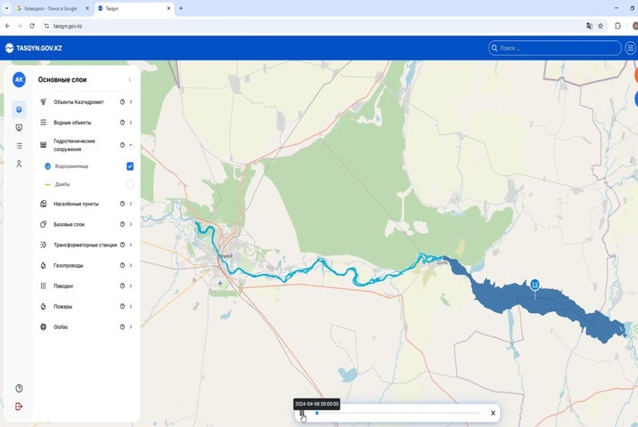 |
Information System "Tasqyn" - Flood Forecasting in Kazakhstan
Sentinel Asia Secretariat:
We appreciate your first participation at Sentinel Asia's Joint Project Team Meeting (JPTM) this year in the UAE. What is your impression of attending this meeting? And what did you find useful or new, including any new methods, communications with other participants, etc., if any?
KGS:
Our first participation in JPTM marked an important step in integrating into the international professional community of Sentinel Asia.
We found the hands-on demonstration of the AWARE Platform introduced by Dr. Giriraj Amanath from International Water Management Institute (IIWMI), and Today's Earth platforms by JAXA particularly valuable, as well as learning about the request submission mechanism via online operation system of Sentinel Asia “OPTEMIS” and discussing the future development of the UN-SPIDER initiative.
This enabled us to gain a deeper understanding of Sentinel Asia's operational processes and coordination mechanisms in emergency response situations.
Equally important was the in-person professional networking with colleagues from across the region. We became acquainted with real-world cases of using satellite data in response to floods, typhoons, and other natural disasters in participating countries. These examples clearly demonstrated how space technologies are becoming a practical tool for rapid response and damage mitigation.
Space-based monitoring today is a key element of regional resilience, and Kazakhstan is ready to make a full and systematic contribution to this effort.
Sentinel Asia Secretariat:
What is your motivation to join Sentinel Asia as a DPN, how do you benefit from Sentinel Asia? Can you elaborate the features of KazEOSat-1 and KazEOSat-2?
KGS:
Our motivation to join Sentinel Asia as a Data Provider Node (DPN) is driven by our desire to strengthen international cooperation in the field of Earth observation and to integrate Kazakhstan's remote sensing system into the regional emergency response architecture.
Participation in Sentinel Asia allows us to rapidly exchange satellite data during natural disasters, align our technological approaches with international standards, and gain practical experience in collaborating with space agencies across the Asia-Pacific region. This not only enhances our professional competencies but also strengthens the resilience of the entire regional monitoring system.
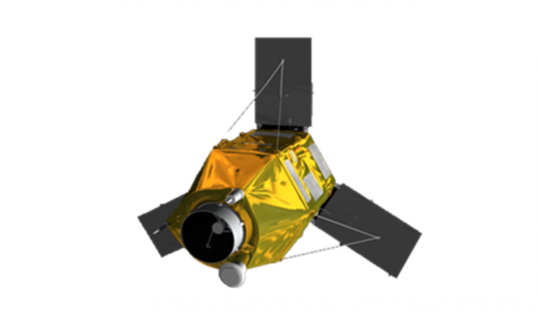
Speaking of technical capabilities, KazEOSat-1 provides imagery with a spatial resolution of up to 1 meter. This enables detailed infrastructure analysis, post-disaster damage assessment, mapping of affected areas, and targeted monitoring of specific sites.
KazEOSat-2, with a spatial resolution of 6.5 meters and an extended spectral range, is designed for monitoring large areas, agriculture, forestry, natural resources, and environmental processes. Its wider coverage makes it particularly effective for analyzing large-scale natural phenomena.
The combined use of these satellites enables both high-precision, detailed imaging and broad-area monitoring, which is especially important for rapid response to emergency situations.
Thus, for us, participation in Sentinel Asia represents a combination of technological exchange, practical collaboration, and the opportunity to make a tangible contribution to regional resilience.
 |
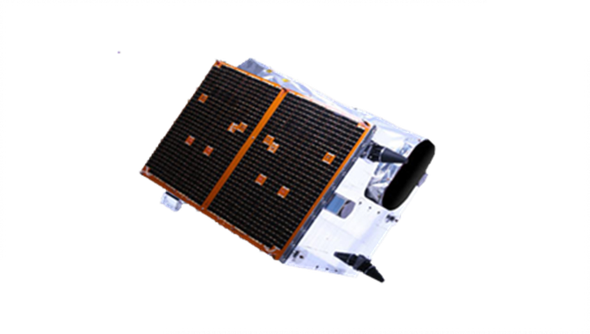 |
| KazEOSat-1 Resolution: 1 m Coverage: 200,000 km2 /day |
KazEOSat-2 Resolution: 6.5 m Coverage: 1 million km2/day |
Sentinel Asia Secretariat:
Also, as a DPN, how do you plan to contribute to Sentinel Asia?
KGS:
As a DPN, we view our participation in Sentinel Asia as a systematic and long-term contribution to the development of regional space-based monitoring infrastructure.
First and foremost, KGS is ready to provide up-to-date high- and medium-resolution satellite data for the analysis and monitoring of the territories of participating countries. The availability of KazEOSat-1 and KazEOSat-2 allows us to generate both detailed imagery for damage assessment and broader data for the analysis of large-scale natural processes.
In addition, we utilize our own ground infrastructure and digital platforms for the rapid reception, processing, and dissemination of data. This allows us to minimize the time between image acquisition and the delivery of analytical information, which is critically important during emergency situations.
We also plan to actively participate in joint Sentinel Asia initiatives and projects focused on monitoring floods, forest and steppe fires, land degradation, environmental risks, and other natural hazards.
 |
 |
National Space Center in Astana city, Kazakhstan
Sentinel Asia Secretariat:
How is your participation in Sentinel Asia recognized within other agencies or with stakeholders in Kazakhstan?
KGS:
The participation of KGS in Sentinel Asia is perceived in Kazakhstan as a strategically important step for the development of the national space industry.
From the perspective of government authorities, this is seen as confirmation that Kazakhstan's Earth observation system meets international standards and is integrated into global mechanisms for space-based emergency monitoring. This strengthens confidence in the national remote sensing infrastructure and in the management decisions based on its data.
For the professional and scientific community, participation in Sentinel Asia serves as recognition of the level of domestic engineering and analytical expertise. It demonstrates that Kazakhstan not only applies space technologies nationally but is also ready to act as a full partner in international initiatives.
Moreover, membership in Sentinel Asia strengthens Kazakhstan's international image as a country capable of providing high-quality satellite data and digital solutions for monitoring natural resources, environmental security, and emergency response. This also expands opportunities for further international cooperation and technological exchange.
Sentinel Asia Secretariat:
Please share your future EO satellite development plan.
KGS:
The development of the Earth observation satellite constellation is one of KGS's key priorities for the medium and long term.
Within the framework of the national space program, we plan to develop a new constellation of medium- and high-resolution satellites. This will significantly increase the revisit frequency and bring territorial monitoring closer to a daily schedule, which is particularly important for rapid emergency response and dynamic analysis of natural processes.
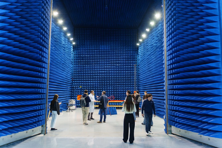
Special attention is given to developing domestic expertise. Projects are implemented with elements of technology transfer and the involvement of international partners in the design and development of satellites, while key stages—design, assembly, and testing—are gradually being localized at the Satellite Assembly and Testing Complex in Kazakhstan.
At the same time, ground infrastructure is being developed, including the modernization of data reception and processing stations in the S/X bands. This will enhance the speed of information acquisition and enable the integration of data from both national and international satellite systems.
A key focus is the further integration of satellite data into sectoral digital platforms—for agriculture, mineral resource management, environmental monitoring, water resources management, and emergency response systems.
Our strategic goal is to establish a sustainable, technologically advanced, and competitive Earth observation system capable of meeting national needs while actively participating in international space initiatives.
 |
 |
 |
 |
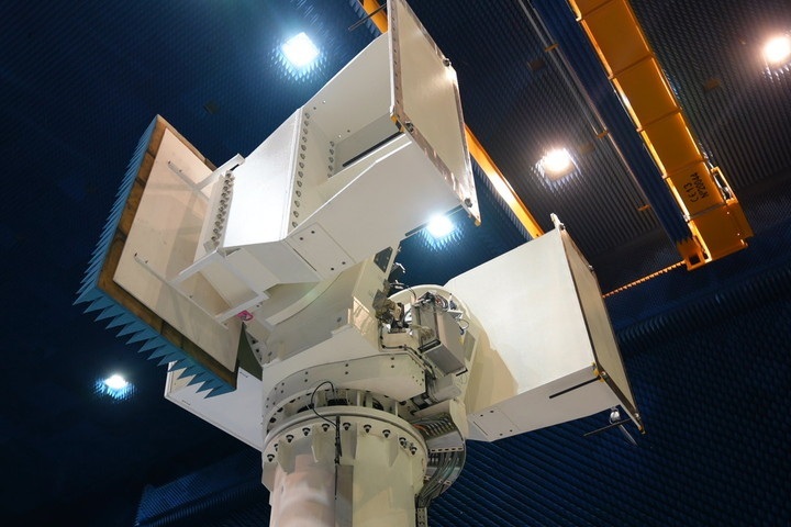
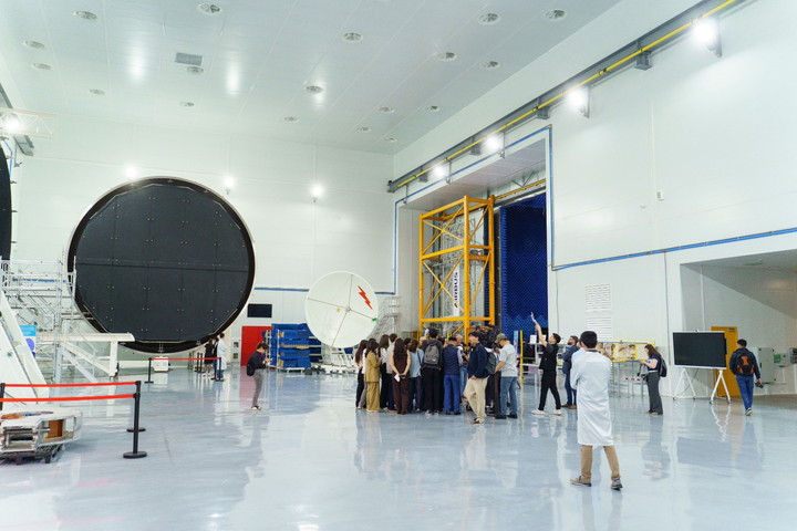
Spacecraft Assembly and Testing Complex in Astana city, Kazakhstan