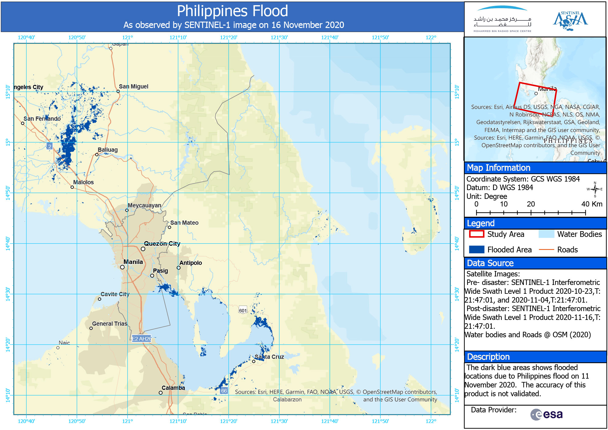
2020-11-11
Emergency Obs. Request Information
- Disaster Type: Flood, Storm
- Country/Region: Philippines
- Occurrence Date (UTC): 11 November, 2020
- SA activation Date(UTC): 11 November, 2020
- Requester: Manila Observatory (MO)
- Escalation to the International Charter: No
- GLIDE Number:
Disaster Situation
Metro Manila (CNN Philippines, November 12) — Hundreds of residents were forced to flee their homes on Thursday as water in Marikina River steadily rose, moving closer to the peak level during the onslaught of Tropical Storm Ondoy in 2009. At 10:33 a.m., the water level rose to 22 meters — one meter below the 23 meters above sea level reached when Ondoy battered the country 11 years ago and left Marikina City submerged in floodwater for days. Residents near the river were forced to evacuate at past 3 a.m. when the water rose to 18 meters due to nonstop rains brought by Typhoon Ulysses starting Wednesday night. The local government also deployed rescue boats to extricate stranded residents.Product
AIT
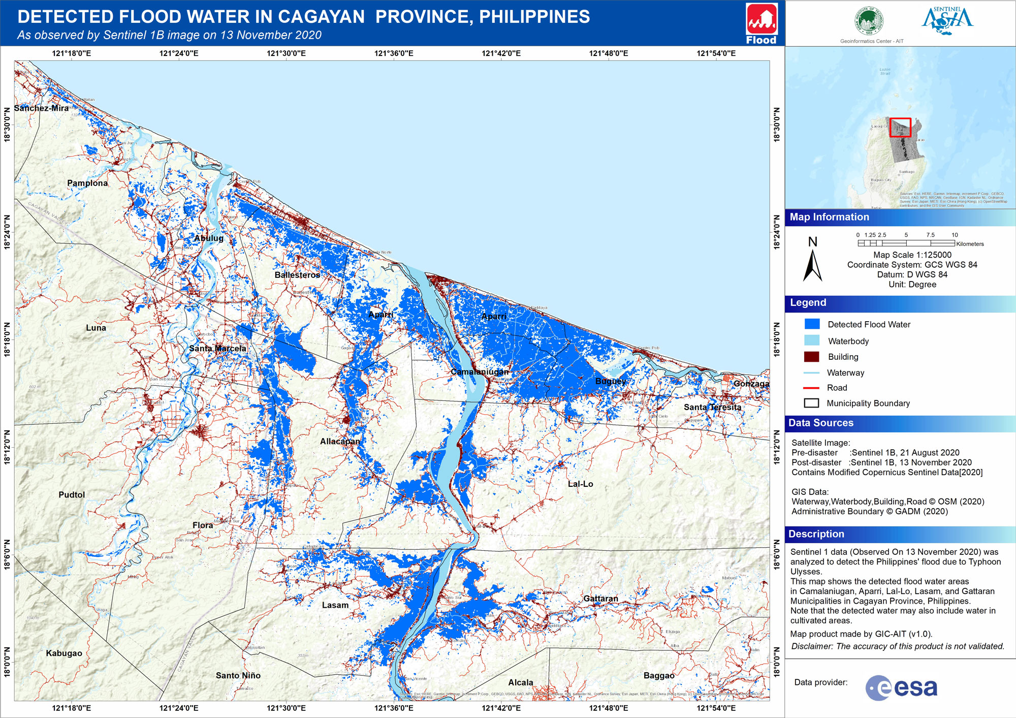
DETECTED FLOOD WATER IN CAGAYAN PROVINCE, PHILIPPINES
As observed by Sentinel 1B image on 13 November 2020
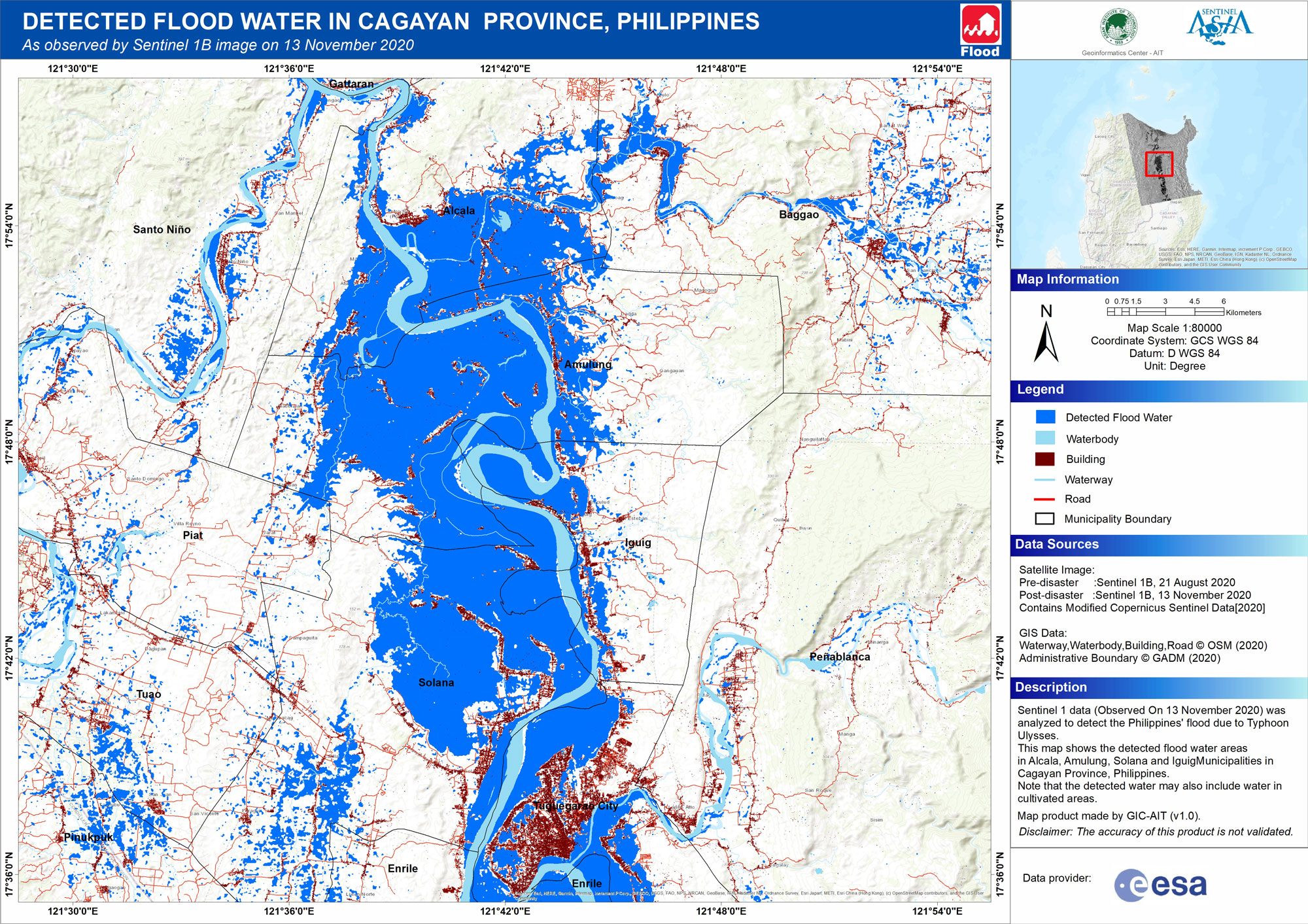
DETECTED FLOOD WATER IN CAGAYAN PROVINCE, PHILIPPINES
As observed by Sentinel 1B image on 13 November 2020
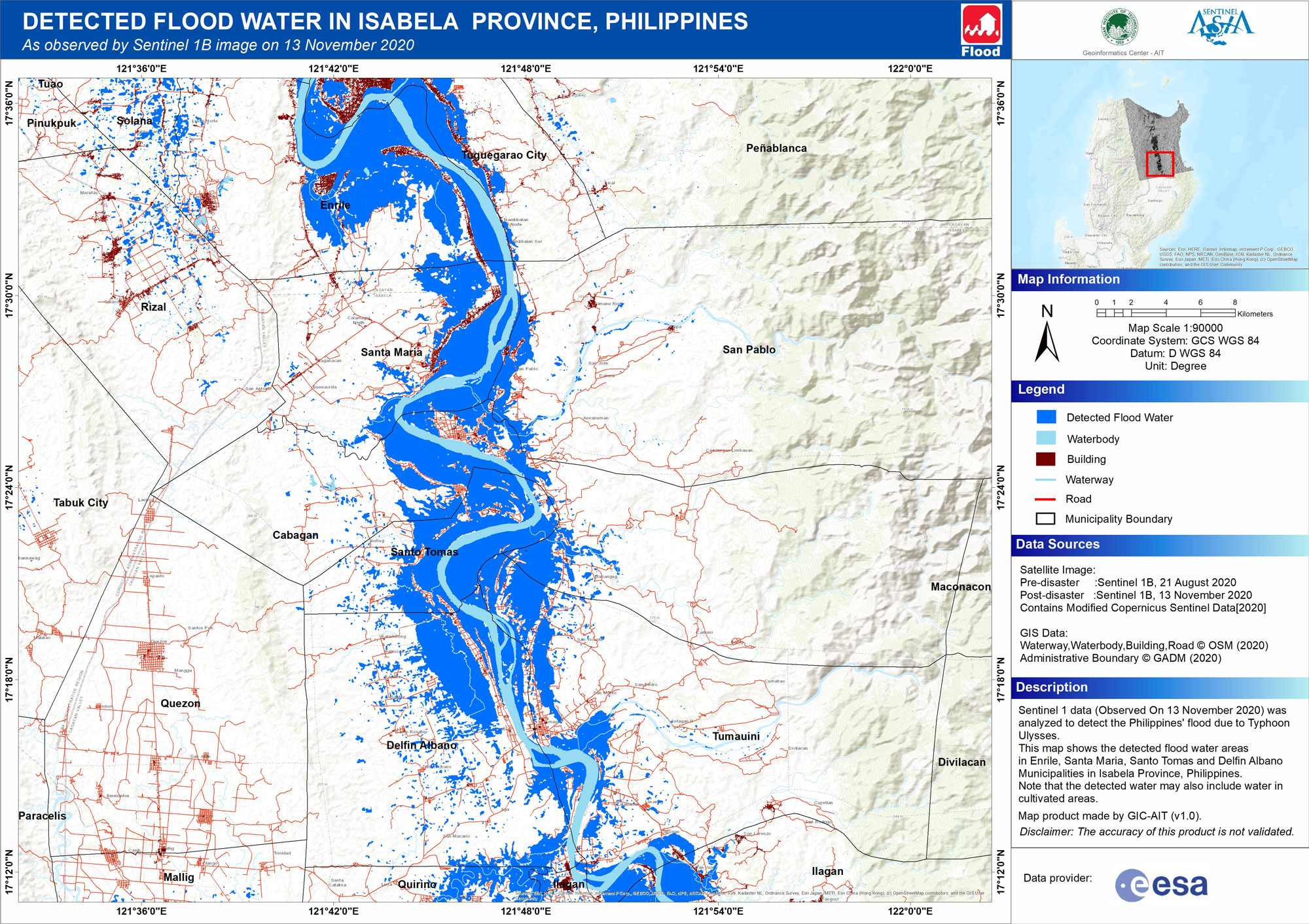
DETECTED FLOOD WATER IN ISABELA PROVINCE, PHILIPPINES
As observed by Sentinel 1B image on 13 November 2020
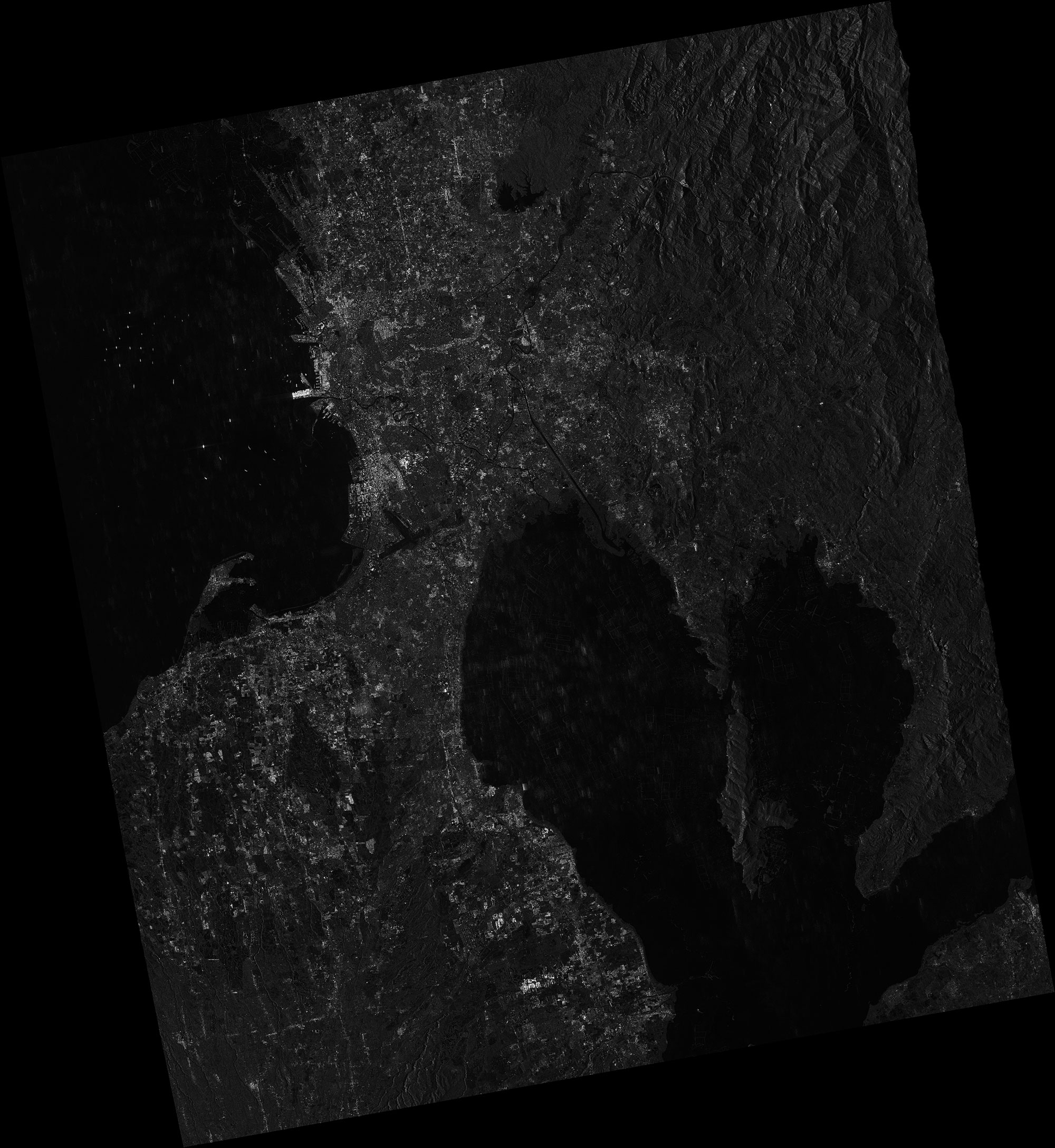
DETECTED FLOOD WATER IN PAMPANGA PROVINCE, PHILIPPINES
As observed by ALOS-2 PALSAR-2 image on 15 November 2020
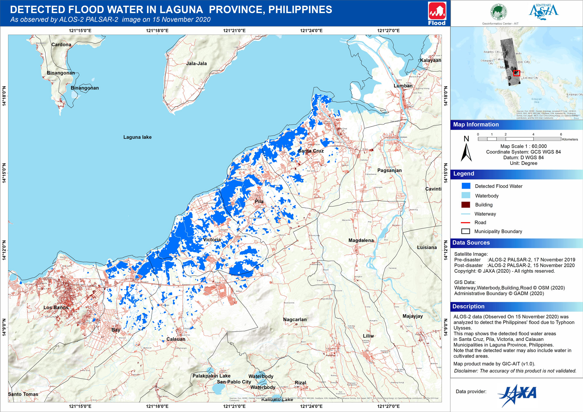
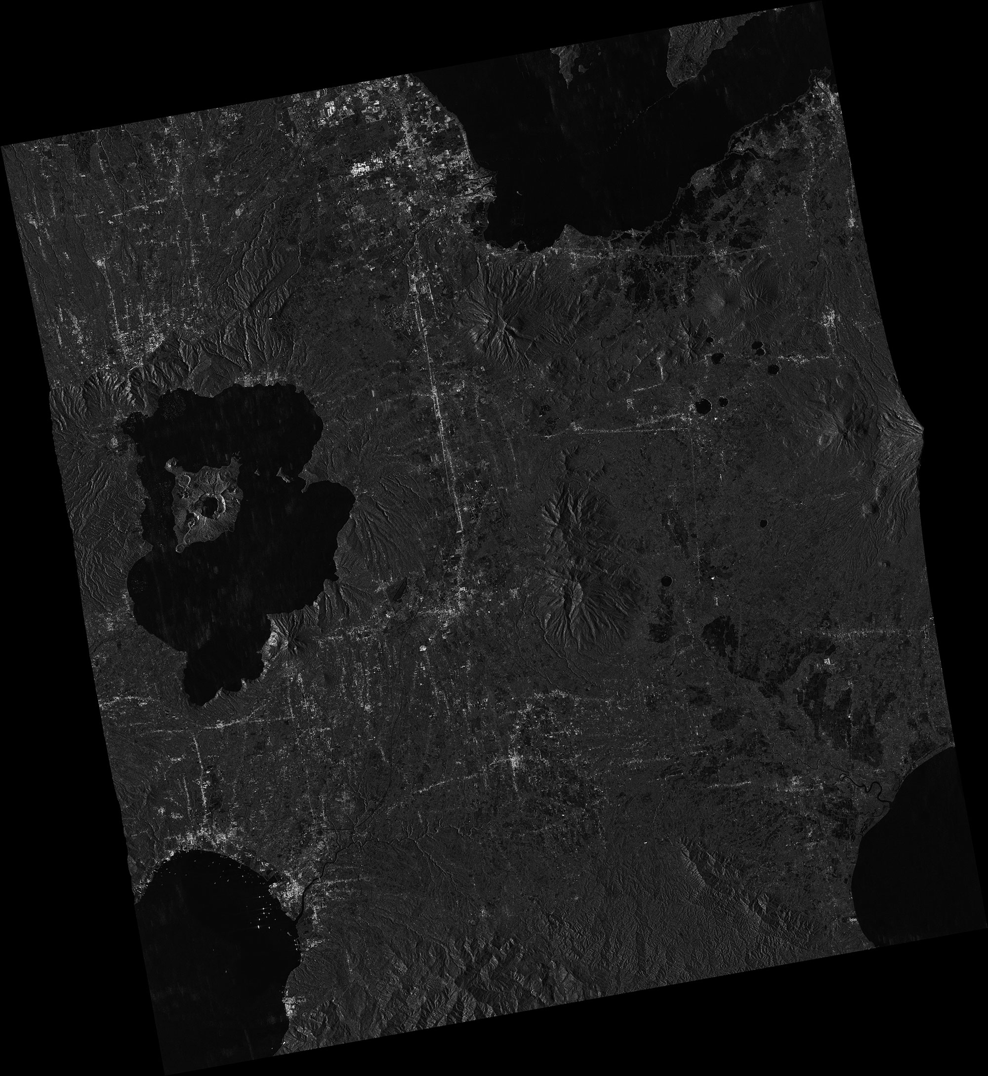
DETECTED FLOOD WATER IN LAGUNA PROVINCE, PHILIPPINES
As observed by ALOS-2 PALSAR-2 image on 15 November 2020
MBRSC
MO
2020-11-20