2023-05-14
Emergency Obs. Request Information
- Disaster Type: Storm
- Country/Region: Myanmar
- Occurrence Date (UTC): 14 May, 2023
- SA activation Date(UTC): 11 May, 2023
- Requester: ASEAN Coordinating Centre for Humanitarian Assistance on disaster management (AHA Centre)
- Escalation to the International Charter: Yes
- GLIDE Number: TC-2023-000069-MMR
Disaster Situation
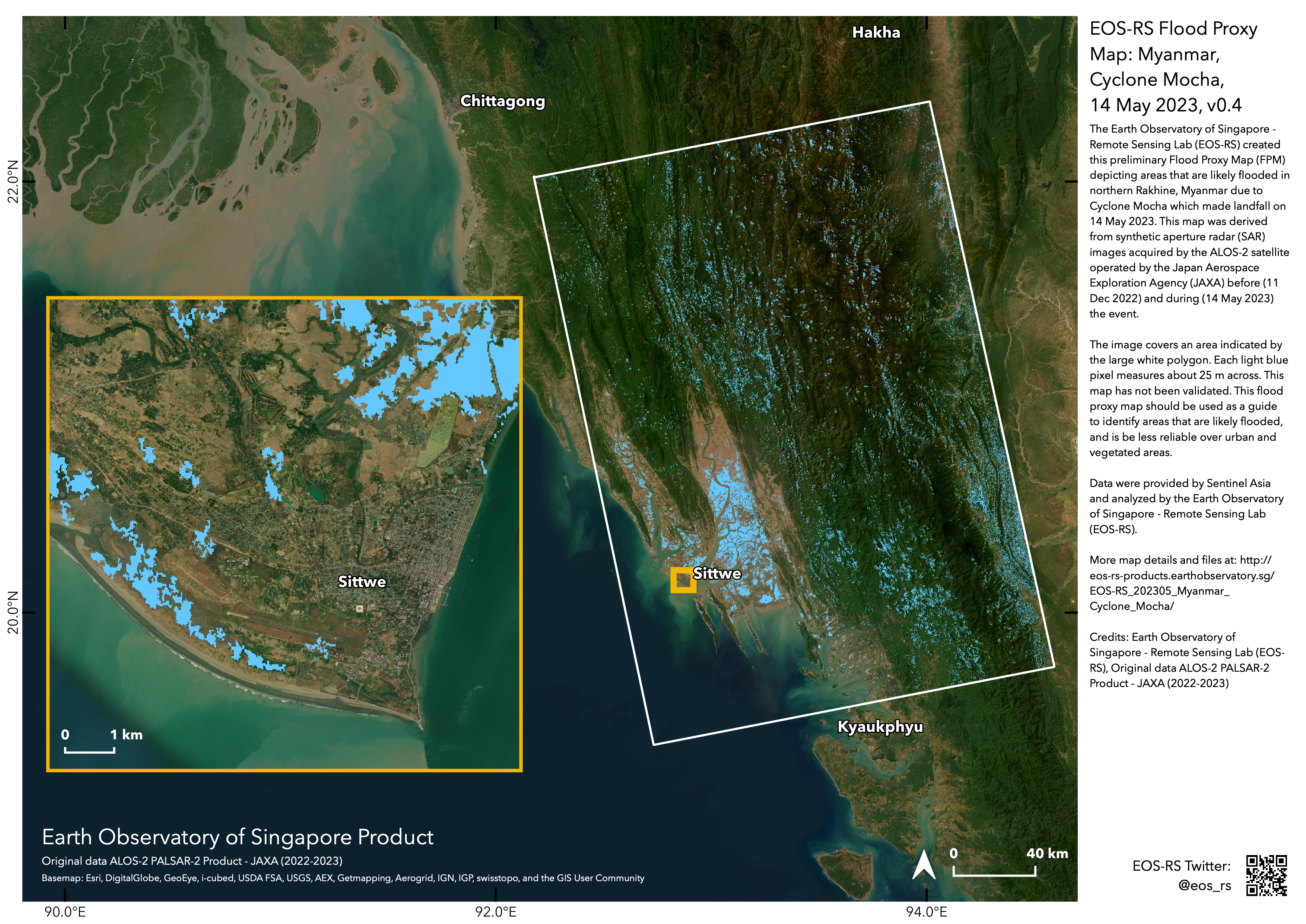
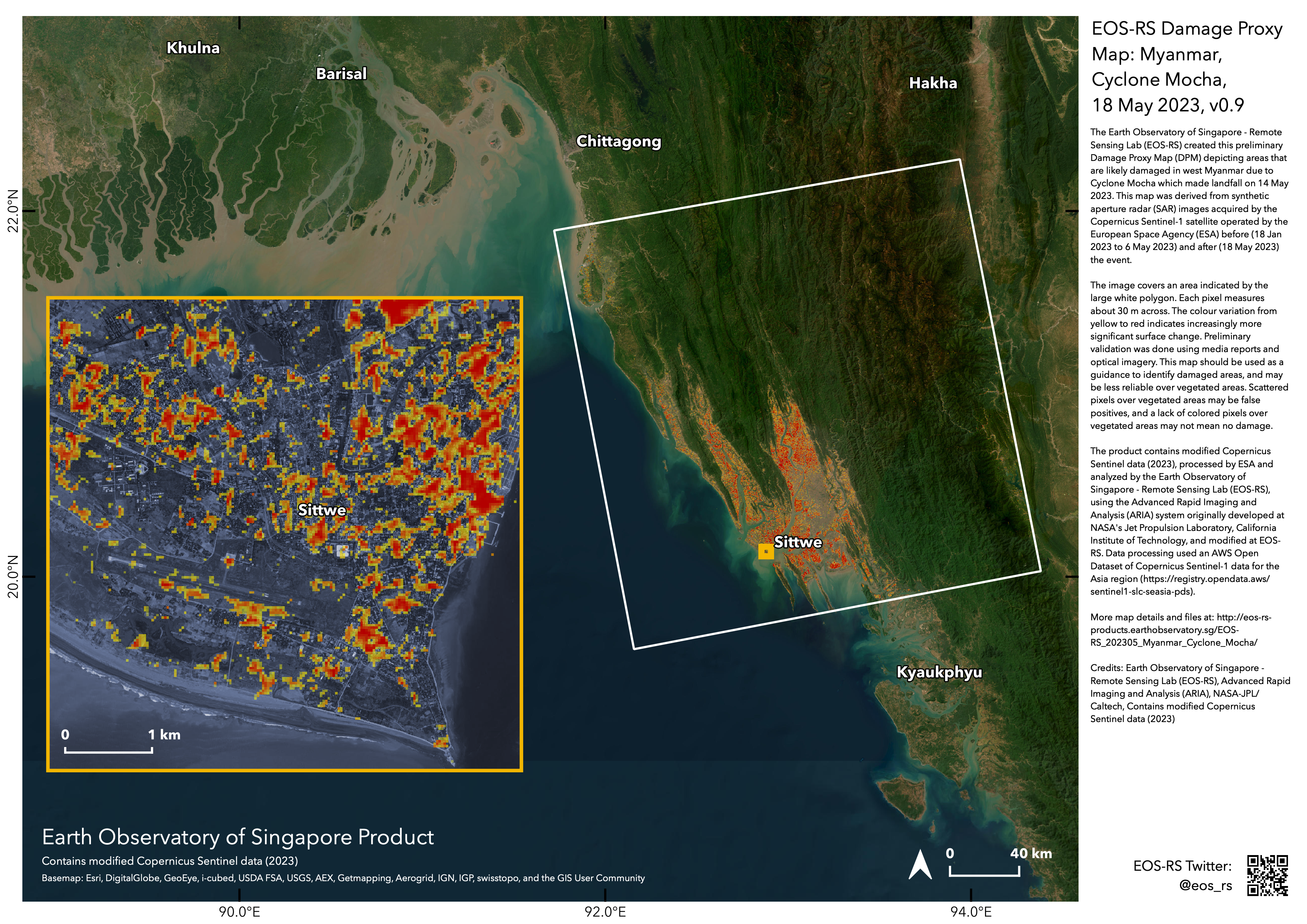
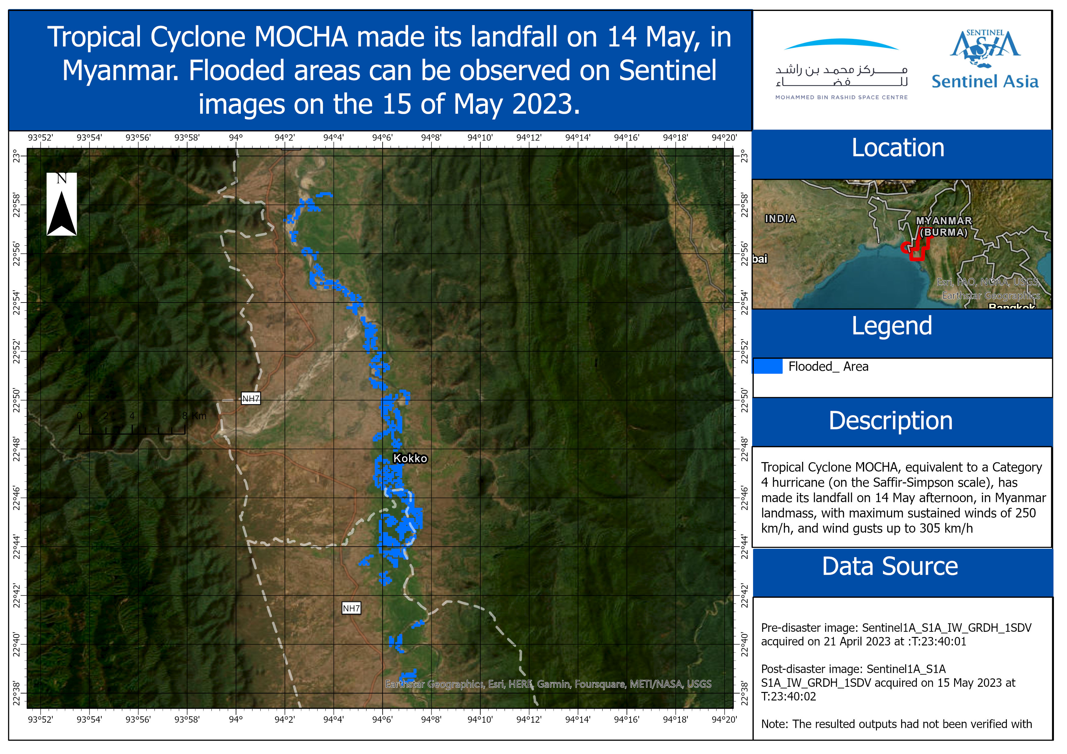
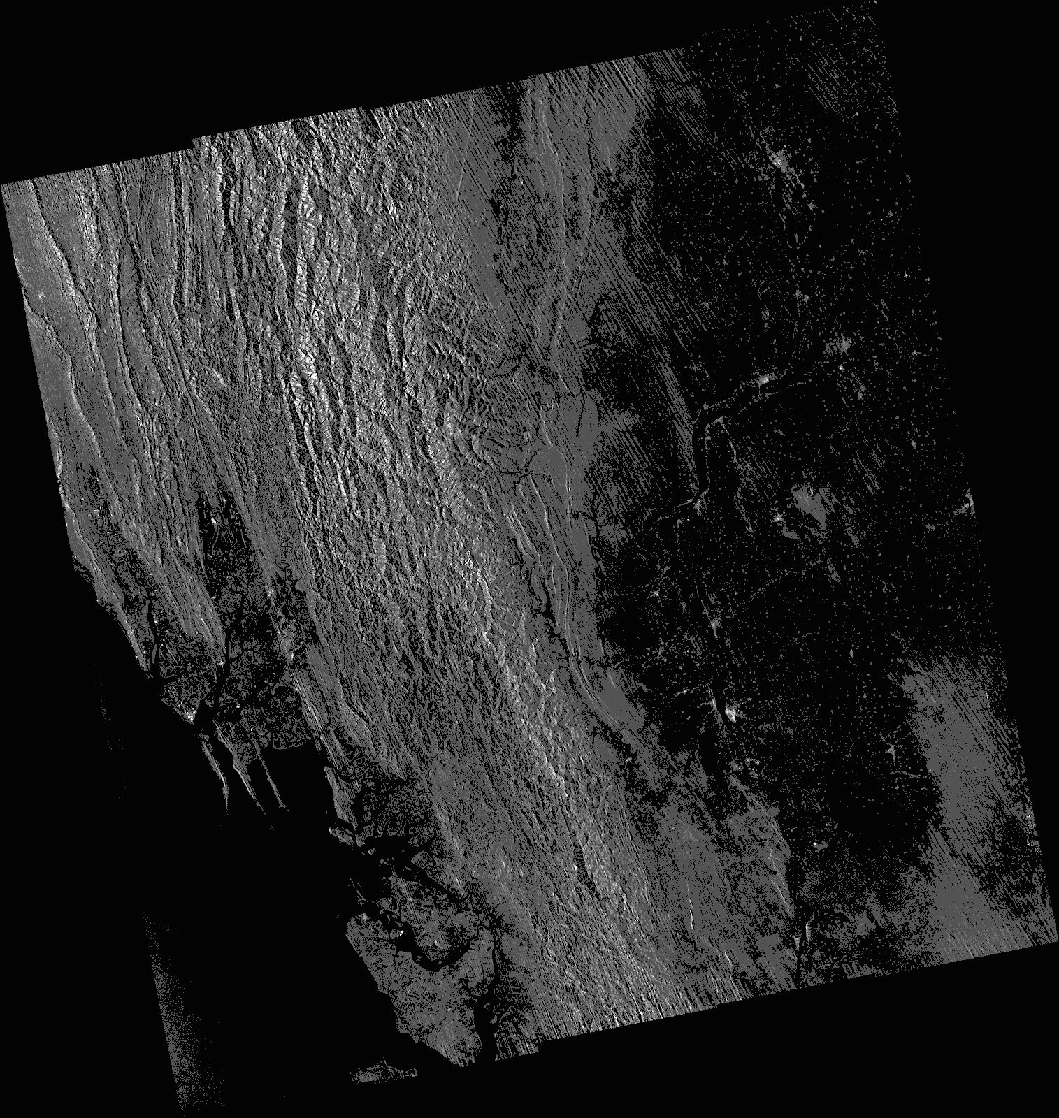
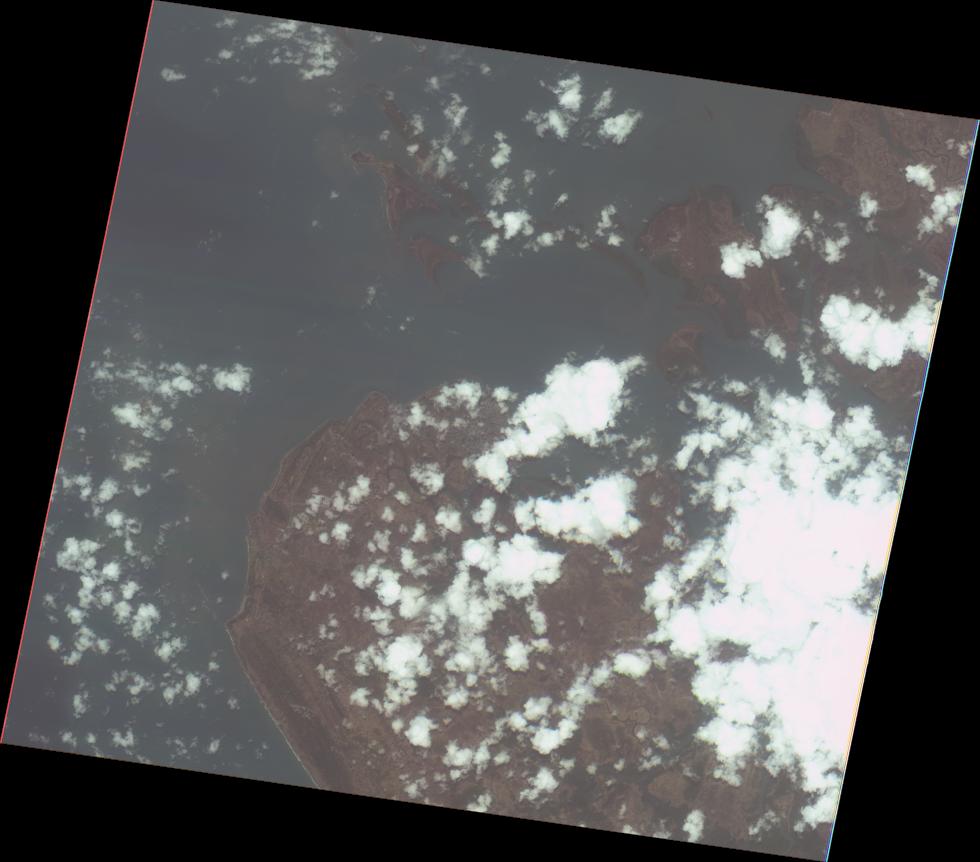
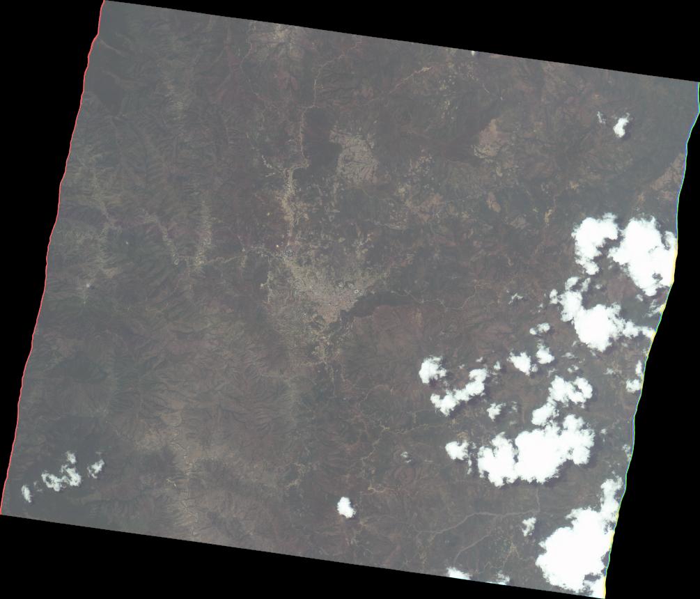
1. METEOROLOGICAL CONDITION. Tropical Cyclone MOCHA, equivalent to a Category 4 hurricane (on the Saffir-Simpson scale), has made its landfall today, 14 May afternoon, in Myanmar landmass, with maximum sustained winds of 250 km/h, and wind gusts up to 305 km/h. According to the latest available forecast, TC MOCHA is headed Northeast at about 26 km/h, and is expected to weaken over the next 24 hours. 2. LANDFALL: According to Department of Meteorology and Hydrology at 1430 HRS UTC+7, TC MOCHA has crossed Rakhine Coast, near Sittwe (Myanmar). The present stage of the Extremely Severe Cyclonic Storm is coded brown stage. Brown Color Emergency Stage means the storm is crossing Myanmar Coasts currently. After made its landfall in the coast between Cox’s Bazar (Bangladesh) and Kyaukphyu (Myanmar) near Sittwe (Myanmar) around afternoon of 14 May as an Extremely Severe Cyclonic Storm, MOCHA is likely to continue to move NorthNortheastwards towards Chin State and Magway Region as a Very Severe Cyclonic Storm; then towards Sagaing Regionas a Cyclonic Storm; and towards Kachin State as a deep land depression. 3. Potential Hazards a. At most, Catastrophic Damage-causing winds is possible especially in the areas of Rakhine State and Chin State, and Severe Damage-causing winds is possible in the areas of Rakhine, Chin, Magway, and Sagaing (source: TAOS Model, DisasterAWARE). Maximum wind speed may reach 177-193 km/h in Rakhine State, 113-145 km/h in Sagaing, Mandalay, Magway, Ayeyarwady Regions and Chin State and 64-97 km/h in Naypyitaw, Bago, Yangon Regions and Kachin, Shan, Kayah States (DMH). b. At most, 152-229 mm of tropical cyclone-associated rainfall is possible in areas of Rakhine and Chin States (source: TAOS Model, DisasterAWARE); and rain or thundershowers will be fairly widespread to widespread in Naypyitaw, Sagaing, Mandalay, Magway, Bago, Yangon, Ayeyarwady, Taninthayi Regions and Kachin, Shan, Chin, Rakhine, Kayah, Kayin, Mon States (DMH). 4. Potential Impacts in Myanmar – POTENTIAL OF A CATASTROPHIC DISASTER. An estimated 8.7 Million people, 1.9M households, and $35.3 Billion (USD) of infrastructure (total replacement value) are potentially exposed to moderate to severe damaging winds. Source: AHA Centre Situation Update #2
Web GIS
-
Cyclone MOCHA in Myanmar on 14 May, 2023 see detail
-
-Flood-Landslide-Storm-Other-00468.jpg)
EOR requesters-only Web-GIS site (with satellite imagery)
see detail
The account will be sent to the EOR requester after Web GIS page is prepared.
If you are interested in to be a member of Sentinel Asia, please contact: z-sentinel.asia@ml.jaxa.jp