Dr. Sang-Ho Yun, Earth Observation of Singapore
The Earth Observatory of Singapore (EOS) was created in 2008 with the mission to conduct fundamental research on earthquakes, volcanic eruptions, tsunamis, and climate change in and around Southeast Asia, toward safer and more sustainable societies. Since their joining Sentinel Asia, they work very actively as a Data Analysis Node (DAN) member and provided Value Added Products to Sentinel Asia’s Emergency Observation Requests (EORs). The Sentinel Asia Secretariat interviewed Dr. Sang-Ho Yun regarding the backgrounds of their contribution.
 |
| Dr. Sang-Ho Yun |
Dr. Sang-Ho Yun is the Director of the Earth Observatory of Singapore – Remote Sensing Lab (EOS-RS) and Associate Professor of the Asian School of the Environment (ASE) and the School of Electric and Electronic Engineering (EEE) at Nanyang Technological University (NTU) in Singapore. Prior to joining NTU, he was a geophysicist and radar scientist at NASA’s Jet Propulsion Laboratory (JPL). He received the 2018 NASA Exceptional Public Achievement Medal and the 2014 NASA Exceptional Early Career Medal for innovative use of satellite Synthetic Aperture Radar (SAR) data in support of rapid post-disaster response. Prior to his work at JPL, Sang-Ho was a postdoctoral fellow at the US Geological Survey in Menlo Park, California. He received his PhD in geophysics and MS in electrical engineering from Stanford University in California and his BS in earth system science from Seoul National University in Korea.
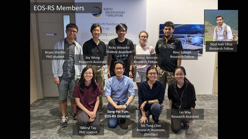 |
| EOS-RS Members |
Sentinel Asia Secretariat
The Sentinel Asia Secretariat very much appreciates your participation in Sentinel Asia in 2017 and your continuous efforts as a Data Analysis Node (DAN) in providing Value Added Products (VAPs). Especially, international humanitarian aid agencies including UNWFP and JICA are very interested in and very much appreciate your damage estimation map for earthquakes and volcanic eruptions. We share this gratefulness, too. Can you introduce EOS to our readers?
Dr. Sang-Ho Yun, EOS
We are sincerely grateful for the opportunity to be a part of Sentinel Asia. It means a lot to us when we learn that our products are well-received by users. Our participation in this collaborative initiative has also greatly benefited our research institution.
The Earth Observatory of Singapore (EOS), founded in 2008, is dedicated to conducting fundamental research on earthquakes, volcanic eruptions, tsunamis, and climate change in Southeast Asia, with the goal of promoting safer and more sustainable societies. This mission is particularly important for Singapore and Southeast Asia, where the threat of natural hazards is exacerbated by the impact of climate change and rising sea levels.
Sentinel Asia Secretariat
In 2021, the Remote Sensing Lab was established. Could you also introduce it?
Dr. Yun
The EOS Remote Sensing Lab (EOS-RS) is a new flagship laboratory that uses satellite remote-sensing data for rapid disaster response and hazard monitoring. To give a tangible example, EOS-RS generates damage proxy maps (DPMs) and flood proxy maps (FPMs), using satellite Synthetic Aperture Radar (SAR) data. SAR data is particularly useful for Southeast Asia as radar signals can penetrate clouds and provide imagery day and night. Our maps are frequently shared on Sentinel Asia, to aid regional and local stakeholders in their disaster response efforts.
Sentinel Asia Secretariat
We suppose that you have only a few natural disasters in Singapore. Could you tell us the background of your participation in Sentinel Asia and what you expect from it?
Dr. Yun
As Singapore experiences relatively few natural hazards and disasters, it provides a stable environment for reliable operations and data gathering. That puts EOS in an ideal position for implementing rapid discovery and access to relevant satellite data and processing and disseminating value-added geospatial information for decision-making.
Joining Sentinel Asia was a logical step for us as it allows us to put our technical know-how into practice and have a direct impact through our research and innovation. Additionally, being a part of Sentinel Asia enables us to gather timely feedback from users, which enables user-driven improvements to our algorithms and products. For instance, user queries about how to interpret our DPMs prompted us to add a color bar and legend to our maps, which helps to improve the readability of our products.
Sentinel Asia Secretariat
From Singapore, the Centre for Remote Imaging, Sensing and Processing (CRISP) and the National University of Singapore (NUS) are members of Sentinel Asia as DPN and DAN, respectively. Do you cooperate with CRISP? If so, do you have any examples of such cooperation in Sentinel Asia Emergency Observation Requests (EORs)? And if not, do you have any plans for cooperation with them?
Dr. Yun
EOS-RS was established in late 2021 and since then we have been building our team and undertaking a variety of research projects while supporting disaster response efforts in the region. Also, we are actively collaborating and in the process of building collaborative relationships with other institutions, including NUS and CRISP, as well as with industry.
Sentinel Asia Secretariat
Regarding your activities with Sentinel Asia, are there any experiences that stand out?
Dr. Yun
Witnessing the level of cohesiveness and sincere spirit amongst members at Sentinel Asia’s annual Joint Project Team (JPT) meetings has been heartening. Through this space-based disaster management support system, we have also expanded our networks and had the opportunity to connect directly with major disaster management organizations. Our interactions with ASEAN Coordinating Centre for Humanitarian Assistance on Disaster Management (AHA Centre) and Asian Disaster Preparedness Center (ADPC) have been particularly beneficial, as the feedback we received has helped to improve our mapping products, making them more lightweight and easily accessible for on-ground responders in disaster situations who may have limited access to the internet following a disaster event. We also actively collaborate with many local, regional, and global organizations for more efficient and effective support for response and recovery.
We have also received positive attention from Data Provider Nodes (DPNs) of Sentinel Asia like Japan Aerospace Exploration Agency (JAXA), who have provided support for satellite tasking requests and access to archived data, allowing us to produce advanced mapping products.
Sentinel Asia Secretariat
Are there any Sentinel Asia EORs in which you provided VAPs that stand out, and why?
Dr. Yun
When Super Typhoon Rai (Odette) made landfall in the Philippines, we received requests from the United Nations World Food Programme (WFP) and Manila Observatory via the Sentinel-Asia network. We were able to quickly produce two FPMs and six DPMs which we distributed within a week of receiving the satellite data. The AHA Center utilized our maps in their Situation Update reports. This event was particularly significant as it required us to make use of radar data acquired over six orbital tracks by JAXA’s ALOS-2 and Copernicus Sentinel-1 satellites covering a vast area of 418,700 km2. Of all the events we have responded to thus far, this event set a new record for EOS-RS: it produced the most mapping products for a short period of time and covered the largest area of any response.
https://sentinel-asia.org/EO/2021/article20211214PH.html
Sentinel Asia Secretariat
Are there any EORs that functioned effectively? And why?
Dr. Yun
We are proud to share that many EORs have functioned effectively, as we strive to create maps that are useful for on-the-ground responses. Here are some examples:
1.The DPMs we generated in response to the Semeru volcano eruption in 2021 https://sentinel-asia.org/EO/2021/article20211204ID.html were used by Japan International Cooperation Agency (JICA) to prioritize areas for field surveys, and they also confirmed that our maps closely matched the results of the field surveys. As a DAN, every EOR is an opportunity for gaining on-ground feedback to improve our algorithms and products, hence it is great that users of all levels keep this in mind while evaluating the crisis.
2.Across the 2019 Kajiki Tropical Storm, 2020 Super Typhoon Goni, 2021 Super Typhoon Odette/Rai, 2022 Storm Nalgae, and 2022 Typhoon Noru, AHA Center also used our FPMs as reference for their situation update reports. In some of these instances, our maps were used to estimate populations affected and the amount of supplies that should be sent for emergency and relief. While we know that the maps we create are published for all Sentinel Asia members to access, it is heartening to know that these maps are also being utilized for situational awareness and decision-making processes for real responses.
*Details of the above mentioned EORs are on the Sentinel Asia website:
https://sentinel-asia.org/EO/2019/article20190905VN.html
https://sentinel-asia.org/EO/2020/article20201101PH.html
https://sentinel-asia.org/EO/2021/article20211214PH.html
https://sentinel-asia.org/EO/2022/article20221029PH.html
https://sentinel-asia.org/EO/2022/article20220925PH.html
Sentinel Asia Secretariat
What are the advantages of Sentinel Asia?
Dr. Yun
As a part of the Asia-Pacific region, known to be one of the most disaster-prone areas in the world, EOS-RS aims to conduct user-driven innovation of space-based remote sensing technology to support response to natural disasters or crises. Our goal is to potentially help save lives in the crucial moments after a disaster strikes, and to contribute to informed decision-making for effective response and recovery toward more resilient societies in the region.
Sentinel Asia aligns perfectly with our vision as it provides a platform for members to understand their roles and actively participate and collaborate in helping EOR requestors in times of crisis, regardless of nationality. The well-established workflow of the platform enables a seamless flow of requests from users (including timely information on geographic areas of interest and event timelines), information on satellite observations from data providers, and updates about what other products are being generated by other contributors. This makes coordination amongst DANs like us and DPNs extremely smooth, allowing for rapid decision-making on our side and the creation and dissemination of our mapping products.
Furthermore, Sentinel Asia also enables us to gain support from corporates and external organizations to improve our responses. For example, upon our membership to the Sentinel Asia network, we approached the Amazon Web Services Open Data program and were provided free cloud storage for Sentinel-1 Synthetic Aperture Radar (SAR) in the Asia-Pacific region. This greatly reduced the time for data downloads, speeding up our responses.
Sentinel Asia Secretariat
Sentinel Asia greatly contributes to the promotion of solutions to socioeconomic challenges, which are mentioned in “APRSAF Nagoya Vision” https://www.aprsaf.org/annual_meetings/aprsaf26/outcome_documents.php . For Sentinel Asia to be included in these solutions in Southeast Asia further, what is needed?
Dr. Yun
As a DAN, EOS-RS generates satellite SAR-based maps. We always validate our maps before dissemination, and often a few words in the corner of a news media report were all we find for our validation. It would be helpful if Sentinel Asia could also encourage the regional community to share any timely information relevant to validation, such as a simple GIS layer of observed/reported/crowdsourced areas of damage or floods even if they are just a few locations. This would provide an additional opportunity for quality assurance and ensure that our maps are as accurate as possible at the time of dissemination.
From our perspective, this would align with the Nagoya Vision, in advancing solutions and science-technology capability.
Sentinel Asia Secretariat
As the final question, could you tell us what your expectations are of Sentinel Asia and how you will contribute to Sentinel Asia?
Dr. Yun
We have no doubt that Sentinel Asia will continue to make important contributions to supporting response efforts in the face of the ever-growing frequency and intensity of natural disaster events and the impacts of ongoing climate change.