at Millennium Airport Hotel Dubai, Dubai, the United Arab Emirates
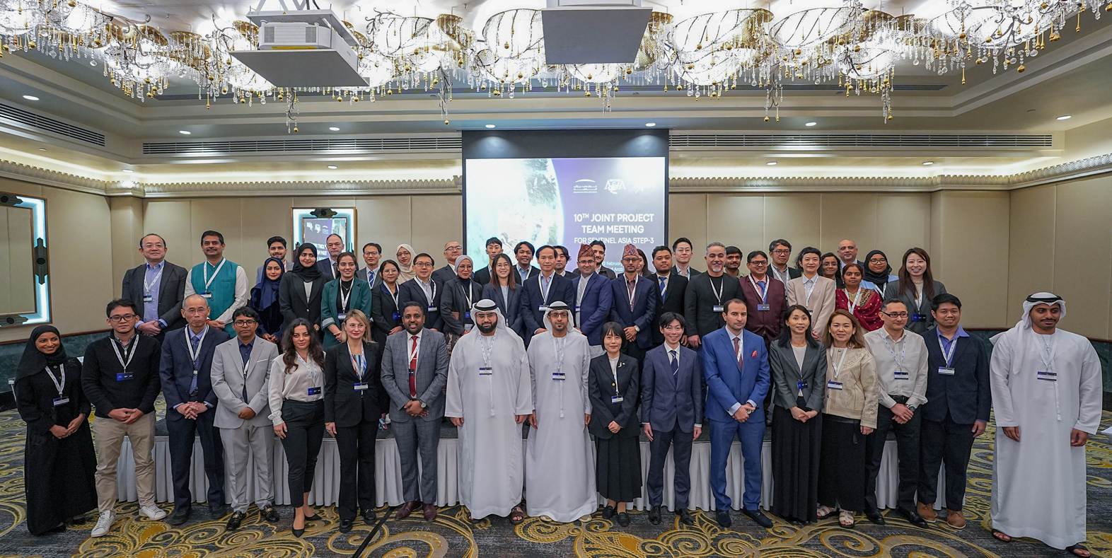
The 10th Joint Project Team Meeting for Sentinel Asia STEP-3 (JPTM2025) was held in Dubai, the United Arab Emirates from 10 to 12 February 2025. It was jointly organized by the Mohammed Bin Rashid Space Centre (MBRSC) and the Japan Aerospace Exploration Agency (JAXA).
Number of Participants : 67
Number of Organization : 36
Meeting Details
Co-Organizer
Agenda
February 10th-12th, 2026
Millennium Airport Hotel Dubai, Dubai, the United Arab Emirates
Day 1: Co-Chair:
Dr. Saeed Al Mansoori, Director, Remote Sensing Department, MBRSC, UAE
Ms. Shiho Taguchi, Acting Executive Secretary of Sentinel Asia, SAOC, JAXA, Japan
[Day 1] February 10th
| Time | Program items | ||
|---|---|---|---|
| Opening Ceremony (Chaired by MBRSC) | |||
| 9:00 | 9:10 | 10 min | Welcome Remarks: MBRSC (Mr. Adnan Al Rais, Assistant DG - Space Operations and Exploration Sector) and JAXA (Ms. Shiho Taguchi, Acting Executive Secretary of Sentinel Asia) |
| 9:10 | 9:20 | 10 min | Adoption of agenda |
| 9:20 | 9:30 | 10 min | Group Photo |
| Session 1 : Overview (Chaired by MBRSC) | |||
| 9:30 | 9:45 | 15 min | Recent activities of Sentinel Asia (Mr. Goro Takei, Deputy Executive Secretariat of Sentinel Asia, Japan) |
| 9:45 | 10:00 | 15 min | Report on the Steering Committee and APRSAF-31 (Mr. Goro Takei, Deputy Executive Secretariat of Sentinel Asia, Japan) |
| Session 2: New membership (Chaired by JAXA) | |||
| Presentation by new members | |||
| 10:00 | 10:15 | 15 min | Use of Satellite information for Water Resources Management (Dr. Morimasa Tsuda, Japan Water Agency (JWA), Japan) |
| 10:15 | 10:30 | 15 min | NDRRMA and Its Role in Disaster Risk Reduction and Management in Nepal (Mr. Bal Deep Sharma, National Disaster Risk Reduction and Management Authority (NDRRMA), Nepal) |
| 10:30 | 10:45 | 15 min | Toyama University of International Studies (Dr. Shiro Ochi, Toyama University of International Studies (TUNIS), Japan) |
| 10:45 | 11:00 | Coffee Break | |
| Session 2: New membership (Chaired by JAXA) | |||
| Presentation by new members | |||
| 11:00 | 11:15 | 15 min | Eskisehir Technical University, Institute of Earth and Space Sciences (ESTU-IESS), New Member of Sentinel Asia (Dr. Onur Kaplan, Eskisehir Technical University, Institute of Earth and Space Sciences (ESTU-IESS), Turkey) |
| 11:15 | 11:30 | 15 min | National Earth Remote Sensing System Kazakhstan (Mr. Altair Tleubergenov, JSC National Company Kazakhstan Gharysh Sapary (KGS), Kazakhstan) |
| 11:30 | 11:35 | 5 min | Organizational Changes of Sentinel Asia members (Ms. Yuki Tanaka, Sentinel Asia Secretariat, Japan) |
| Latest Research Activities (Chaired by JAXA) | |||
| 11:35 | 11:45 | 10 min | IWMI Digital Twin and applications in Disaster Risk Management (Prof. Ian Overton, IWMI, Sri Lanka) |
| 11:45 | 12:00 | 15 min | Calibration and Harmonization for Multi-Satellite Utilization (Prof. Masahiko Nagai, Yamaguchi University, Japan) |
| 12:00 | 13:00 | Lunch | |
| Special Session (Chaired by MBRSC) | |||
| 13:00 | 14:30 | 90 min | Titled: "From Pixels to Preparedness: Satellite Imagery and AI for Disaster Risk Management in the UAE" "Moderator: Ms. Khadeijah Al Dhanhani, Vice President of UAESA Youth Council, Strategic Research Specialist, UAE Space Agency (UAESA)" Panelists from UAE
|
| 14:30 | 14:45 | Coffee Break | |
| Session 3: User’s Session (Chaired by JAXA) | |||
| Presentation on good practices of Sentinel Asia or expectations of Sentinel Asia | |||
| 14:45 | 15:05 | 20 min | 2025 GLOF and Landslide Events in the Kyrgyz Republic: Validation Results and Good Practices (Mr. Ulan Abdybachaev, CAIAG, Kyrgyz) |
| 15:05 | 15:25 | 20 min | Beyond Mapping: Integrating Sentinel Asia Data with Global Exposure Datasets for Flood Impact Assessment (Mr. Imran Khan, Institute of Water Modelling (IWM), Bangladesh) |
| 15:25 | 15:45 | 20 min | Rapid Flood Mapping for Emergency Response: Insights from the 2024 Bangladesh and Nepal Floods (Mr. Kabir Uddin, International Centre for Integrated Mountain Development (ICIMOD), Nepal) |
| 15:45 | 16:00 | Coffee Break | |
| Session 3: User’s Session (Chaired by MBRSC) | |||
| Presentation on good practices of Sentinel Asia or expectations of Sentinel Asia | |||
| 16:00 | 16:20 | 20 min | Extreme Rainfall in the UAE: Flood Impacts of the April 2024 Storm (Eng. Naseeb Albakri and Eng. Leena Elneel Research Assistant, MBRSC Lab, UAE) |
| 16:20 | 16:40 | 20 min | Response operation using satellite data and lessons learned for earthquake in Türkiye (Ms. Seher Turan, AFAD, Türkiye) |
| 16:40 | 17:00 | 20 min | Utilizing satellite imagery data and supporting products from the Sentinel Asia system in monitoring and recovery efforts following major floods in Vietnam in 2025 (Mr. Vu Huu Liem, MAE, Vietnam) |
| 17:00 | Adjourn | ||
| Networking reception including facility tour of MBRSC will be hosted by MBRSC | |||
| 17:00 | 17:30 | Leave Millennium Airport Hotel Dubai for MBRSC *Take a chartered bus | |
| 17:30 | 18:30 | Technical Tour at MBRSC | |
| 18:30 | 19:30 | Networking Reception at MBRSC | |
| 19:30 | 20:00 | Leave the MBRSC for Millennium Airport Hotel Dubai *Take a chartered bus | |
Day 2: Co-Chair:
Dr. Saeed Al Mansoori, Director, Remote Sensing Department, MBRSC, UAE
Ms. Shiho Taguchi, Acting Executive Secretary of Sentinel Asia, SAOC, JAXA, Japan
[Day 2] February 11th
| Time | Program items | ||
|---|---|---|---|
| Session 3: User’s Session (Chaired by JAXA) | |||
| Presentation on good practices of Sentinel Asia or expectations of Sentinel Asia | |||
| 9:00 | 9:20 | 20 min | Operationalizing satellite data for humanitarian response (Mr. Michael Manalili, WFP) |
| 9:20 | 9:40 | 20 min | Multiscale Satellite Analysis of the 2025 Sumatra Floods: A Report on Sentinel Asia Training and Multi-Party Collaboration (Dr. Yenni Vetrita, BRIN, Indonesia) |
| 9:40 | 10:00 | 20 min | Value of Satellite Data from Sentinel Asia in Supporting Disaster Response Activities in the Philippines (Mr. Julius Morales Judan, PhilSA, the Philippines) |
| 10:00 | 10:20 | 20 min | Application of Geo-informatics and Hydrological Modeling for Generating Emergency Response Information: A Case Study of Hat Yai, Thailand (Ms. Thitawadee Suvachananonda, GISTDA, Thailand) |
| Training Workshop I: How to activate Sentinel Asia and escalate to the International Disaster Charter (Chaired by JAXA) | |||
| 10:20 | 10:50 | 30 min | Trend of past requests and steps to make smooth EORs (Dr. Makoto Ikeda, Asian Disaster Reduction Center (ADRC), Japan) |
| 10:50 | 11:00 | Short Break | |
| Training Workshop II: Data Analysis Method on Flood (Chaired by MBRSC) *Hands-on training |
|||
| 11:00 | 13:00 | 120 min | Flood Mapping Using SAR Satellite Data in QGIS Hands-on Training on Flood Analysis Using SAR Images (Dr. Surya Deb Chakraborty, MBRSC, UAE) |
| 13:00 | 14:00 | Lunch | |
| Training Workshop III: Data Analysis Method on Flood (Chaired by MBRSC) | |||
| 14:00 | 14:45 | 45 min | Urban Flood Mapping Using SAR and Validation Insights from Recent Floods in Southern Thailand (Mr. Syams Nashrrullah Suprijatna, AIT, Thailand) |
| Training Workshop IV: Data Analysis Method on Flood (Chaired by MBRSC) | |||
| 14:45 | 15:05 | 20 min | Optimization of demographic and spatial data to calculate population exposure using Google Earth Engine (Mr. Udhi Catur Nugroho, BRIN, Indonesia) |
| 15:05 | 15:20 | Coffee Break | |
| Training Workshop V: Latest Tools/Systems at preparedness phase (Chaired by JAXA) | |||
| 15:20 | 15:50 | 30 min | Overview of AWARE Platform (Dr. Giriraj Amanath, IWMI, Sri Lanka) |
| Training Workshop VI: Demonstration of rainfall monitoring systems (Chaired by JAXA) | |||
| 15:50 | 16:20 | 30 min | Precipitation monitoring by GSMaP and introduction of GSMaP Local Integration tool with gauges (G-LINT) (Dr. Nao Yoshida, JAXA, Japan) |
| Training Workshop VII: Use case of rainfall monitoring systems (Chaired by JAXA) | |||
| 16:20 | 16:40 | 20 min | Use case of GSMaP and GSMaP-IF for Flood Management (Dr. Morimasa Tsuda, JWA, Japan) |
| 16:40 | 16:50 | Short Break | |
| Training Workshop VIII: Demonstration of flood monitoring/forecasting systems (Chaired by JAXA) | |||
| 16:50 | 17:20 | 30 min | Introduction of "Today’s Earth": Global Hydrological Simulation System (Mr. Keisuke Yoshida, JAXA, Japan) |
| Training Workshop IX: Demonstration of flood monitoring/forecasting systems (Chaired by MBRSC) | |||
| 17:20 | 17:35 | 15 min | Information System “Tasqyn” - Flood Forecasting in Kazakhstan (Ms. Gulnara Bissenalina, KGS, Kazakhstan) |
| Latest activities by UNOOSA (Chaired by MBRSC) | |||
| 17:35 | 17:45 | 10 min | Achieved and Planned Activities supported by Japanese Government/Industries regarding GeoAI and Digital Twin (Mr. Jumpei Takami, UNOOSA, Vienna) |
| 17:45 | Adjourn | ||
Day 3: Co-Chair:
Dr. Saeed Al Mansoori, Director, Remote Sensing Department, MBRSC, UAE
Ms. Shiho Taguchi, Acting Executive Secretary of Sentinel Asia, SAOC, JAXA, Japan
[Day 3] February 12th
| Time | Program items | ||
|---|---|---|---|
| Latest activities by IWMI (Chaired by MBRSC) | |||
| 9:00 | 9:10 | 10 min | Progress on White Paper on the integration of STEP3 with EW4ALL and Sendai Framework (Dr. Giriraj Amanath, IWMI, Sri Lanka) |
| Training Workshop X: Feedback on tailor-made trainings (Chaired by MBRSC) | |||
| 9:10 | 9:30 | 20 min | Feedback on SAR data analysis method training held in Türkiye (Dr. Fatma Canaslan Çomut, AFAD, Türkiye) |
| 9:30 | 9:50 | 20 min | Review and Feedback on the Disaster Assessment Map Workshop in the Pacific (Ms. Natsumi Ueda, JAXA, Japan, and Ms. Ofa Mariwawa, NDRMO, Tonga) |
| 9:50 | 10:10 | 20 min | Feedback on GLOF monitoring training including the floods and GLOF events in Nepal, 2025 (Mr. Joshan Maharjan, DHM, Nepal) |
| 10:10 | 10:25 | Coffee Break | |
| Training Workshop XI: Data Analysis method (Chaired by JAXA) *Lecture and hands-on training |
|||
| 10:25 | 11:25 | 60 min | EVAP Concept Overview and Workflow in QGIS (Ms. Claire Hung, TASA) |
| 11:25 | 11:30 | Short Break | |
| Training Workshop XI: Data Analysis method (Chaired by JAXA) *Lecture and hands-on training |
|||
| 11:30 | 12:30 | 60 min | EVAP Concept Overview and Workflow in QGIS (Ms. Claire Hung, TASA) |
| 12:30 | 13:30 | Lunch | |
| Training Workshop XII: Data Analysis method (Chaired by MBRSC) *Lecture and hands on training |
|||
| 13:30 | 15:00 | 90 min | AI for Resilient Infrastructure: Vision Transformers in Earthquake Damage Mapping (Ms. Amulya Sri Pulijala, ISRO, India) |
| 15:00 | 15:15 | Coffee Break | |
| Training Workshop XII: Data Analysis method (Chaired by MBRSC) *Lecture and hands on training |
|||
| 15:15 | 16:15 | 60 min | AI for Resilient Infrastructure: Vision Transformers in Earthquake Damage Mapping (Ms. Amulya Sri Pulijala, ISRO, India) |
| 16:15 | 16:45 | Break | |
| 16:45 | 17:00 | 15 min | Summary of JPTM 2025 (Sentinel Asia Secretariat) |
| 17:00 | 17:10 | 10 min | Announcement of next JPTM host organization |
| 17:10 | 17:20 | 10 min | Closing Remarks (Dr. Saeed Al Mansoori, Director, Remote Sensing Department, MBRSC, UAE) |
| 17:20 | Adjourn | ||